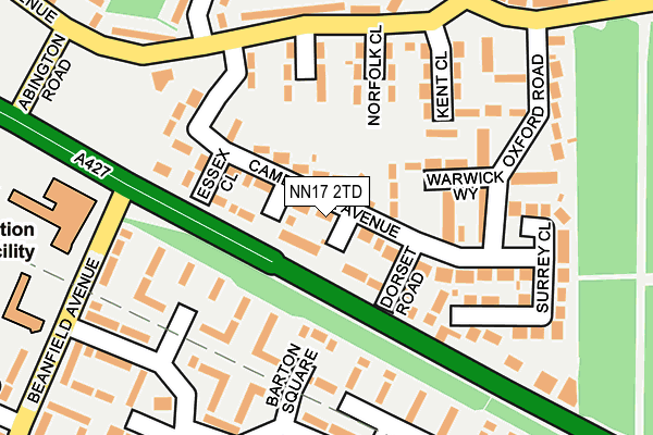
NN17 2TD is located in the Corby West electoral ward, within the unitary authority of North Northamptonshire and the English Parliamentary constituency of Corby. The Sub Integrated Care Board (ICB) Location is NHS Northamptonshire ICB - 78H and the police force is Northamptonshire. This postcode has been in use since January 1980.


GetTheData
Source: OS OpenMap – Local (Ordnance Survey)
Source: OS VectorMap District (Ordnance Survey)
Licence: Open Government Licence (requires attribution)
| Easting | 487043 |
| Northing | 288889 |
| Latitude | 52.490996 |
| Longitude | -0.719439 |
GetTheData
Source: Open Postcode Geo
Licence: Open Government Licence
| Country | England |
| Postcode District | NN17 |
| ➜ NN17 open data dashboard ➜ See where NN17 is on a map ➜ Where is Corby? | |
GetTheData
Source: Land Registry Price Paid Data
Licence: Open Government Licence
Elevation or altitude of NN17 2TD as distance above sea level:
| Metres | Feet | |
|---|---|---|
| Elevation | 120m | 394ft |
Elevation is measured from the approximate centre of the postcode, to the nearest point on an OS contour line from OS Terrain 50, which has contour spacing of ten vertical metres.
➜ How high above sea level am I? Find the elevation of your current position using your device's GPS.
GetTheData
Source: Open Postcode Elevation
Licence: Open Government Licence
| Ward | Corby West |
| Constituency | Corby |
GetTheData
Source: ONS Postcode Database
Licence: Open Government Licence
| January 2024 | Burglary | On or near Bridgford Place | 302m |
| October 2023 | Violence and sexual offences | On or near Bridgford Place | 302m |
| May 2023 | Violence and sexual offences | On or near Bridgford Place | 302m |
| ➜ Get more crime data in our Crime section | |||
GetTheData
Source: data.police.uk
Licence: Open Government Licence
| Dorset Road (Cottingham Road) | Beanfield | 70m |
| Dorset Road (Cottingham Road) | Beanfield | 88m |
| Norfolk Close (Kingsthorpe Avenue) | Lodge Park | 188m |
| Norfolk Close (Kingsthorpe Avenue) | Lodge Park | 198m |
| Barton Square (Newark Drive) | Beanfield | 202m |
| Corby Station | 2.1km |
GetTheData
Source: NaPTAN
Licence: Open Government Licence
| Percentage of properties with Next Generation Access | 100.0% |
| Percentage of properties with Superfast Broadband | 100.0% |
| Percentage of properties with Ultrafast Broadband | 100.0% |
| Percentage of properties with Full Fibre Broadband | 0.0% |
Superfast Broadband is between 30Mbps and 300Mbps
Ultrafast Broadband is > 300Mbps
| Percentage of properties unable to receive 2Mbps | 0.0% |
| Percentage of properties unable to receive 5Mbps | 0.0% |
| Percentage of properties unable to receive 10Mbps | 0.0% |
| Percentage of properties unable to receive 30Mbps | 0.0% |
GetTheData
Source: Ofcom
Licence: Ofcom Terms of Use (requires attribution)
GetTheData
Source: ONS Postcode Database
Licence: Open Government Licence


➜ Get more ratings from the Food Standards Agency
GetTheData
Source: Food Standards Agency
Licence: FSA terms & conditions
| Last Collection | |||
|---|---|---|---|
| Location | Mon-Fri | Sat | Distance |
| Farmstead Road | 17:00 | 11:15 | 1,390m |
| Saxon Way East | 18:00 | 09:00 | 1,459m |
| Shire Road | 17:00 | 11:15 | 1,480m |
GetTheData
Source: Dracos
Licence: Creative Commons Attribution-ShareAlike
| Facility | Distance |
|---|---|
| Abington Road Playing Fields Collingwood Avenue, Corby Grass Pitches | 599m |
| Maplefields Academy Tower Hill Road, Corby Artificial Grass Pitch, Sports Hall | 957m |
| Woodsend Pavilion Gainsborough Road, Corby Grass Pitches | 959m |
GetTheData
Source: Active Places
Licence: Open Government Licence
| School | Phase of Education | Distance |
|---|---|---|
| St Brendan's Catholic Primary School Beanfield Avenue, Corby, NN18 0AZ | Primary | 323m |
| Woodnewton- A Learning Community Rowlett Road, Corby, NN17 2NU | Primary | 704m |
| Beanfield Primary School Farmstead Road, Corby, NN18 0LJ | Primary | 802m |
GetTheData
Source: Edubase
Licence: Open Government Licence
The below table lists the International Territorial Level (ITL) codes (formerly Nomenclature of Territorial Units for Statistics (NUTS) codes) and Local Administrative Units (LAU) codes for NN17 2TD:
| ITL 1 Code | Name |
|---|---|
| TLF | East Midlands (England) |
| ITL 2 Code | Name |
| TLF2 | Leicestershire, Rutland and Northamptonshire |
| ITL 3 Code | Name |
| TLF25 | North Northamptonshire |
| LAU 1 Code | Name |
| E07000150 | Corby |
GetTheData
Source: ONS Postcode Directory
Licence: Open Government Licence
The below table lists the Census Output Area (OA), Lower Layer Super Output Area (LSOA), and Middle Layer Super Output Area (MSOA) for NN17 2TD:
| Code | Name | |
|---|---|---|
| OA | E00137187 | |
| LSOA | E01026973 | Corby 004B |
| MSOA | E02005615 | Corby 004 |
GetTheData
Source: ONS Postcode Directory
Licence: Open Government Licence
| NN17 2SZ | Cambridge Avenue | 4m |
| NN17 2TB | Dorset Road | 64m |
| NN18 0AB | Cottingham Road | 75m |
| NN17 2TF | Warwick Way | 82m |
| NN17 2TE | Durham Close | 103m |
| NN18 0HH | Rufford Walk | 104m |
| NN18 0HQ | Barton Square | 143m |
| NN18 0HG | Brinsley Green | 146m |
| NN17 2TJ | Kent Close | 147m |
| NN17 2TL | Norfolk Close | 148m |
GetTheData
Source: Open Postcode Geo; Land Registry Price Paid Data
Licence: Open Government Licence