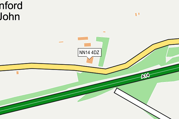
NN14 4DZ is located in the Ise electoral ward, within the unitary authority of North Northamptonshire and the English Parliamentary constituency of Kettering. The Sub Integrated Care Board (ICB) Location is NHS Northamptonshire ICB - 78H and the police force is Northamptonshire. This postcode has been in use since September 2004.


GetTheData
Source: OS OpenMap – Local (Ordnance Survey)
Source: OS VectorMap District (Ordnance Survey)
Licence: Open Government Licence (requires attribution)
| Easting | 493161 |
| Northing | 276988 |
| Latitude | 52.383011 |
| Longitude | -0.632688 |
GetTheData
Source: Open Postcode Geo
Licence: Open Government Licence
| Country | England |
| Postcode District | NN14 |
| ➜ NN14 open data dashboard ➜ See where NN14 is on a map ➜ Where is Cranford St John? | |
GetTheData
Source: Land Registry Price Paid Data
Licence: Open Government Licence
Elevation or altitude of NN14 4DZ as distance above sea level:
| Metres | Feet | |
|---|---|---|
| Elevation | 70m | 230ft |
Elevation is measured from the approximate centre of the postcode, to the nearest point on an OS contour line from OS Terrain 50, which has contour spacing of ten vertical metres.
➜ How high above sea level am I? Find the elevation of your current position using your device's GPS.
GetTheData
Source: Open Postcode Elevation
Licence: Open Government Licence
| Ward | Ise |
| Constituency | Kettering |
GetTheData
Source: ONS Postcode Database
Licence: Open Government Licence
| December 2021 | Other crime | On or near Duck End | 460m |
| December 2021 | Violence and sexual offences | On or near Duck End | 460m |
| ➜ Get more crime data in our Crime section | |||
GetTheData
Source: data.police.uk
Licence: Open Government Licence
| Battle Close (High Street) | Cranford St John | 768m |
| Battle Close (High Street) | Cranford St John | 823m |
| Grafton Road (High Street) | Cranford St John | 964m |
GetTheData
Source: NaPTAN
Licence: Open Government Licence
GetTheData
Source: ONS Postcode Database
Licence: Open Government Licence


➜ Get more ratings from the Food Standards Agency
GetTheData
Source: Food Standards Agency
Licence: FSA terms & conditions
| Last Collection | |||
|---|---|---|---|
| Location | Mon-Fri | Sat | Distance |
| Barton Road | 16:45 | 11:45 | 2,269m |
| Church Street | 16:45 | 08:15 | 3,806m |
| St Johns Road | 17:15 | 11:30 | 4,139m |
GetTheData
Source: Dracos
Licence: Creative Commons Attribution-ShareAlike
| Facility | Distance |
|---|---|
| Woodford Community And Sports Club Highfield, Woodford Grass Pitches | 3.3km |
| The Assembly Room Meeting Lane, Burton Latimer, Kettering Studio | 3.6km |
| John Yeomans Hall Meeting Lane, Burton Latimer Sports Hall | 3.7km |
GetTheData
Source: Active Places
Licence: Open Government Licence
| School | Phase of Education | Distance |
|---|---|---|
| Cranford CofE Primary School Church Lane, Cranford, Kettering, NN14 4AE | Primary | 570m |
| Hayfield Cross CofE School Hayfield Crescent, Kettering, NN15 5FJ | Primary | 3.2km |
| Great Addington CofE Primary School Woodford Road, Great Addington, Kettering, NN14 4BS | Primary | 3.3km |
GetTheData
Source: Edubase
Licence: Open Government Licence
The below table lists the International Territorial Level (ITL) codes (formerly Nomenclature of Territorial Units for Statistics (NUTS) codes) and Local Administrative Units (LAU) codes for NN14 4DZ:
| ITL 1 Code | Name |
|---|---|
| TLF | East Midlands (England) |
| ITL 2 Code | Name |
| TLF2 | Leicestershire, Rutland and Northamptonshire |
| ITL 3 Code | Name |
| TLF25 | North Northamptonshire |
| LAU 1 Code | Name |
| E07000153 | Kettering |
GetTheData
Source: ONS Postcode Directory
Licence: Open Government Licence
The below table lists the Census Output Area (OA), Lower Layer Super Output Area (LSOA), and Middle Layer Super Output Area (MSOA) for NN14 4DZ:
| Code | Name | |
|---|---|---|
| OA | E00137801 | |
| LSOA | E01027090 | Kettering 001A |
| MSOA | E02005639 | Kettering 001 |
GetTheData
Source: ONS Postcode Directory
Licence: Open Government Licence
| NN14 4AD | Duck End | 507m |
| NN14 4AE | Church Lane | 521m |
| NN14 4AW | 663m | |
| NN14 4AB | The Green | 720m |
| NN14 4AA | High Street | 798m |
| NN14 4QH | Battles Close | 864m |
| NN14 4AQ | St Andrews Lane | 979m |
| NN14 4AH | Rectory Hill | 1147m |
| NN14 4AG | Top Dysons | 1229m |
| NN14 4AP | Cranford Road | 1252m |
GetTheData
Source: Open Postcode Geo; Land Registry Price Paid Data
Licence: Open Government Licence