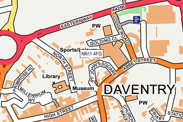
NN11 4FG is located in the Daventry East electoral ward, within the unitary authority of West Northamptonshire and the English Parliamentary constituency of Daventry. The Sub Integrated Care Board (ICB) Location is NHS Northamptonshire ICB - 78H and the police force is Northamptonshire. This postcode has been in use since September 2004.


GetTheData
Source: OS OpenMap – Local (Ordnance Survey)
Source: OS VectorMap District (Ordnance Survey)
Licence: Open Government Licence (requires attribution)
| Easting | 457380 |
| Northing | 262691 |
| Latitude | 52.259402 |
| Longitude | -1.160742 |
GetTheData
Source: Open Postcode Geo
Licence: Open Government Licence
| Country | England |
| Postcode District | NN11 |
| ➜ NN11 open data dashboard ➜ See where NN11 is on a map ➜ Where is Daventry? | |
GetTheData
Source: Land Registry Price Paid Data
Licence: Open Government Licence
Elevation or altitude of NN11 4FG as distance above sea level:
| Metres | Feet | |
|---|---|---|
| Elevation | 140m | 459ft |
Elevation is measured from the approximate centre of the postcode, to the nearest point on an OS contour line from OS Terrain 50, which has contour spacing of ten vertical metres.
➜ How high above sea level am I? Find the elevation of your current position using your device's GPS.
GetTheData
Source: Open Postcode Elevation
Licence: Open Government Licence
| Ward | Daventry East |
| Constituency | Daventry |
GetTheData
Source: ONS Postcode Database
Licence: Open Government Licence
| January 2024 | Vehicle crime | On or near Parking Area | 18m |
| January 2024 | Violence and sexual offences | On or near Parking Area | 18m |
| December 2023 | Public order | On or near Parking Area | 18m |
| ➜ Get more crime data in our Crime section | |||
GetTheData
Source: data.police.uk
Licence: Open Government Licence
| Council Offices (Lodge Road) | Daventry | 126m |
| Council Offices (Lodge Road) | Daventry | 143m |
| Bus Station (New Street) | Daventry | 281m |
| Abbey School (Inlands Rise) | Daventry | 396m |
| Car Park (St James Street) | Daventry | 422m |
GetTheData
Source: NaPTAN
Licence: Open Government Licence
GetTheData
Source: ONS Postcode Database
Licence: Open Government Licence


➜ Get more ratings from the Food Standards Agency
GetTheData
Source: Food Standards Agency
Licence: FSA terms & conditions
| Last Collection | |||
|---|---|---|---|
| Location | Mon-Fri | Sat | Distance |
| Prospect Way | 18:30 | 1,602m | |
| Churchill Road | 16:00 | 09:30 | 3,117m |
| Kiln Lane | 16:00 | 09:00 | 3,205m |
GetTheData
Source: Dracos
Licence: Creative Commons Attribution-ShareAlike
| Facility | Distance |
|---|---|
| Daventry Leisure Centre Lodge Road, Daventry Sports Hall, Swimming Pool, Health and Fitness Gym, Studio, Squash Courts | 72m |
| Anytime Fitness (Daventry) Bowen Square, Bowen Square, Daventry Health and Fitness Gym | 297m |
| The Abbey Church Of England Academy Vicar Lane, Daventry Sports Hall, Grass Pitches | 349m |
GetTheData
Source: Active Places
Licence: Open Government Licence
| School | Phase of Education | Distance |
|---|---|---|
| Daventry Hill School Ashby Road, Daventry, NN11 0QE | Not applicable | 238m |
| Abbey CofE Academy Vicar Lane, Daventry, NN11 4GD | Primary | 349m |
| St James Infant School 90 St James Street, Daventry, NN11 4AG | Primary | 512m |
GetTheData
Source: Edubase
Licence: Open Government Licence
The below table lists the International Territorial Level (ITL) codes (formerly Nomenclature of Territorial Units for Statistics (NUTS) codes) and Local Administrative Units (LAU) codes for NN11 4FG:
| ITL 1 Code | Name |
|---|---|
| TLF | East Midlands (England) |
| ITL 2 Code | Name |
| TLF2 | Leicestershire, Rutland and Northamptonshire |
| ITL 3 Code | Name |
| TLF24 | West Northamptonshire |
| LAU 1 Code | Name |
| E07000151 | Daventry |
GetTheData
Source: ONS Postcode Directory
Licence: Open Government Licence
The below table lists the Census Output Area (OA), Lower Layer Super Output Area (LSOA), and Middle Layer Super Output Area (MSOA) for NN11 4FG:
| Code | Name | |
|---|---|---|
| OA | E00137282 | |
| LSOA | E01026992 | Daventry 007D |
| MSOA | E02005625 | Daventry 007 |
GetTheData
Source: ONS Postcode Directory
Licence: Open Government Licence
| NN11 4FF | Golding Close | 43m |
| NN11 4WL | North Street | 62m |
| NN11 4BE | Thomas Webb Close | 96m |
| NN11 4HT | High Street | 105m |
| NN11 4BH | Market Square | 112m |
| NN11 4GJ | North Street | 116m |
| NN11 4BP | Thomas Webb Close | 118m |
| NN11 4BL | Church Walk | 183m |
| NN11 4BT | New Street | 195m |
| NN11 4HU | High Street | 212m |
GetTheData
Source: Open Postcode Geo; Land Registry Price Paid Data
Licence: Open Government Licence