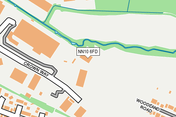
NN10 6FD is located in the Higham Ferrers electoral ward, within the unitary authority of North Northamptonshire and the English Parliamentary constituency of Wellingborough. The Sub Integrated Care Board (ICB) Location is NHS Northamptonshire ICB - 78H and the police force is Northamptonshire. This postcode has been in use since February 2008.


GetTheData
Source: OS OpenMap – Local (Ordnance Survey)
Source: OS VectorMap District (Ordnance Survey)
Licence: Open Government Licence (requires attribution)
| Easting | 494749 |
| Northing | 267513 |
| Latitude | 52.297582 |
| Longitude | -0.612033 |
GetTheData
Source: Open Postcode Geo
Licence: Open Government Licence
| Country | England |
| Postcode District | NN10 |
| ➜ NN10 open data dashboard ➜ See where NN10 is on a map ➜ Where is Rushden? | |
GetTheData
Source: Land Registry Price Paid Data
Licence: Open Government Licence
Elevation or altitude of NN10 6FD as distance above sea level:
| Metres | Feet | |
|---|---|---|
| Elevation | 50m | 164ft |
Elevation is measured from the approximate centre of the postcode, to the nearest point on an OS contour line from OS Terrain 50, which has contour spacing of ten vertical metres.
➜ How high above sea level am I? Find the elevation of your current position using your device's GPS.
GetTheData
Source: Open Postcode Elevation
Licence: Open Government Licence
| Ward | Higham Ferrers |
| Constituency | Wellingborough |
GetTheData
Source: ONS Postcode Database
Licence: Open Government Licence
| June 2022 | Violence and sexual offences | On or near Brindley Close | 275m |
| June 2022 | Violence and sexual offences | On or near Brindley Close | 275m |
| June 2022 | Violence and sexual offences | On or near Chestnut Close | 356m |
| ➜ Get more crime data in our Crime section | |||
GetTheData
Source: data.police.uk
Licence: Open Government Licence
| Totectors Factory (Crown Way) | Rushden | 320m |
| St Peters Avenue (Wellingborough Road) | Rushden | 424m |
| Gordon Street (Wellingborough Road) | Rushden | 458m |
| Waitrose (Crown Way) | Rushden | 511m |
| Moor Road (Washbrook Road) | Rushden | 545m |
| Wellingborough Station | 4.5km |
GetTheData
Source: NaPTAN
Licence: Open Government Licence
GetTheData
Source: ONS Postcode Database
Licence: Open Government Licence


➜ Get more ratings from the Food Standards Agency
GetTheData
Source: Food Standards Agency
Licence: FSA terms & conditions
| Last Collection | |||
|---|---|---|---|
| Location | Mon-Fri | Sat | Distance |
| Washbrook Road | 17:15 | 11:15 | 558m |
| Mazefield Road | 17:15 | 11:00 | 575m |
| Birchall Road | 17:15 | 11:00 | 792m |
GetTheData
Source: Dracos
Licence: Creative Commons Attribution-ShareAlike
| Facility | Distance |
|---|---|
| Rushden Academy Hayway, Rushden Grass Pitches, Sports Hall, Outdoor Tennis Courts | 483m |
| Rushden Town Indoor Bowls Club Northampton Road, Rushden Indoor Bowls | 551m |
| Spencer Park Washbrook Road, Rushden Grass Pitches, Outdoor Tennis Courts | 588m |
GetTheData
Source: Active Places
Licence: Open Government Licence
| School | Phase of Education | Distance |
|---|---|---|
| Rushden Academy Hayway, Rushden, NN10 6AG | Secondary | 483m |
| Alfred Lord Tennyson School-2 sites (Tennyson Rd and Alfred St) Alfred Street, Rushden, NN10 9YS | Primary | 1.2km |
| Denfield Park Primary School Victoria Road, Rushden, NN10 0DA | Primary | 1.4km |
GetTheData
Source: Edubase
Licence: Open Government Licence
The below table lists the International Territorial Level (ITL) codes (formerly Nomenclature of Territorial Units for Statistics (NUTS) codes) and Local Administrative Units (LAU) codes for NN10 6FD:
| ITL 1 Code | Name |
|---|---|
| TLF | East Midlands (England) |
| ITL 2 Code | Name |
| TLF2 | Leicestershire, Rutland and Northamptonshire |
| ITL 3 Code | Name |
| TLF25 | North Northamptonshire |
| LAU 1 Code | Name |
| E07000152 | East Northamptonshire |
GetTheData
Source: ONS Postcode Directory
Licence: Open Government Licence
The below table lists the Census Output Area (OA), Lower Layer Super Output Area (LSOA), and Middle Layer Super Output Area (MSOA) for NN10 6FD:
| Code | Name | |
|---|---|---|
| OA | E00137653 | |
| LSOA | E01027063 | East Northamptonshire 008C |
| MSOA | E02005636 | East Northamptonshire 008 |
GetTheData
Source: ONS Postcode Directory
Licence: Open Government Licence
| NN10 6EN | Brindley Close | 221m |
| NN10 6RW | Orchard Close | 252m |
| NN10 6RL | Bramley Close | 262m |
| NN10 6RY | Paddocks Road | 269m |
| NN10 6UB | St Georges Way | 308m |
| NN10 6PZ | Pippin Close | 331m |
| NN10 6EH | Heatherbreea Gardens | 341m |
| NN10 6UD | Nicholas Way | 351m |
| NN10 9RS | Chestnut Close | 360m |
| NN10 6BT | Crown Way | 379m |
GetTheData
Source: Open Postcode Geo; Land Registry Price Paid Data
Licence: Open Government Licence