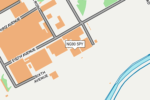
NG90 5PY is located in the Lenton & Wollaton East electoral ward, within the unitary authority of Nottingham and the English Parliamentary constituency of Nottingham South. The Sub Integrated Care Board (ICB) Location is NHS Nottingham and Nottinghamshire ICB - 52R and the police force is Nottinghamshire. This postcode has been in use since June 1999.


GetTheData
Source: OS OpenMap – Local (Ordnance Survey)
Source: OS VectorMap District (Ordnance Survey)
Licence: Open Government Licence (requires attribution)
| Easting | 454607 |
| Northing | 336549 |
| Latitude | 52.923586 |
| Longitude | -1.189206 |
GetTheData
Source: Open Postcode Geo
Licence: Open Government Licence
| Country | England |
| Postcode District | NG90 |
➜ Where is Nottingham? | |
GetTheData
Source: Land Registry Price Paid Data
Licence: Open Government Licence
Elevation or altitude of NG90 5PY as distance above sea level:
| Metres | Feet | |
|---|---|---|
| Elevation | 30m | 98ft |
Elevation is measured from the approximate centre of the postcode, to the nearest point on an OS contour line from OS Terrain 50, which has contour spacing of ten vertical metres.
➜ How high above sea level am I? Find the elevation of your current position using your device's GPS.
GetTheData
Source: Open Postcode Elevation
Licence: Open Government Licence
| Ward | Lenton & Wollaton East |
| Constituency | Nottingham South |
GetTheData
Source: ONS Postcode Database
Licence: Open Government Licence
| Building D101 (B Road) | Boots | 188m |
| Building D80 (Second Avenue) | Boots | 326m |
| Fifth Avenue | Boots | 335m |
| Building D6 (First Avenue) | Boots | 403m |
| D82 Green Stop A (Second Avenue) | Boots | 435m |
| University Boulevard Tram Stop (University Boulevard) | Nottingham University Main Campus | 1,295m |
| Middle Street Tram Stop (Middle Street) | Beeston | 1,416m |
| Southchurch Drive North Tram Stop (Southchurch Drive) | Clifton | 1,909m |
| Beeston Station | 1.3km |
| Attenborough Station | 3.4km |
| Nottingham Station | 3.9km |
GetTheData
Source: NaPTAN
Licence: Open Government Licence
GetTheData
Source: ONS Postcode Database
Licence: Open Government Licence


➜ Get more ratings from the Food Standards Agency
GetTheData
Source: Food Standards Agency
Licence: FSA terms & conditions
| Last Collection | |||
|---|---|---|---|
| Location | Mon-Fri | Sat | Distance |
| Nottingham Mailcentre | 19:30 | 14:00 | 779m |
| Mailcentre | 782m | ||
| Lilac Grove | 17:00 | 10:30 | 887m |
GetTheData
Source: Dracos
Licence: Creative Commons Attribution-ShareAlike
| Risk of NG90 5PY flooding from rivers and sea | Low |
| ➜ NG90 5PY flood map | |
GetTheData
Source: Open Flood Risk by Postcode
Licence: Open Government Licence
The below table lists the International Territorial Level (ITL) codes (formerly Nomenclature of Territorial Units for Statistics (NUTS) codes) and Local Administrative Units (LAU) codes for NG90 5PY:
| ITL 1 Code | Name |
|---|---|
| TLF | East Midlands (England) |
| ITL 2 Code | Name |
| TLF1 | Derbyshire and Nottinghamshire |
| ITL 3 Code | Name |
| TLF14 | Nottingham |
| LAU 1 Code | Name |
| E06000018 | Nottingham |
GetTheData
Source: ONS Postcode Directory
Licence: Open Government Licence
The below table lists the Census Output Area (OA), Lower Layer Super Output Area (LSOA), and Middle Layer Super Output Area (MSOA) for NG90 5PY:
| Code | Name | |
|---|---|---|
| OA | E00070259 | |
| LSOA | E01013928 | Nottingham 031G |
| MSOA | E02002898 | Nottingham 031 |
GetTheData
Source: ONS Postcode Directory
Licence: Open Government Licence
| NG90 1BS | Thane Road | 534m |
| NG9 1PS | Leyton Crescent | 716m |
| NG9 1PT | Leyton Crescent | 722m |
| NG9 1PR | Leyton Crescent | 747m |
| NG9 1PN | Technology Drive | 753m |
| NG9 1PF | Lilac Grove | 774m |
| NG9 1PU | Maple Avenue | 782m |
| NG9 1PW | Maple Avenue | 817m |
| NG9 1PZ | East Crescent | 821m |
| NG9 1QA | East Crescent | 842m |
GetTheData
Source: Open Postcode Geo; Land Registry Price Paid Data
Licence: Open Government Licence