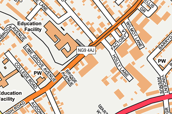
NG9 4AJ is located in the Attenborough & Chilwell East electoral ward, within the local authority district of Broxtowe and the English Parliamentary constituency of Broxtowe. The Sub Integrated Care Board (ICB) Location is NHS Nottingham and Nottinghamshire ICB - 52R and the police force is Nottinghamshire. This postcode has been in use since January 1980.


GetTheData
Source: OS OpenMap – Local (Ordnance Survey)
Source: OS VectorMap District (Ordnance Survey)
Licence: Open Government Licence (requires attribution)
| Easting | 452348 |
| Northing | 336249 |
| Latitude | 52.921134 |
| Longitude | -1.222848 |
GetTheData
Source: Open Postcode Geo
Licence: Open Government Licence
| Country | England |
| Postcode District | NG9 |
| ➜ NG9 open data dashboard ➜ See where NG9 is on a map ➜ Where is Beeston? | |
GetTheData
Source: Land Registry Price Paid Data
Licence: Open Government Licence
Elevation or altitude of NG9 4AJ as distance above sea level:
| Metres | Feet | |
|---|---|---|
| Elevation | 30m | 98ft |
Elevation is measured from the approximate centre of the postcode, to the nearest point on an OS contour line from OS Terrain 50, which has contour spacing of ten vertical metres.
➜ How high above sea level am I? Find the elevation of your current position using your device's GPS.
GetTheData
Source: Open Postcode Elevation
Licence: Open Government Licence
| Ward | Attenborough & Chilwell East |
| Constituency | Broxtowe |
GetTheData
Source: ONS Postcode Database
Licence: Open Government Licence
| April 2023 | Drugs | On or near Cedar Road | 253m |
| March 2023 | Burglary | On or near Cedar Road | 253m |
| November 2022 | Anti-social behaviour | On or near Cedar Road | 253m |
| ➜ Get more crime data in our Crime section | |||
GetTheData
Source: data.police.uk
Licence: Open Government Licence
| Central College Nottingham (High Road) | Chilwell | 32m |
| Central College Nottingham (B6464) | Chilwell | 59m |
| Wilmot Lane (Chilwell Road) | Chilwell | 200m |
| Cator Lane (High Road) | Chilwell | 289m |
| Ellis Grove (High Road) | Chilwell | 299m |
| High Road - Central College Tram Stop (High Road) | Chilwell | 33m |
| Chilwell Road Tram Stop (Chilwell Road) | Beeston | 250m |
| Cator Lane Tram Stop (N/A) | Chilwell | 602m |
| Beeston Centre Tram Stop (Styring Street) | Beeston | 718m |
| Bramcote Lane Tram Stop (Sandby Court) | Chilwell | 900m |
| Beeston Station | 1km |
| Attenborough Station | 1.8km |
| Long Eaton Station | 5.9km |
GetTheData
Source: NaPTAN
Licence: Open Government Licence
GetTheData
Source: ONS Postcode Database
Licence: Open Government Licence


➜ Get more ratings from the Food Standards Agency
GetTheData
Source: Food Standards Agency
Licence: FSA terms & conditions
| Last Collection | |||
|---|---|---|---|
| Location | Mon-Fri | Sat | Distance |
| Chilwell Road | 17:30 | 11:30 | 184m |
| Vincent Avenue | 17:30 | 11:00 | 319m |
| Cator Lane | 17:30 | 11:00 | 332m |
GetTheData
Source: Dracos
Licence: Creative Commons Attribution-ShareAlike
| Facility | Distance |
|---|---|
| Chilwell Memorial Hall High Road, Chilwell, Beeston, Nottingham Outdoor Tennis Courts, Sports Hall | 265m |
| The Lanes Primary School Cator Lane, Beeston, Nottingham Grass Pitches | 284m |
| Chilwell Manor Golf Club Meadow Lane, Beeston, Nottingham Golf | 414m |
GetTheData
Source: Active Places
Licence: Open Government Licence
| School | Phase of Education | Distance |
|---|---|---|
| The Lanes Primary School Cator Lane, Chilwell, Beeston, Nottingham, NG9 4BB | Primary | 311m |
| Round Hill Primary School Foster Avenue, Beeston, Round Hill Primary School, Nottingham, NG9 1AE | Primary | 753m |
| John Clifford Primary School Nether Street, Beeston, Nottingham, NG9 2AT | Primary | 1km |
GetTheData
Source: Edubase
Licence: Open Government Licence
The below table lists the International Territorial Level (ITL) codes (formerly Nomenclature of Territorial Units for Statistics (NUTS) codes) and Local Administrative Units (LAU) codes for NG9 4AJ:
| ITL 1 Code | Name |
|---|---|
| TLF | East Midlands (England) |
| ITL 2 Code | Name |
| TLF1 | Derbyshire and Nottinghamshire |
| ITL 3 Code | Name |
| TLF16 | South Nottinghamshire |
| LAU 1 Code | Name |
| E07000172 | Broxtowe |
GetTheData
Source: ONS Postcode Directory
Licence: Open Government Licence
The below table lists the Census Output Area (OA), Lower Layer Super Output Area (LSOA), and Middle Layer Super Output Area (MSOA) for NG9 4AJ:
| Code | Name | |
|---|---|---|
| OA | E00143152 | |
| LSOA | E01028096 | Broxtowe 014E |
| MSOA | E02005863 | Broxtowe 014 |
GetTheData
Source: ONS Postcode Directory
Licence: Open Government Licence
| NG9 4AG | High Road | 87m |
| NG9 4AP | Bridge Avenue | 112m |
| NG9 4BT | High Road | 131m |
| NG9 4AQ | High Road | 133m |
| NG9 4ED | Grove Avenue | 144m |
| NG9 4AF | High Road | 148m |
| NG9 4AR | Lime Grove Avenue | 160m |
| NG9 4AE | High Road | 164m |
| NG9 4AA | Factory Lane | 172m |
| NG9 4AB | Holly Lane | 172m |
GetTheData
Source: Open Postcode Geo; Land Registry Price Paid Data
Licence: Open Government Licence