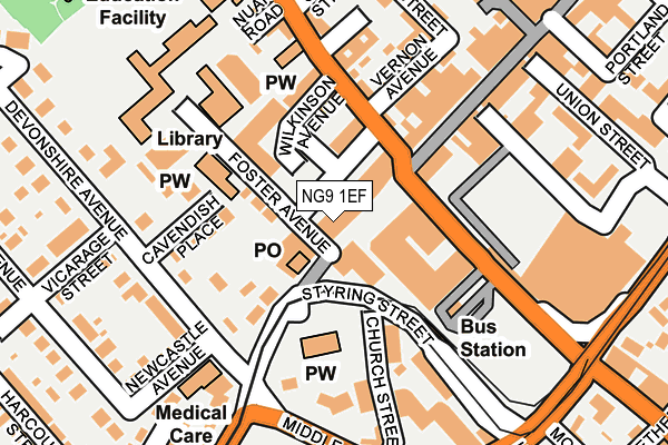
NG9 1EF is located in the Beeston West electoral ward, within the local authority district of Broxtowe and the English Parliamentary constituency of Broxtowe. The Sub Integrated Care Board (ICB) Location is NHS Nottingham and Nottinghamshire ICB - 52R and the police force is Nottinghamshire. This postcode has been in use since January 1980.


GetTheData
Source: OS OpenMap – Local (Ordnance Survey)
Source: OS VectorMap District (Ordnance Survey)
Licence: Open Government Licence (requires attribution)
| Easting | 452778 |
| Northing | 336853 |
| Latitude | 52.926501 |
| Longitude | -1.216359 |
GetTheData
Source: Open Postcode Geo
Licence: Open Government Licence
| Country | England |
| Postcode District | NG9 |
| ➜ NG9 open data dashboard ➜ See where NG9 is on a map ➜ Where is Beeston? | |
GetTheData
Source: Land Registry Price Paid Data
Licence: Open Government Licence
Elevation or altitude of NG9 1EF as distance above sea level:
| Metres | Feet | |
|---|---|---|
| Elevation | 30m | 98ft |
Elevation is measured from the approximate centre of the postcode, to the nearest point on an OS contour line from OS Terrain 50, which has contour spacing of ten vertical metres.
➜ How high above sea level am I? Find the elevation of your current position using your device's GPS.
GetTheData
Source: Open Postcode Elevation
Licence: Open Government Licence
| Ward | Beeston West |
| Constituency | Broxtowe |
GetTheData
Source: ONS Postcode Database
Licence: Open Government Licence
| January 2024 | Bicycle theft | On or near Parking Area | 424m |
| January 2024 | Criminal damage and arson | On or near Parking Area | 424m |
| December 2023 | Burglary | On or near Montague Street | 477m |
| ➜ Get more crime data in our Crime section | |||
GetTheData
Source: data.police.uk
Licence: Open Government Licence
| Bus & Tram Interchange (Styring Street) | Beeston | 99m |
| Bus & Tram Interchange (Styring Street) | Beeston | 117m |
| Wilkinson Avenue (Wollaton Road) | Beeston | 126m |
| Bus & Tram Interchange (Styring Street) | Beeston | 140m |
| Newcastle Avenue (Devonshire Avenue) | Beeston | 148m |
| Beeston Centre Tram Stop (Styring Street) | Beeston | 167m |
| Chilwell Road Tram Stop (Chilwell Road) | Beeston | 496m |
| Middle Street Tram Stop (Middle Street) | Beeston | 513m |
| High Road - Central College Tram Stop (High Road) | Chilwell | 744m |
| Cator Lane Tram Stop (N/A) | Chilwell | 1,103m |
| Beeston Station | 0.9km |
| Attenborough Station | 2.5km |
| Nottingham Station | 5.2km |
GetTheData
Source: NaPTAN
Licence: Open Government Licence
GetTheData
Source: ONS Postcode Database
Licence: Open Government Licence


➜ Get more ratings from the Food Standards Agency
GetTheData
Source: Food Standards Agency
Licence: FSA terms & conditions
| Last Collection | |||
|---|---|---|---|
| Location | Mon-Fri | Sat | Distance |
| Beeston Post Office | 17:30 | 12:30 | 54m |
| Beeston Post Office | 17:30 | 12:30 | 54m |
| West End | 17:00 | 11:00 | 256m |
GetTheData
Source: Dracos
Licence: Creative Commons Attribution-ShareAlike
| Facility | Distance |
|---|---|
| Puregym (Nottingham Beeston) The Square, Beeston, Nottingham Health and Fitness Gym, Studio | 71m |
| Roundhill Primary School Foster Avenue, Beeston, Nottingham Grass Pitches | 200m |
| The Pearson Centre For Young People Nuart Road, Beeston, Nottingham Sports Hall, Artificial Grass Pitch, Studio | 253m |
GetTheData
Source: Active Places
Licence: Open Government Licence
| School | Phase of Education | Distance |
|---|---|---|
| Round Hill Primary School Foster Avenue, Beeston, Round Hill Primary School, Nottingham, NG9 1AE | Primary | 200m |
| John Clifford Primary School Nether Street, Beeston, Nottingham, NG9 2AT | Primary | 445m |
| Beeston Fields Primary School and Nursery Boundary Road, Beeston, Nottingham, NG9 2RG | Primary | 905m |
GetTheData
Source: Edubase
Licence: Open Government Licence
The below table lists the International Territorial Level (ITL) codes (formerly Nomenclature of Territorial Units for Statistics (NUTS) codes) and Local Administrative Units (LAU) codes for NG9 1EF:
| ITL 1 Code | Name |
|---|---|
| TLF | East Midlands (England) |
| ITL 2 Code | Name |
| TLF1 | Derbyshire and Nottinghamshire |
| ITL 3 Code | Name |
| TLF16 | South Nottinghamshire |
| LAU 1 Code | Name |
| E07000172 | Broxtowe |
GetTheData
Source: ONS Postcode Directory
Licence: Open Government Licence
The below table lists the Census Output Area (OA), Lower Layer Super Output Area (LSOA), and Middle Layer Super Output Area (MSOA) for NG9 1EF:
| Code | Name | |
|---|---|---|
| OA | E00173568 | |
| LSOA | E01028085 | Broxtowe 011D |
| MSOA | E02005860 | Broxtowe 011 |
GetTheData
Source: ONS Postcode Directory
Licence: Open Government Licence
| NG9 2NJ | Commercial Avenue | 77m |
| NG9 1AE | Foster Avenue | 96m |
| NG9 1BY | Cavendish Place | 115m |
| NG9 2NL | Wilkinson Avenue | 119m |
| NG9 1FA | Church Street | 119m |
| NG9 2NR | Wollaton Road | 135m |
| NG9 2NS | Vernon Avenue | 143m |
| NG9 1FY | Church Street | 146m |
| NG9 1FH | Church Street | 149m |
| NG9 2JP | High Road | 172m |
GetTheData
Source: Open Postcode Geo; Land Registry Price Paid Data
Licence: Open Government Licence