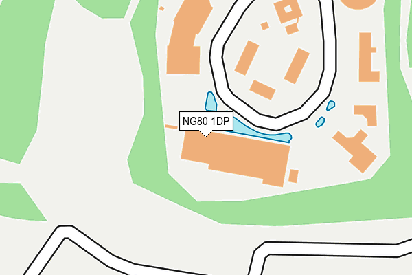
NG80 1DP is located in the Ruddington electoral ward, within the local authority district of Rushcliffe and the English Parliamentary constituency of Rushcliffe. The Sub Integrated Care Board (ICB) Location is NHS Nottingham and Nottinghamshire ICB - 52R and the police force is Nottinghamshire. This postcode has been in use since January 2004.


GetTheData
Source: OS OpenMap – Local (Ordnance Survey)
Source: OS VectorMap District (Ordnance Survey)
Licence: Open Government Licence (requires attribution)
| Easting | 457596 |
| Northing | 331719 |
| Latitude | 52.879861 |
| Longitude | -1.145607 |
GetTheData
Source: Open Postcode Geo
Licence: Open Government Licence
| Country | England |
| Postcode District | NG80 |
| ➜ NG80 open data dashboard ➜ Where is Ruddington? | |
GetTheData
Source: Land Registry Price Paid Data
Licence: Open Government Licence
Elevation or altitude of NG80 1DP as distance above sea level:
| Metres | Feet | |
|---|---|---|
| Elevation | 40m | 131ft |
Elevation is measured from the approximate centre of the postcode, to the nearest point on an OS contour line from OS Terrain 50, which has contour spacing of ten vertical metres.
➜ How high above sea level am I? Find the elevation of your current position using your device's GPS.
GetTheData
Source: Open Postcode Elevation
Licence: Open Government Licence
| Ward | Ruddington |
| Constituency | Rushcliffe |
GetTheData
Source: ONS Postcode Database
Licence: Open Government Licence
| April 2022 | Other theft | On or near Mere Way | 362m |
| January 2022 | Other theft | On or near Mere Way | 362m |
| November 2021 | Criminal damage and arson | On or near Mere Way | 362m |
| ➜ Get more crime data in our Crime section | |||
GetTheData
Source: data.police.uk
Licence: Open Government Licence
| Experian (Mere Way) | Ruddington Business Park | 57m |
| Greene Tweed (Mere Way) | Ruddington Business Park | 197m |
| Capita (Mere Way) | Ruddington Business Park | 233m |
| Rushcliffe Country Park (Mere Way) | Ruddington Business Park | 498m |
| Rushcliffe Country Park (Mere Way) | Ruddington Business Park | 504m |
| Beeston Station | 6.2km |
GetTheData
Source: NaPTAN
Licence: Open Government Licence
GetTheData
Source: ONS Postcode Database
Licence: Open Government Licence


➜ Get more ratings from the Food Standards Agency
GetTheData
Source: Food Standards Agency
Licence: FSA terms & conditions
| Last Collection | |||
|---|---|---|---|
| Location | Mon-Fri | Sat | Distance |
| Elms Park Road | 17:30 | 09:30 | 991m |
| Bradmore | 16:30 | 11:30 | 1,076m |
| Musters Road | 17:30 | 09:30 | 1,222m |
GetTheData
Source: Dracos
Licence: Creative Commons Attribution-ShareAlike
| Facility | Distance |
|---|---|
| Ruddington Jubilee Playing Field Harvey Close, Ruddington, Nottingham Grass Pitches | 805m |
| Elms Park Loughborough Road, Ruddington Grass Pitches | 983m |
| Sellors Playing Field Wilford Road, Ruddington, Nottingham Grass Pitches | 2.1km |
GetTheData
Source: Active Places
Licence: Open Government Licence
| School | Phase of Education | Distance |
|---|---|---|
| James Peacock Infant and Nursery School Manor Park, Ruddington, Nottingham, NG11 6DS | Primary | 1.6km |
| Easthorpe School 165 Loughborough Road, Ruddington, Nottingham, NG11 6LQ | Not applicable | 1.8km |
| Bunny CofE Primary School Church Street, Bunny, Nottingham, NG11 6QW | Primary | 2.1km |
GetTheData
Source: Edubase
Licence: Open Government Licence
The below table lists the International Territorial Level (ITL) codes (formerly Nomenclature of Territorial Units for Statistics (NUTS) codes) and Local Administrative Units (LAU) codes for NG80 1DP:
| ITL 1 Code | Name |
|---|---|
| TLF | East Midlands (England) |
| ITL 2 Code | Name |
| TLF1 | Derbyshire and Nottinghamshire |
| ITL 3 Code | Name |
| TLF16 | South Nottinghamshire |
| LAU 1 Code | Name |
| E07000176 | Rushcliffe |
GetTheData
Source: ONS Postcode Directory
Licence: Open Government Licence
The below table lists the Census Output Area (OA), Lower Layer Super Output Area (LSOA), and Middle Layer Super Output Area (MSOA) for NG80 1DP:
| Code | Name | |
|---|---|---|
| OA | E00144737 | |
| LSOA | E01028405 | Rushcliffe 011B |
| MSOA | E02005916 | Rushcliffe 011 |
GetTheData
Source: ONS Postcode Directory
Licence: Open Government Licence
| NG11 6JT | Wheatley Close | 733m |
| NG11 6NJ | Harvey Close | 738m |
| NG11 6JH | Fields Avenue | 762m |
| NG11 6GX | Maclaren Gardens | 790m |
| NG11 6NS | Sheepfold Lane | 798m |
| NG11 6NH | Stevenson Gardens | 800m |
| NG11 6JG | Barleylands | 820m |
| NG11 6NT | Elms Park | 842m |
| NG11 6JP | Sellars Avenue | 852m |
| NG11 6PG | Donkey Lane | 863m |
GetTheData
Source: Open Postcode Geo; Land Registry Price Paid Data
Licence: Open Government Licence