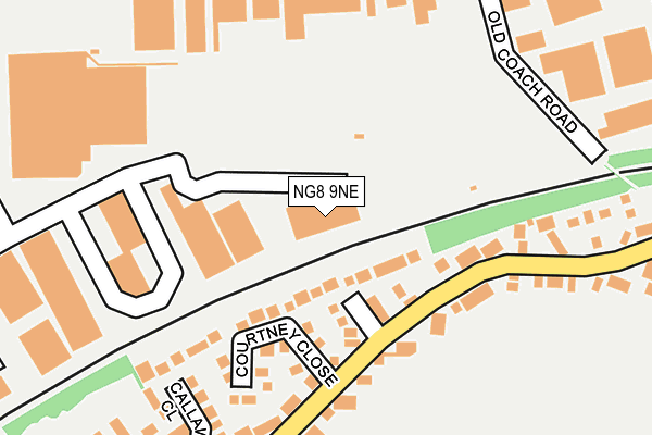
NG8 9NE is located in the Bilborough electoral ward, within the unitary authority of Nottingham and the English Parliamentary constituency of Nottingham North. The Sub Integrated Care Board (ICB) Location is NHS Nottingham and Nottinghamshire ICB - 52R and the police force is Nottinghamshire. This postcode has been in use since July 2014.


GetTheData
Source: OS OpenMap – Local (Ordnance Survey)
Source: OS VectorMap District (Ordnance Survey)
Licence: Open Government Licence (requires attribution)
| Easting | 452350 |
| Northing | 340560 |
| Latitude | 52.959863 |
| Longitude | -1.222128 |
GetTheData
Source: Open Postcode Geo
Licence: Open Government Licence
| Country | England |
| Postcode District | NG8 |
| ➜ NG8 open data dashboard ➜ See where NG8 is on a map ➜ Where is Nottingham? | |
GetTheData
Source: Land Registry Price Paid Data
Licence: Open Government Licence
Elevation or altitude of NG8 9NE as distance above sea level:
| Metres | Feet | |
|---|---|---|
| Elevation | 60m | 197ft |
Elevation is measured from the approximate centre of the postcode, to the nearest point on an OS contour line from OS Terrain 50, which has contour spacing of ten vertical metres.
➜ How high above sea level am I? Find the elevation of your current position using your device's GPS.
GetTheData
Source: Open Postcode Elevation
Licence: Open Government Licence
| Ward | Bilborough |
| Constituency | Nottingham North |
GetTheData
Source: ONS Postcode Database
Licence: Open Government Licence
| August 2023 | Vehicle crime | On or near Callaway Close | 217m |
| March 2023 | Anti-social behaviour | On or near Callaway Close | 217m |
| February 2023 | Criminal damage and arson | On or near Torvill Drive | 216m |
| ➜ Get more crime data in our Crime section | |||
GetTheData
Source: data.police.uk
Licence: Open Government Licence
| Courtney Close (Torvill Drive) | Wollaton | 169m |
| Moorhouse Road (Glaisdale Drive) | Bilborough | 235m |
| Moorhouse Road (Glaisdale Drive) | Bilborough | 249m |
| Wingate Close (Glaisdale Drive) | Glaisdale Drive Industrial Estate | 326m |
| Parkway Court (Glaisdale Parkway) | Glaisdale Drive Industrial Estate | 331m |
| Beeston Station | 4.5km |
| Bulwell Station | 4.8km |
| Ilkeston Station | 5.4km |
GetTheData
Source: NaPTAN
Licence: Open Government Licence
GetTheData
Source: ONS Postcode Database
Licence: Open Government Licence


➜ Get more ratings from the Food Standards Agency
GetTheData
Source: Food Standards Agency
Licence: FSA terms & conditions
| Last Collection | |||
|---|---|---|---|
| Location | Mon-Fri | Sat | Distance |
| Torville Drive | 17:00 | 12:30 | 109m |
| Glaisdale Drive | 17:00 | 11:00 | 263m |
| Bracebridge Drive P O | 17:00 | 11:30 | 678m |
GetTheData
Source: Dracos
Licence: Creative Commons Attribution-ShareAlike
| Facility | Distance |
|---|---|
| Wollaton Sports Association Ground Wollaton Road, Nottingham Grass Pitches, Outdoor Tennis Courts | 698m |
| Oakfield School Wigman Road, Nottingham Health and Fitness Gym, Artificial Grass Pitch, Sports Hall | 801m |
| Bilborough Park Wigman Road, Nottingham Grass Pitches | 816m |
GetTheData
Source: Active Places
Licence: Open Government Licence
| School | Phase of Education | Distance |
|---|---|---|
| Oak Field School Wigman Road, Bilborough, Nottingham, NG8 3HW | Not applicable | 810m |
| Glenbrook Spencer Academy Wigman Road, Bilborough, Nottingham, NG8 4PD | Primary | 821m |
| Fernwood School Goodwood Road, Wollaton, Nottingham, NG8 2FT | Secondary | 894m |
GetTheData
Source: Edubase
Licence: Open Government Licence
The below table lists the International Territorial Level (ITL) codes (formerly Nomenclature of Territorial Units for Statistics (NUTS) codes) and Local Administrative Units (LAU) codes for NG8 9NE:
| ITL 1 Code | Name |
|---|---|
| TLF | East Midlands (England) |
| ITL 2 Code | Name |
| TLF1 | Derbyshire and Nottinghamshire |
| ITL 3 Code | Name |
| TLF14 | Nottingham |
| LAU 1 Code | Name |
| E06000018 | Nottingham |
GetTheData
Source: ONS Postcode Directory
Licence: Open Government Licence
The below table lists the Census Output Area (OA), Lower Layer Super Output Area (LSOA), and Middle Layer Super Output Area (MSOA) for NG8 9NE:
| Code | Name | |
|---|---|---|
| OA | E00069921 | |
| LSOA | E01013860 | Nottingham 025B |
| MSOA | E02002892 | Nottingham 025 |
GetTheData
Source: ONS Postcode Directory
Licence: Open Government Licence
| NG8 2AY | Jayne Close | 80m |
| NG8 2AZ | Crawford Close | 81m |
| NG8 2BS | Courtney Close | 133m |
| NG8 2BT | Callaway Close | 198m |
| NG8 2BR | Torvill Drive | 232m |
| NG8 2AX | Christopher Close | 253m |
| NG8 4GU | Glaisdale Drive East | 275m |
| NG8 2BU | Torvill Drive | 280m |
| NG8 2DZ | Uplands Court | 325m |
| NG8 4NQ | Bramerton Road | 335m |
GetTheData
Source: Open Postcode Geo; Land Registry Price Paid Data
Licence: Open Government Licence