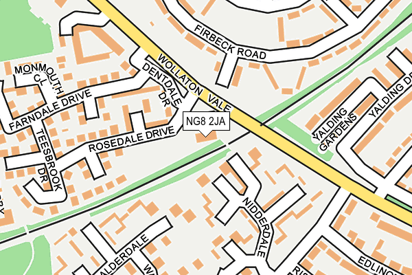
NG8 2JA is located in the Bilborough electoral ward, within the unitary authority of Nottingham and the English Parliamentary constituency of Nottingham North. The Sub Integrated Care Board (ICB) Location is NHS Nottingham and Nottinghamshire ICB - 52R and the police force is Nottinghamshire. This postcode has been in use since January 1980.


GetTheData
Source: OS OpenMap – Local (Ordnance Survey)
Source: OS VectorMap District (Ordnance Survey)
Licence: Open Government Licence (requires attribution)
| Easting | 451063 |
| Northing | 339623 |
| Latitude | 52.951584 |
| Longitude | -1.241429 |
GetTheData
Source: Open Postcode Geo
Licence: Open Government Licence
| Country | England |
| Postcode District | NG8 |
| ➜ NG8 open data dashboard ➜ See where NG8 is on a map ➜ Where is Nottingham? | |
GetTheData
Source: Land Registry Price Paid Data
Licence: Open Government Licence
Elevation or altitude of NG8 2JA as distance above sea level:
| Metres | Feet | |
|---|---|---|
| Elevation | 70m | 230ft |
Elevation is measured from the approximate centre of the postcode, to the nearest point on an OS contour line from OS Terrain 50, which has contour spacing of ten vertical metres.
➜ How high above sea level am I? Find the elevation of your current position using your device's GPS.
GetTheData
Source: Open Postcode Elevation
Licence: Open Government Licence
| Ward | Bilborough |
| Constituency | Nottingham North |
GetTheData
Source: ONS Postcode Database
Licence: Open Government Licence
| November 2023 | Vehicle crime | On or near Hillbeck Crescent | 322m |
| June 2023 | Anti-social behaviour | On or near Birchwood Road | 231m |
| June 2023 | Anti-social behaviour | On or near Birchwood Road | 231m |
| ➜ Get more crime data in our Crime section | |||
GetTheData
Source: data.police.uk
Licence: Open Government Licence
| Rosedale Drive (Wollaton Vale) | Wollaton | 52m |
| Wollaton Vale (Rosedale Drive) | Wollaton | 53m |
| Rosedale Drive (Wollaton Vale) | Wollaton | 67m |
| Grangewood Road (Wollaton Vale) | Wollaton | 190m |
| Grangewood Court (Grangewood Road) | Wollaton | 217m |
| Beeston Station | 4.1km |
| Ilkeston Station | 4.8km |
GetTheData
Source: NaPTAN
Licence: Open Government Licence
GetTheData
Source: ONS Postcode Database
Licence: Open Government Licence


➜ Get more ratings from the Food Standards Agency
GetTheData
Source: Food Standards Agency
Licence: FSA terms & conditions
| Last Collection | |||
|---|---|---|---|
| Location | Mon-Fri | Sat | Distance |
| Dentdale Drive | 17:30 | 11:00 | 116m |
| Edlington Drive | 17:30 | 11:30 | 231m |
| Firbeck | 17:00 | 11:00 | 406m |
GetTheData
Source: Dracos
Licence: Creative Commons Attribution-ShareAlike
| Facility | Distance |
|---|---|
| Birchover Park Westwick Road, Nottingham Grass Pitches | 749m |
| Fernwood School Goodwood Road, Nottingham Sports Hall, Artificial Grass Pitch, Grass Pitches, Outdoor Tennis Courts | 766m |
| Bramcote Hills Golf Course (Closed) Thoresby Road, Bramcote, Nottingham Golf | 938m |
GetTheData
Source: Active Places
Licence: Open Government Licence
| School | Phase of Education | Distance |
|---|---|---|
| Firbeck Academy Firbeck Road, Wollaton, Nottingham, NG8 2FB | Primary | 297m |
| Fernwood School Goodwood Road, Wollaton, Nottingham, NG8 2FT | Secondary | 786m |
| Fernwood Primary School Arleston Drive, Wollaton, Nottingham, NG8 2FZ | Primary | 819m |
GetTheData
Source: Edubase
Licence: Open Government Licence
The below table lists the International Territorial Level (ITL) codes (formerly Nomenclature of Territorial Units for Statistics (NUTS) codes) and Local Administrative Units (LAU) codes for NG8 2JA:
| ITL 1 Code | Name |
|---|---|
| TLF | East Midlands (England) |
| ITL 2 Code | Name |
| TLF1 | Derbyshire and Nottinghamshire |
| ITL 3 Code | Name |
| TLF14 | Nottingham |
| LAU 1 Code | Name |
| E06000018 | Nottingham |
GetTheData
Source: ONS Postcode Directory
Licence: Open Government Licence
The below table lists the Census Output Area (OA), Lower Layer Super Output Area (LSOA), and Middle Layer Super Output Area (MSOA) for NG8 2JA:
| Code | Name | |
|---|---|---|
| OA | E00069930 | |
| LSOA | E01013862 | Nottingham 025C |
| MSOA | E02002892 | Nottingham 025 |
GetTheData
Source: ONS Postcode Directory
Licence: Open Government Licence
| NG8 2TN | Nidderdale | 91m |
| NG8 2FB | Firbeck Road | 111m |
| NG8 2TH | Fylingdale Way | 115m |
| NG8 2TP | Nidderdale | 116m |
| NG8 2TU | Calderdale | 131m |
| NG8 2JE | Rosedale Drive | 138m |
| NG8 2TQ | Nidderdale Close | 151m |
| NG8 2TJ | Fylingdale Way | 175m |
| NG8 2JN | Whitby Close | 184m |
| NG8 2FD | Firbeck Road | 184m |
GetTheData
Source: Open Postcode Geo; Land Registry Price Paid Data
Licence: Open Government Licence