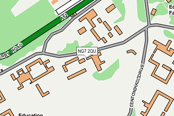
NG7 2QU is located in the Lenton & Wollaton East electoral ward, within the unitary authority of Nottingham and the English Parliamentary constituency of Nottingham South. The Sub Integrated Care Board (ICB) Location is NHS Nottingham and Nottinghamshire ICB - 52R and the police force is Nottinghamshire. This postcode has been in use since January 1980.


GetTheData
Source: OS OpenMap – Local (Ordnance Survey)
Source: OS VectorMap District (Ordnance Survey)
Licence: Open Government Licence (requires attribution)
| Easting | 453938 |
| Northing | 338596 |
| Latitude | 52.942073 |
| Longitude | -1.198812 |
GetTheData
Source: Open Postcode Geo
Licence: Open Government Licence
| Country | England |
| Postcode District | NG7 |
| ➜ NG7 open data dashboard ➜ See where NG7 is on a map ➜ Where is Nottingham? | |
GetTheData
Source: Land Registry Price Paid Data
Licence: Open Government Licence
Elevation or altitude of NG7 2QU as distance above sea level:
| Metres | Feet | |
|---|---|---|
| Elevation | 50m | 164ft |
Elevation is measured from the approximate centre of the postcode, to the nearest point on an OS contour line from OS Terrain 50, which has contour spacing of ten vertical metres.
➜ How high above sea level am I? Find the elevation of your current position using your device's GPS.
GetTheData
Source: Open Postcode Elevation
Licence: Open Government Licence
| Ward | Lenton & Wollaton East |
| Constituency | Nottingham South |
GetTheData
Source: ONS Postcode Database
Licence: Open Government Licence
| January 2024 | Violence and sexual offences | On or near Adams Hill | 387m |
| November 2023 | Vehicle crime | On or near Adams Hill | 387m |
| November 2023 | Vehicle crime | On or near Adams Hill | 387m |
| ➜ Get more crime data in our Crime section | |||
GetTheData
Source: data.police.uk
Licence: Open Government Licence
| Lincoln Hall (Beeston Lane) | Nottingham University Main Campus | 43m |
| Lenton And Wortley Hall (Beeston Lane) | Nottingham University Main Campus | 123m |
| Lenton Hall (Derby Road) | Nottingham University Main Campus | 179m |
| Lenton Hall (Derby Road) | Nottingham University Main Campus | 199m |
| Derby Hall (Beeston Lane) | Nottingham University Main Campus | 243m |
| University Of Nottingham Tram Stop (University Boulevard) | Nottingham University Main Campus | 886m |
| Queens Medical Centre Tram Stop (South Road) | Queens Medical Centre | 1,016m |
| University Boulevard Tram Stop (University Boulevard) | Nottingham University Main Campus | 1,119m |
| Gregory Street Tram Stop (Lenton Lane) | Lenton | 1,477m |
| Beeston Station | 2.4km |
| Nottingham Station | 3.6km |
| Attenborough Station | 4.5km |
GetTheData
Source: NaPTAN
Licence: Open Government Licence
GetTheData
Source: ONS Postcode Database
Licence: Open Government Licence


➜ Get more ratings from the Food Standards Agency
GetTheData
Source: Food Standards Agency
Licence: FSA terms & conditions
| Last Collection | |||
|---|---|---|---|
| Location | Mon-Fri | Sat | Distance |
| Middleton Boulevard | 16:30 | 11:00 | 760m |
| Highfields (University) | 17:00 | 12:30 | 762m |
| Charles Avenue | 17:00 | 12:00 | 840m |
GetTheData
Source: Dracos
Licence: Creative Commons Attribution-ShareAlike
| Facility | Distance |
|---|---|
| Wollaton Park Golf Club Lime Tree Avenue, Nottingham Golf | 636m |
| University Of Nottingham (David Ross Sports Village) University Boulevard, Nottingham Sports Hall, Swimming Pool, Artificial Grass Pitch, Studio, Squash Courts, Health and Fitness Gym, Outdoor Tennis Courts | 679m |
| Nottingham Tennis Centre University Park, Nottingham Health and Fitness Gym, Indoor Tennis Centre, Studio, Outdoor Tennis Courts | 964m |
GetTheData
Source: Active Places
Licence: Open Government Licence
| School | Phase of Education | Distance |
|---|---|---|
| University of Nottingham University Park, Nottingham, NG7 2RD | Not applicable | 744m |
| Bluecoat Wollaton Academy Sutton Passeys Crescent, Wollaton Park, Nottingham, NG8 1EA | Secondary | 1km |
| Nottingham University Academy of Science and Technology 93 Abbey Street, Dunkirk, Nottingham, NG7 2PL | Secondary | 1.2km |
GetTheData
Source: Edubase
Licence: Open Government Licence
The below table lists the International Territorial Level (ITL) codes (formerly Nomenclature of Territorial Units for Statistics (NUTS) codes) and Local Administrative Units (LAU) codes for NG7 2QU:
| ITL 1 Code | Name |
|---|---|
| TLF | East Midlands (England) |
| ITL 2 Code | Name |
| TLF1 | Derbyshire and Nottinghamshire |
| ITL 3 Code | Name |
| TLF14 | Nottingham |
| LAU 1 Code | Name |
| E06000018 | Nottingham |
GetTheData
Source: ONS Postcode Directory
Licence: Open Government Licence
The below table lists the Census Output Area (OA), Lower Layer Super Output Area (LSOA), and Middle Layer Super Output Area (MSOA) for NG7 2QU:
| Code | Name | |
|---|---|---|
| OA | E00173533 | |
| LSOA | E01013975 | Nottingham 032C |
| MSOA | E02002899 | Nottingham 032 |
GetTheData
Source: ONS Postcode Directory
Licence: Open Government Licence
| NG7 2GZ | Adams Hill | 439m |
| NG8 1BS | Baildon Close | 517m |
| NG8 1BN | Oundle Drive | 537m |
| NG8 1BQ | Lanark Close | 599m |
| NG8 1BP | Coombe Close | 629m |
| NG8 1BX | Sutton Passeys Crescent | 699m |
| NG8 1BH | Middleton Boulevard | 717m |
| NG8 1BU | Sutton Passeys Crescent | 749m |
| NG8 1DB | Selston Drive | 749m |
| NG8 1BW | Sutton Passeys Crescent | 755m |
GetTheData
Source: Open Postcode Geo; Land Registry Price Paid Data
Licence: Open Government Licence