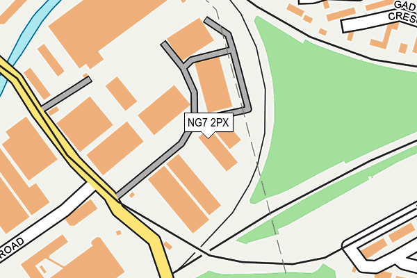
NG7 2PX lies on Lenton Lane in Nottingham. NG7 2PX is located in the Lenton & Wollaton East electoral ward, within the unitary authority of Nottingham and the English Parliamentary constituency of Nottingham South. The Sub Integrated Care Board (ICB) Location is NHS Nottingham and Nottinghamshire ICB - 52R and the police force is Nottinghamshire. This postcode has been in use since June 2000.


GetTheData
Source: OS OpenMap – Local (Ordnance Survey)
Source: OS VectorMap District (Ordnance Survey)
Licence: Open Government Licence (requires attribution)
| Easting | 455764 |
| Northing | 338624 |
| Latitude | 52.942139 |
| Longitude | -1.171640 |
GetTheData
Source: Open Postcode Geo
Licence: Open Government Licence
| Street | Lenton Lane |
| Town/City | Nottingham |
| Country | England |
| Postcode District | NG7 |
➜ See where NG7 is on a map ➜ Where is Nottingham? | |
GetTheData
Source: Land Registry Price Paid Data
Licence: Open Government Licence
Elevation or altitude of NG7 2PX as distance above sea level:
| Metres | Feet | |
|---|---|---|
| Elevation | 30m | 98ft |
Elevation is measured from the approximate centre of the postcode, to the nearest point on an OS contour line from OS Terrain 50, which has contour spacing of ten vertical metres.
➜ How high above sea level am I? Find the elevation of your current position using your device's GPS.
GetTheData
Source: Open Postcode Elevation
Licence: Open Government Licence
| Ward | Lenton & Wollaton East |
| Constituency | Nottingham South |
GetTheData
Source: ONS Postcode Database
Licence: Open Government Licence
| Willow Road (Lenton Lane) | Lenton Lane Industrial Estate | 126m |
| Willow Road (Lenton Lane) | Lenton Lane Industrial Estate | 165m |
| Pc Service Call (Lenton Lane) | Lenton Lane Industrial Estate | 296m |
| Pc Service Call (Lenton Lane) | Lenton Lane Industrial Estate | 357m |
| Red Cow (Lenton Lane) | Dunkirk | 418m |
| Gregory Street Tram Stop (Lenton Lane) | Lenton | 412m |
| Ng2 Tram Stop (Enterprise Way) | Lenton Lane Industrial Estate | 433m |
| Queens Medical Centre Tram Stop (South Road) | Queens Medical Centre | 813m |
| Meadows Way West Tram Stop (Meadows Way) | Meadows | 1,014m |
| University Of Nottingham Tram Stop (University Boulevard) | Nottingham University Main Campus | 1,246m |
| Nottingham Station | 1.8km |
| Beeston Station | 3.4km |
| Attenborough Station | 5.7km |
GetTheData
Source: NaPTAN
Licence: Open Government Licence
| Median download speed | 40.0Mbps |
| Average download speed | 43.7Mbps |
| Maximum download speed | 79.24Mbps |
| Median upload speed | 10.0Mbps |
| Average upload speed | 10.4Mbps |
| Maximum upload speed | 20.00Mbps |
GetTheData
Source: Ofcom
Licence: Ofcom Terms of Use (requires attribution)
Estimated total energy consumption in NG7 2PX by fuel type, 2015.
| Consumption (kWh) | 435,112 |
|---|---|
| Meter count | 14 |
| Mean (kWh/meter) | 31,079 |
| Median (kWh/meter) | 34,483 |
GetTheData
Source: Postcode level gas estimates: 2015 (experimental)
Source: Postcode level electricity estimates: 2015 (experimental)
Licence: Open Government Licence
GetTheData
Source: ONS Postcode Database
Licence: Open Government Licence


➜ Get more ratings from the Food Standards Agency
GetTheData
Source: Food Standards Agency
Licence: FSA terms & conditions
| Last Collection | |||
|---|---|---|---|
| Location | Mon-Fri | Sat | Distance |
| Grove Road | 17:00 | 11:00 | 519m |
| Old Lenton | 17:30 | 11:00 | 590m |
| Lenton Lane | 642m | ||
GetTheData
Source: Dracos
Licence: Creative Commons Attribution-ShareAlike
| Risk of NG7 2PX flooding from rivers and sea | Low |
| ➜ NG7 2PX flood map | |
GetTheData
Source: Open Flood Risk by Postcode
Licence: Open Government Licence
The below table lists the International Territorial Level (ITL) codes (formerly Nomenclature of Territorial Units for Statistics (NUTS) codes) and Local Administrative Units (LAU) codes for NG7 2PX:
| ITL 1 Code | Name |
|---|---|
| TLF | East Midlands (England) |
| ITL 2 Code | Name |
| TLF1 | Derbyshire and Nottinghamshire |
| ITL 3 Code | Name |
| TLF14 | Nottingham |
| LAU 1 Code | Name |
| E06000018 | Nottingham |
GetTheData
Source: ONS Postcode Directory
Licence: Open Government Licence
The below table lists the Census Output Area (OA), Lower Layer Super Output Area (LSOA), and Middle Layer Super Output Area (MSOA) for NG7 2PX:
| Code | Name | |
|---|---|---|
| OA | E00070248 | |
| LSOA | E01013926 | Nottingham 031E |
| MSOA | E02002898 | Nottingham 031 |
GetTheData
Source: ONS Postcode Directory
Licence: Open Government Licence
| NG7 2RR | Poplars Court | 255m |
| NG7 1GT | Turnstone Wharf | 291m |
| NG7 1TH | Avocet Wharf | 310m |
| NG7 1GU | Curlew Wharf | 314m |
| NG7 2PF | Claytons Drive | 324m |
| NG7 1GF | Heron Wharf | 337m |
| NG7 2NP | Gregory Street | 351m |
| NG7 1TJ | Dunlin Wharf | 353m |
| NG2 1AE | The Triangle | 360m |
| NG7 1TL | Plover Wharf | 379m |
GetTheData
Source: Open Postcode Geo; Land Registry Price Paid Data
Licence: Open Government Licence