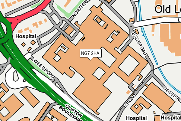
NG7 2HA is located in the Lenton & Wollaton East electoral ward, within the unitary authority of Nottingham and the English Parliamentary constituency of Nottingham South. The Sub Integrated Care Board (ICB) Location is NHS Nottingham and Nottinghamshire ICB - 52R and the police force is Nottinghamshire. This postcode has been in use since August 2002.


GetTheData
Source: OS OpenMap – Local (Ordnance Survey)
Source: OS VectorMap District (Ordnance Survey)
Licence: Open Government Licence (requires attribution)
| Easting | 454811 |
| Northing | 338760 |
| Latitude | 52.943439 |
| Longitude | -1.185800 |
GetTheData
Source: Open Postcode Geo
Licence: Open Government Licence
| Country | England |
| Postcode District | NG7 |
| ➜ NG7 open data dashboard ➜ See where NG7 is on a map ➜ Where is Nottingham? | |
GetTheData
Source: Land Registry Price Paid Data
Licence: Open Government Licence
Elevation or altitude of NG7 2HA as distance above sea level:
| Metres | Feet | |
|---|---|---|
| Elevation | 30m | 98ft |
Elevation is measured from the approximate centre of the postcode, to the nearest point on an OS contour line from OS Terrain 50, which has contour spacing of ten vertical metres.
➜ How high above sea level am I? Find the elevation of your current position using your device's GPS.
GetTheData
Source: Open Postcode Elevation
Licence: Open Government Licence
| Ward | Lenton & Wollaton East |
| Constituency | Nottingham South |
GetTheData
Source: ONS Postcode Database
Licence: Open Government Licence
| January 2024 | Other theft | On or near Stores Road | 176m |
| January 2024 | Other theft | On or near Stores Road | 176m |
| December 2023 | Violence and sexual offences | On or near Stores Road | 176m |
| ➜ Get more crime data in our Crime section | |||
GetTheData
Source: data.police.uk
Licence: Open Government Licence
| Qmc Forecourt (Qmc) | Queens Medical Centre | 116m |
| Treatment Centre (Perimeter Road) | Queens Medical Centre | 134m |
| Qmc Forecourt | Queens Medical Centre | 136m |
| Qmc West Entrance (Clifton Boulevard) | Queens Medical Centre | 151m |
| Accident & Emergency (Qmc) | Queens Medical Centre | 165m |
| Queens Medical Centre Tram Stop (South Road) | Queens Medical Centre | 172m |
| Gregory Street Tram Stop (Lenton Lane) | Lenton | 591m |
| University Of Nottingham Tram Stop (University Boulevard) | Nottingham University Main Campus | 711m |
| Ng2 Tram Stop (Enterprise Way) | Lenton Lane Industrial Estate | 1,394m |
| University Boulevard Tram Stop (University Boulevard) | Nottingham University Main Campus | 1,666m |
| Nottingham Station | 2.7km |
| Beeston Station | 2.9km |
| Attenborough Station | 5.2km |
GetTheData
Source: NaPTAN
Licence: Open Government Licence
GetTheData
Source: ONS Postcode Database
Licence: Open Government Licence


➜ Get more ratings from the Food Standards Agency
GetTheData
Source: Food Standards Agency
Licence: FSA terms & conditions
| Last Collection | |||
|---|---|---|---|
| Location | Mon-Fri | Sat | Distance |
| Old Lenton | 17:30 | 11:00 | 395m |
| Hillside | 17:00 | 11:00 | 414m |
| Dunkirk Post Office | 17:30 | 11:30 | 493m |
GetTheData
Source: Dracos
Licence: Creative Commons Attribution-ShareAlike
| Facility | Distance |
|---|---|
| Nottingham Tennis Centre University Park, Nottingham Health and Fitness Gym, Indoor Tennis Centre, Studio, Outdoor Tennis Courts | 953m |
| Raw Physique (Closed) Sherwin Road, Nottingham Health and Fitness Gym | 994m |
| Majestics Fitness (Closed) Prospect Place, Nottingham Health and Fitness Gym | 1km |
GetTheData
Source: Active Places
Licence: Open Government Licence
| School | Phase of Education | Distance |
|---|---|---|
| University of Nottingham University Park, Nottingham, NG7 2RD | Not applicable | 196m |
| Nottingham University Academy of Science and Technology 93 Abbey Street, Dunkirk, Nottingham, NG7 2PL | Secondary | 450m |
| Dunkirk Primary and Nursery School Marlborough Street, Dunkirk, Nottingham, NG7 2LE | Primary | 560m |
GetTheData
Source: Edubase
Licence: Open Government Licence
The below table lists the International Territorial Level (ITL) codes (formerly Nomenclature of Territorial Units for Statistics (NUTS) codes) and Local Administrative Units (LAU) codes for NG7 2HA:
| ITL 1 Code | Name |
|---|---|
| TLF | East Midlands (England) |
| ITL 2 Code | Name |
| TLF1 | Derbyshire and Nottinghamshire |
| ITL 3 Code | Name |
| TLF14 | Nottingham |
| LAU 1 Code | Name |
| E06000018 | Nottingham |
GetTheData
Source: ONS Postcode Directory
Licence: Open Government Licence
The below table lists the Census Output Area (OA), Lower Layer Super Output Area (LSOA), and Middle Layer Super Output Area (MSOA) for NG7 2HA:
| Code | Name | |
|---|---|---|
| OA | E00070273 | |
| LSOA | E01033410 | Nottingham 031I |
| MSOA | E02002898 | Nottingham 031 |
GetTheData
Source: ONS Postcode Directory
Licence: Open Government Licence
| NG7 2EB | Derby Road | 230m |
| NG7 2FT | Lister Road | 257m |
| NG7 2GY | Derby Road | 301m |
| NG7 2HR | The Garland | 314m |
| NG7 2HS | The Bayley | 314m |
| NG7 2HT | The Gregory | 314m |
| NG7 2HU | The Babington | 314m |
| NG7 2HX | The Stretton | 314m |
| NG7 2HY | The Victor | 314m |
| NG7 2HZ | The Galeb | 314m |
GetTheData
Source: Open Postcode Geo; Land Registry Price Paid Data
Licence: Open Government Licence