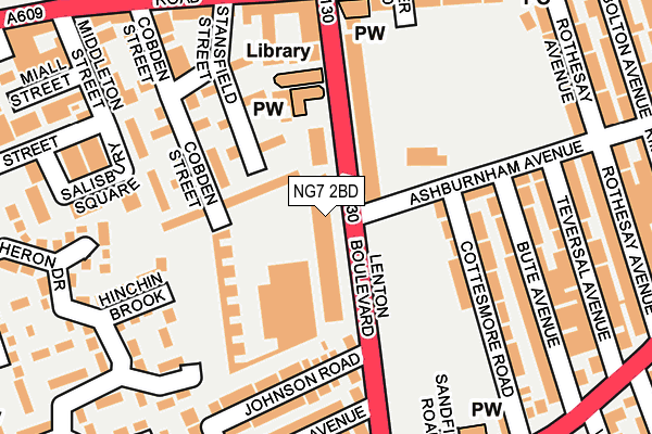
NG7 2BD is located in the Radford electoral ward, within the unitary authority of Nottingham and the English Parliamentary constituency of Nottingham South. The Sub Integrated Care Board (ICB) Location is NHS Nottingham and Nottinghamshire ICB - 52R and the police force is Nottinghamshire. This postcode has been in use since January 1995.


GetTheData
Source: OS OpenMap – Local (Ordnance Survey)
Source: OS VectorMap District (Ordnance Survey)
Licence: Open Government Licence (requires attribution)
| Easting | 455479 |
| Northing | 339913 |
| Latitude | 52.953734 |
| Longitude | -1.175663 |
GetTheData
Source: Open Postcode Geo
Licence: Open Government Licence
| Country | England |
| Postcode District | NG7 |
| ➜ NG7 open data dashboard ➜ See where NG7 is on a map ➜ Where is Nottingham? | |
GetTheData
Source: Land Registry Price Paid Data
Licence: Open Government Licence
Elevation or altitude of NG7 2BD as distance above sea level:
| Metres | Feet | |
|---|---|---|
| Elevation | 40m | 131ft |
Elevation is measured from the approximate centre of the postcode, to the nearest point on an OS contour line from OS Terrain 50, which has contour spacing of ten vertical metres.
➜ How high above sea level am I? Find the elevation of your current position using your device's GPS.
GetTheData
Source: Open Postcode Elevation
Licence: Open Government Licence
| Ward | Radford |
| Constituency | Nottingham South |
GetTheData
Source: ONS Postcode Database
Licence: Open Government Licence
| October 2023 | Violence and sexual offences | On or near Denman Street Central | 469m |
| June 2023 | Criminal damage and arson | On or near Denman Street Central | 469m |
| February 2023 | Criminal damage and arson | On or near Denman Street Central | 469m |
| ➜ Get more crime data in our Crime section | |||
GetTheData
Source: data.police.uk
Licence: Open Government Licence
| Lenton Boulevard H&r (Lenton Boulevard) | Lenton | 54m |
| Radford Boulevard (Ilkeston Road) | Radford | 206m |
| Radford Boulevard (Ilkeston Road) | Radford | 212m |
| Radford Boulevard (Ilkeston Road) | Radford | 254m |
| Savoy Cinema (Derby Road) | Lenton | 268m |
| Gregory Street Tram Stop (Lenton Lane) | Lenton | 1,101m |
| High School Tram Stop (Waverley Street) | Arboretum | 1,355m |
| Queens Medical Centre Tram Stop (South Road) | Queens Medical Centre | 1,358m |
| The Forest Tram Stop (Noel Street) | The Forest | 1,386m |
| Hyson Green Market Tram Stop (Radford Road) | Hyson Green | 1,418m |
| Nottingham Station | 2.1km |
| Beeston Station | 4.3km |
GetTheData
Source: NaPTAN
Licence: Open Government Licence
GetTheData
Source: ONS Postcode Database
Licence: Open Government Licence


➜ Get more ratings from the Food Standards Agency
GetTheData
Source: Food Standards Agency
Licence: FSA terms & conditions
| Last Collection | |||
|---|---|---|---|
| Location | Mon-Fri | Sat | Distance |
| Radford Boulevard | 17:30 | 11:00 | 255m |
| Johnson Road/Cycle Road | 17:30 | 11:00 | 270m |
| Ilkeston Road P O | 17:00 | 12:00 | 311m |
GetTheData
Source: Dracos
Licence: Creative Commons Attribution-ShareAlike
| Facility | Distance |
|---|---|
| John Carroll Leisure Centre (Closed) Denman Street, Nottingham Sports Hall, Swimming Pool, Health and Fitness Gym, Studio, Artificial Grass Pitch | 454m |
| University Of Nottingham (Jubilee Campus Sports Centre) Triumph Road, Nottingham Sports Hall, Health and Fitness Gym, Squash Courts, Artificial Grass Pitch, Studio | 566m |
| The Lenton Centre Willoughby Street, Nottingham Swimming Pool, Health and Fitness Gym | 634m |
GetTheData
Source: Active Places
Licence: Open Government Licence
| School | Phase of Education | Distance |
|---|---|---|
| The Nottingham Nursery School and Training Centre Denman Street West, Radford, Nottingham, NG7 3AB | Nursery | 444m |
| Radford Primary School Academy Denman Street West, Radford, Nottingham, NG7 3FL | Primary | 472m |
| Edna G. Olds Academy Church Street, Lenton, Nottingham, NG7 1SJ | Primary | 576m |
GetTheData
Source: Edubase
Licence: Open Government Licence
The below table lists the International Territorial Level (ITL) codes (formerly Nomenclature of Territorial Units for Statistics (NUTS) codes) and Local Administrative Units (LAU) codes for NG7 2BD:
| ITL 1 Code | Name |
|---|---|
| TLF | East Midlands (England) |
| ITL 2 Code | Name |
| TLF1 | Derbyshire and Nottinghamshire |
| ITL 3 Code | Name |
| TLF14 | Nottingham |
| LAU 1 Code | Name |
| E06000018 | Nottingham |
GetTheData
Source: ONS Postcode Directory
Licence: Open Government Licence
The below table lists the Census Output Area (OA), Lower Layer Super Output Area (LSOA), and Middle Layer Super Output Area (MSOA) for NG7 2BD:
| Code | Name | |
|---|---|---|
| OA | E00070411 | |
| LSOA | E01033396 | Nottingham 026H |
| MSOA | E02002893 | Nottingham 026 |
GetTheData
Source: ONS Postcode Directory
Licence: Open Government Licence
| NG7 1QD | Ashburnham Avenue | 77m |
| NG7 2BY | Lenton Boulevard | 91m |
| NG7 2BZ | Lenton Boulevard | 96m |
| NG7 1QE | Cottesmore Road | 164m |
| NG7 1QB | Bute Avenue | 183m |
| NG7 2BX | Johnson Road | 189m |
| NG7 2EF | Hinchin Brook | 190m |
| NG7 2BT | Lenton Boulevard | 193m |
| NG7 2EJ | Bedarra Grove | 204m |
| NG7 1QA | Bute Avenue | 204m |
GetTheData
Source: Open Postcode Geo; Land Registry Price Paid Data
Licence: Open Government Licence