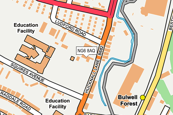
NG6 8AQ is located in the Bulwell electoral ward, within the unitary authority of Nottingham and the English Parliamentary constituency of Nottingham North. The Sub Integrated Care Board (ICB) Location is NHS Nottingham and Nottinghamshire ICB - 52R and the police force is Nottinghamshire. This postcode has been in use since January 1980.


GetTheData
Source: OS OpenMap – Local (Ordnance Survey)
Source: OS VectorMap District (Ordnance Survey)
Licence: Open Government Licence (requires attribution)
| Easting | 454245 |
| Northing | 345838 |
| Latitude | 53.007115 |
| Longitude | -1.193037 |
GetTheData
Source: Open Postcode Geo
Licence: Open Government Licence
| Country | England |
| Postcode District | NG6 |
| ➜ NG6 open data dashboard ➜ See where NG6 is on a map ➜ Where is Nottingham? | |
GetTheData
Source: Land Registry Price Paid Data
Licence: Open Government Licence
Elevation or altitude of NG6 8AQ as distance above sea level:
| Metres | Feet | |
|---|---|---|
| Elevation | 50m | 164ft |
Elevation is measured from the approximate centre of the postcode, to the nearest point on an OS contour line from OS Terrain 50, which has contour spacing of ten vertical metres.
➜ How high above sea level am I? Find the elevation of your current position using your device's GPS.
GetTheData
Source: Open Postcode Elevation
Licence: Open Government Licence
| Ward | Bulwell |
| Constituency | Nottingham North |
GetTheData
Source: ONS Postcode Database
Licence: Open Government Licence
| January 2024 | Possession of weapons | On or near Petrol Station | 292m |
| January 2024 | Criminal damage and arson | On or near Bestwood Terrace | 333m |
| January 2024 | Criminal damage and arson | On or near Bestwood Terrace | 333m |
| ➜ Get more crime data in our Crime section | |||
GetTheData
Source: data.police.uk
Licence: Open Government Licence
| Squires Avenue (Hucknall Lane) | Bulwell | 55m |
| Ludford Road (Hucknall Lane) | Bulwell | 80m |
| Ludford Road (Hucknall Lane) | Bulwell | 96m |
| Squires Avenue (Main Street) | Bulwell | 117m |
| Carey Road | Bulwell | 200m |
| Bulwell Forest Tram Stop (Bestwood Road) | Bulwell Forest | 243m |
| Bulwell Tram Stop (Station Road) | Bulwell | 841m |
| Moor Bridge Tram Stop (Hucknall Lane) | Moor Bridge | 912m |
| Bulwell Station | 0.9km |
| Hucknall Station | 3.5km |
GetTheData
Source: NaPTAN
Licence: Open Government Licence
GetTheData
Source: ONS Postcode Database
Licence: Open Government Licence

➜ Get more ratings from the Food Standards Agency
GetTheData
Source: Food Standards Agency
Licence: FSA terms & conditions
| Last Collection | |||
|---|---|---|---|
| Location | Mon-Fri | Sat | Distance |
| Ravensworth Road | 17:30 | 12:00 | 397m |
| Squires Avenue | 17:30 | 11:00 | 511m |
| St Albans Road | 17:00 | 09:30 | 524m |
GetTheData
Source: Dracos
Licence: Creative Commons Attribution-ShareAlike
| Facility | Distance |
|---|---|
| The River Leen School (Closed) Hucknall Lane, Nottingham Grass Pitches, Sports Hall, Health and Fitness Gym | 101m |
| Bulwell Academy Squires Avenue, Nottingham Health and Fitness Gym, Sports Hall, Studio, Artificial Grass Pitch, Outdoor Tennis Courts | 182m |
| Ken Martin Leisure Centre Hucknall Lane, Nottingham Swimming Pool, Health and Fitness Gym, Studio | 226m |
GetTheData
Source: Active Places
Licence: Open Government Licence
| School | Phase of Education | Distance |
|---|---|---|
| The Bulwell Academy Hucknall Lane, Nottingham, NG6 8AQ | Secondary | 182m |
| Bulwell St Mary's Primary and Nursery School Ragdale Road, Bulwell, Nottingham, NG6 8GQ | Primary | 278m |
| Springfield Academy Lawton Drive, Bulwell Hall Estate, Bulwell, Nottingham, NG6 8BL | Primary | 553m |
GetTheData
Source: Edubase
Licence: Open Government Licence
The below table lists the International Territorial Level (ITL) codes (formerly Nomenclature of Territorial Units for Statistics (NUTS) codes) and Local Administrative Units (LAU) codes for NG6 8AQ:
| ITL 1 Code | Name |
|---|---|
| TLF | East Midlands (England) |
| ITL 2 Code | Name |
| TLF1 | Derbyshire and Nottinghamshire |
| ITL 3 Code | Name |
| TLF14 | Nottingham |
| LAU 1 Code | Name |
| E06000018 | Nottingham |
GetTheData
Source: ONS Postcode Directory
Licence: Open Government Licence
The below table lists the Census Output Area (OA), Lower Layer Super Output Area (LSOA), and Middle Layer Super Output Area (MSOA) for NG6 8AQ:
| Code | Name | |
|---|---|---|
| OA | E00070020 | |
| LSOA | E01013882 | Nottingham 002D |
| MSOA | E02002869 | Nottingham 002 |
GetTheData
Source: ONS Postcode Directory
Licence: Open Government Licence
| NG6 8AR | Hucknall Lane | 61m |
| NG6 8DL | Sandhurst Road | 119m |
| NG6 8DN | Ludford Road | 177m |
| NG6 8AT | Carey Road | 230m |
| NG6 8GL | Squires Avenue | 234m |
| NG6 8YR | Lido Close | 234m |
| NG6 8EJ | Filey Street | 253m |
| NG6 8EH | Main Street | 260m |
| NG6 9JP | Bestwood Road | 271m |
| NG6 8GQ | Ragdale Road | 278m |
GetTheData
Source: Open Postcode Geo; Land Registry Price Paid Data
Licence: Open Government Licence