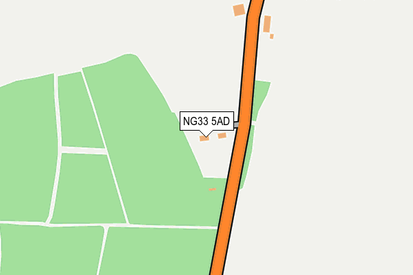
NG33 5AD is located in the Isaac Newton electoral ward, within the local authority district of South Kesteven and the English Parliamentary constituency of Grantham and Stamford. The Sub Integrated Care Board (ICB) Location is NHS Lincolnshire ICB - 71E and the police force is Lincolnshire. This postcode has been in use since January 1980.


GetTheData
Source: OS OpenMap – Local (Ordnance Survey)
Source: OS VectorMap District (Ordnance Survey)
Licence: Open Government Licence (requires attribution)
| Easting | 494344 |
| Northing | 332252 |
| Latitude | 52.879470 |
| Longitude | -0.599545 |
GetTheData
Source: Open Postcode Geo
Licence: Open Government Licence
| Country | England |
| Postcode District | NG33 |
| ➜ NG33 open data dashboard ➜ See where NG33 is on a map ➜ Where is Woodnook? | |
GetTheData
Source: Land Registry Price Paid Data
Licence: Open Government Licence
Elevation or altitude of NG33 5AD as distance above sea level:
| Metres | Feet | |
|---|---|---|
| Elevation | 120m | 394ft |
Elevation is measured from the approximate centre of the postcode, to the nearest point on an OS contour line from OS Terrain 50, which has contour spacing of ten vertical metres.
➜ How high above sea level am I? Find the elevation of your current position using your device's GPS.
GetTheData
Source: Open Postcode Elevation
Licence: Open Government Licence
| Ward | Isaac Newton |
| Constituency | Grantham And Stamford |
GetTheData
Source: ONS Postcode Database
Licence: Open Government Licence
| March 2022 | Anti-social behaviour | On or near High Dike | 112m |
| March 2022 | Vehicle crime | On or near High Dike | 112m |
| January 2022 | Burglary | On or near High Dike | 112m |
| ➜ Get more crime data in our Crime section | |||
GetTheData
Source: data.police.uk
Licence: Open Government Licence
| Valley Cottages (Woodnook) | Woodnook | 287m |
| Valley Cottages (Woodnook) | Woodnook | 292m |
| Grantham Station | 4.2km |
GetTheData
Source: NaPTAN
Licence: Open Government Licence
➜ Broadband speed and availability dashboard for NG33 5AD
| Percentage of properties with Next Generation Access | 100.0% |
| Percentage of properties with Superfast Broadband | 0.0% |
| Percentage of properties with Ultrafast Broadband | 0.0% |
| Percentage of properties with Full Fibre Broadband | 0.0% |
Superfast Broadband is between 30Mbps and 300Mbps
Ultrafast Broadband is > 300Mbps
| Median download speed | 2.3Mbps |
| Average download speed | 2.2Mbps |
| Maximum download speed | 3.32Mbps |
| Median upload speed | 0.8Mbps |
| Average upload speed | 0.7Mbps |
| Maximum upload speed | 1.16Mbps |
| Percentage of properties unable to receive 2Mbps | 0.0% |
| Percentage of properties unable to receive 5Mbps | 0.0% |
| Percentage of properties unable to receive 10Mbps | 100.0% |
| Percentage of properties unable to receive 30Mbps | 100.0% |
➜ Broadband speed and availability dashboard for NG33 5AD
GetTheData
Source: Ofcom
Licence: Ofcom Terms of Use (requires attribution)
GetTheData
Source: ONS Postcode Database
Licence: Open Government Licence

➜ Get more ratings from the Food Standards Agency
GetTheData
Source: Food Standards Agency
Licence: FSA terms & conditions
| Last Collection | |||
|---|---|---|---|
| Location | Mon-Fri | Sat | Distance |
| P.w.o.g. Barracks | 15:40 | 09:00 | 2,238m |
| Tollemach Road | 16:00 | 11:00 | 2,684m |
| Boothby | 16:00 | 08:30 | 3,037m |
GetTheData
Source: Dracos
Licence: Creative Commons Attribution-ShareAlike
| Facility | Distance |
|---|---|
| Kesteven Rfc Woodnook, Grantham Grass Pitches | 1.3km |
| Great Ponton Playing Field Great North Road, Great Ponton, Grantham Grass Pitches | 2.4km |
| Prince Wm Of Glos Barracks Somerby Hill, Grantham Grass Pitches, Outdoor Tennis Courts, Squash Courts | 2.5km |
GetTheData
Source: Active Places
Licence: Open Government Licence
| School | Phase of Education | Distance |
|---|---|---|
| Great Ponton Church of England School Mill Lane, Great Ponton, Grantham, NG33 5DT | Primary | 2.3km |
| Greenfields Academy Great North Road, Grantham, NG31 7US | Not applicable | 3km |
| Grantham Preparatory International School Gorse Lane, Grantham, NG31 7UF | Not applicable | 3.2km |
GetTheData
Source: Edubase
Licence: Open Government Licence
The below table lists the International Territorial Level (ITL) codes (formerly Nomenclature of Territorial Units for Statistics (NUTS) codes) and Local Administrative Units (LAU) codes for NG33 5AD:
| ITL 1 Code | Name |
|---|---|
| TLF | East Midlands (England) |
| ITL 2 Code | Name |
| TLF3 | Lincolnshire |
| ITL 3 Code | Name |
| TLF30 | Lincolnshire CC |
| LAU 1 Code | Name |
| E07000141 | South Kesteven |
GetTheData
Source: ONS Postcode Directory
Licence: Open Government Licence
The below table lists the Census Output Area (OA), Lower Layer Super Output Area (LSOA), and Middle Layer Super Output Area (MSOA) for NG33 5AD:
| Code | Name | |
|---|---|---|
| OA | E00133656 | |
| LSOA | E01026315 | South Kesteven 009A |
| MSOA | E02005484 | South Kesteven 009 |
GetTheData
Source: ONS Postcode Directory
Licence: Open Government Licence
| NG33 5BY | 1889m | |
| NG33 5BX | The Row | 1894m |
| NG33 5DX | 2056m | |
| NG33 4AB | Grantham Road | 2057m |
| NG31 7TT | Bridge End Road | 2141m |
| NG33 5BZ | North Road Cottage | 2221m |
| NG33 5DY | 2244m | |
| NG33 4AQ | School Lane | 2267m |
| NG33 4AH | School Lane | 2318m |
| NG33 5DP | Dallygate | 2397m |
GetTheData
Source: Open Postcode Geo; Land Registry Price Paid Data
Licence: Open Government Licence