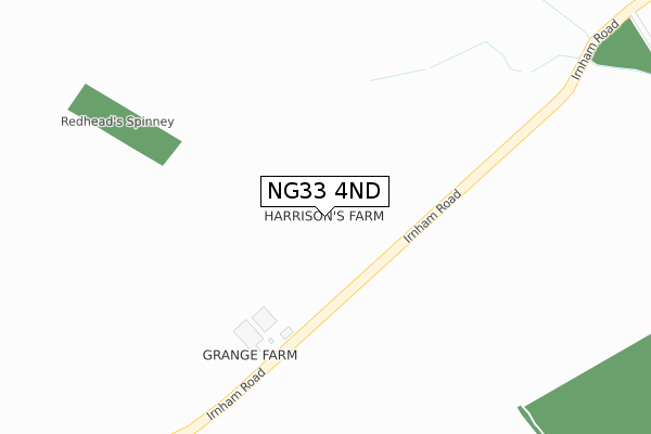
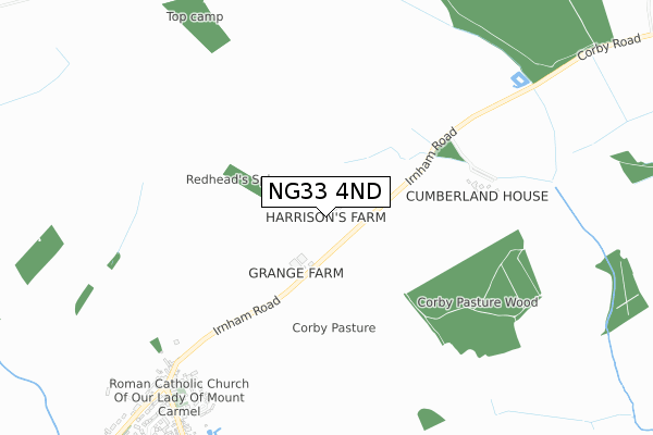
NG33 4ND is located in the Castle electoral ward, within the local authority district of South Kesteven and the English Parliamentary constituency of Grantham and Stamford. The Sub Integrated Care Board (ICB) Location is NHS Lincolnshire ICB - 71E and the police force is Lincolnshire. This postcode has been in use since January 1980.


GetTheData
Source: OS Open Zoomstack (Ordnance Survey)
Licence: Open Government Licence (requires attribution)
Attribution: Contains OS data © Crown copyright and database right 2024
Source: Open Postcode Geo
Licence: Open Government Licence (requires attribution)
Attribution: Contains OS data © Crown copyright and database right 2024; Contains Royal Mail data © Royal Mail copyright and database right 2024; Source: Office for National Statistics licensed under the Open Government Licence v.3.0
| Easting | 500270 |
| Northing | 325739 |
| Latitude | 52.819892 |
| Longitude | -0.513511 |
GetTheData
Source: Open Postcode Geo
Licence: Open Government Licence
| Country | England |
| Postcode District | NG33 |
| ➜ NG33 open data dashboard ➜ See where NG33 is on a map | |
GetTheData
Source: Land Registry Price Paid Data
Licence: Open Government Licence
Elevation or altitude of NG33 4ND as distance above sea level:
| Metres | Feet | |
|---|---|---|
| Elevation | 80m | 262ft |
Elevation is measured from the approximate centre of the postcode, to the nearest point on an OS contour line from OS Terrain 50, which has contour spacing of ten vertical metres.
➜ How high above sea level am I? Find the elevation of your current position using your device's GPS.
GetTheData
Source: Open Postcode Elevation
Licence: Open Government Licence
| Ward | Castle |
| Constituency | Grantham And Stamford |
GetTheData
Source: ONS Postcode Database
Licence: Open Government Licence
| Fighting Cocks Inn (Market Place) | Corby Glen | 846m |
| Fighting Cocks Inn (Market Place) | Corby Glen | 849m |
| Demand Responsive Area | Corby Glen | 899m |
| Primary School (Station Road) | Corby Glen | 914m |
| Coachman Inn (Bourne Road) | Corby Glen | 963m |
GetTheData
Source: NaPTAN
Licence: Open Government Licence
| Percentage of properties with Next Generation Access | 100.0% |
| Percentage of properties with Superfast Broadband | 100.0% |
| Percentage of properties with Ultrafast Broadband | 0.0% |
| Percentage of properties with Full Fibre Broadband | 0.0% |
Superfast Broadband is between 30Mbps and 300Mbps
Ultrafast Broadband is > 300Mbps
| Percentage of properties unable to receive 2Mbps | 0.0% |
| Percentage of properties unable to receive 5Mbps | 0.0% |
| Percentage of properties unable to receive 10Mbps | 0.0% |
| Percentage of properties unable to receive 30Mbps | 0.0% |
GetTheData
Source: Ofcom
Licence: Ofcom Terms of Use (requires attribution)
GetTheData
Source: ONS Postcode Database
Licence: Open Government Licence


➜ Get more ratings from the Food Standards Agency
GetTheData
Source: Food Standards Agency
Licence: FSA terms & conditions
| Last Collection | |||
|---|---|---|---|
| Location | Mon-Fri | Sat | Distance |
| Bourne Road | 15:30 | 09:30 | 994m |
| Swayfield | 14:45 | 09:00 | 3,203m |
| Corby Glen Birkholme | 14:45 | 07:15 | 3,949m |
GetTheData
Source: Dracos
Licence: Creative Commons Attribution-ShareAlike
| Facility | Distance |
|---|---|
| Charles Read Academy Bourne Road, Corby Glen, Grantham Sports Hall, Grass Pitches, Artificial Grass Pitch, Outdoor Tennis Courts | 1.1km |
| Corby Glen Village Hall Swinstead Road, Corby Glen Grass Pitches, Sports Hall | 1.4km |
| Ingoldsby Playing Fields Main Street, Ingoldsby, Grantham Grass Pitches | 4.6km |
GetTheData
Source: Active Places
Licence: Open Government Licence
| School | Phase of Education | Distance |
|---|---|---|
| Corby Glen Community Primary School Station Road, Corby Glen, Grantham, NG33 4NW | Primary | 896m |
| Charles Read Academy Bourne Road, Corby Glen, Grantham, NG33 4NT | Secondary | 1.1km |
| Ingoldsby Academy Lenton Road, Ingoldsby, Grantham, NG33 4HA | Primary | 4.7km |
GetTheData
Source: Edubase
Licence: Open Government Licence
The below table lists the International Territorial Level (ITL) codes (formerly Nomenclature of Territorial Units for Statistics (NUTS) codes) and Local Administrative Units (LAU) codes for NG33 4ND:
| ITL 1 Code | Name |
|---|---|
| TLF | East Midlands (England) |
| ITL 2 Code | Name |
| TLF3 | Lincolnshire |
| ITL 3 Code | Name |
| TLF30 | Lincolnshire CC |
| LAU 1 Code | Name |
| E07000141 | South Kesteven |
GetTheData
Source: ONS Postcode Directory
Licence: Open Government Licence
The below table lists the Census Output Area (OA), Lower Layer Super Output Area (LSOA), and Middle Layer Super Output Area (MSOA) for NG33 4ND:
| Code | Name | |
|---|---|---|
| OA | E00133662 | |
| LSOA | E01026316 | South Kesteven 007D |
| MSOA | E02005482 | South Kesteven 007 |
GetTheData
Source: ONS Postcode Directory
Licence: Open Government Licence
| NG33 4NB | Irnham Road | 607m |
| NG33 4LZ | Coronation Road | 625m |
| NG33 4LX | High Street | 697m |
| NG33 4NJ | Church Street | 790m |
| NG33 4LU | High Street | 800m |
| NG33 4NA | Tanners Lane | 806m |
| NG33 4JN | Pridmore Road | 823m |
| NG33 4LT | Barleycroft Road | 823m |
| NG33 4NH | Market Place | 846m |
| NG33 4HT | Adcock Close | 864m |
GetTheData
Source: Open Postcode Geo; Land Registry Price Paid Data
Licence: Open Government Licence