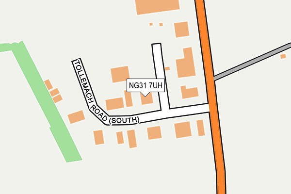
NG31 7UH is located in the Grantham Springfield electoral ward, within the local authority district of South Kesteven and the English Parliamentary constituency of Grantham and Stamford. The Sub Integrated Care Board (ICB) Location is NHS Lincolnshire ICB - 71E and the police force is Lincolnshire. This postcode has been in use since January 1980.


GetTheData
Source: OS OpenMap – Local (Ordnance Survey)
Source: OS VectorMap District (Ordnance Survey)
Licence: Open Government Licence (requires attribution)
| Easting | 491888 |
| Northing | 333214 |
| Latitude | 52.888561 |
| Longitude | -0.635751 |
GetTheData
Source: Open Postcode Geo
Licence: Open Government Licence
| Country | England |
| Postcode District | NG31 |
| ➜ NG31 open data dashboard ➜ See where NG31 is on a map ➜ Where is Grantham? | |
GetTheData
Source: Land Registry Price Paid Data
Licence: Open Government Licence
Elevation or altitude of NG31 7UH as distance above sea level:
| Metres | Feet | |
|---|---|---|
| Elevation | 100m | 328ft |
Elevation is measured from the approximate centre of the postcode, to the nearest point on an OS contour line from OS Terrain 50, which has contour spacing of ten vertical metres.
➜ How high above sea level am I? Find the elevation of your current position using your device's GPS.
GetTheData
Source: Open Postcode Elevation
Licence: Open Government Licence
| Ward | Grantham Springfield |
| Constituency | Grantham And Stamford |
GetTheData
Source: ONS Postcode Database
Licence: Open Government Licence
| February 2022 | Violence and sexual offences | On or near Tollemache Road (North) | 341m |
| December 2021 | Vehicle crime | On or near Tollemache Road (North) | 341m |
| December 2021 | Criminal damage and arson | On or near Tollemache Road (North) | 341m |
| ➜ Get more crime data in our Crime section | |||
GetTheData
Source: data.police.uk
Licence: Open Government Licence
| Mobile Homes Park (B1174) | Grantham | 617m |
| Mobile Homes Park (B1174) | Grantham | 634m |
| A1 Slip Roads (B1174) | Little Ponton | 1,063m |
| Demand Responsive Area | Little Ponton | 1,078m |
| A1 Slip Roads (B1174) | Little Ponton | 1,093m |
| Grantham Station | 2km |
GetTheData
Source: NaPTAN
Licence: Open Government Licence
GetTheData
Source: ONS Postcode Database
Licence: Open Government Licence


➜ Get more ratings from the Food Standards Agency
GetTheData
Source: Food Standards Agency
Licence: FSA terms & conditions
| Last Collection | |||
|---|---|---|---|
| Location | Mon-Fri | Sat | Distance |
| Tollemach Road | 16:00 | 11:00 | 368m |
| Bridge End Road | 18:15 | 11:30 | 1,663m |
| Houghton Road | 18:15 | 11:30 | 1,696m |
GetTheData
Source: Dracos
Licence: Creative Commons Attribution-ShareAlike
| Facility | Distance |
|---|---|
| Grantham Prep. School, Gorse Lane Gorse Lane, Grantham Artificial Grass Pitch, Grass Pitches | 738m |
| Greenfields Academy Great North Road, Grantham Grass Pitches, Sports Hall | 861m |
| Grantham Cricket Club Gorse Lane, Grantham Grass Pitches | 1.3km |
GetTheData
Source: Active Places
Licence: Open Government Licence
| School | Phase of Education | Distance |
|---|---|---|
| Grantham Preparatory International School Gorse Lane, Grantham, NG31 7UF | Not applicable | 752m |
| Greenfields Academy Great North Road, Grantham, NG31 7US | Not applicable | 861m |
| Walton Academy Harlaxton Road, Grantham, NG31 7JR | Secondary | 1.7km |
GetTheData
Source: Edubase
Licence: Open Government Licence
The below table lists the International Territorial Level (ITL) codes (formerly Nomenclature of Territorial Units for Statistics (NUTS) codes) and Local Administrative Units (LAU) codes for NG31 7UH:
| ITL 1 Code | Name |
|---|---|
| TLF | East Midlands (England) |
| ITL 2 Code | Name |
| TLF3 | Lincolnshire |
| ITL 3 Code | Name |
| TLF30 | Lincolnshire CC |
| LAU 1 Code | Name |
| E07000141 | South Kesteven |
GetTheData
Source: ONS Postcode Directory
Licence: Open Government Licence
The below table lists the Census Output Area (OA), Lower Layer Super Output Area (LSOA), and Middle Layer Super Output Area (MSOA) for NG31 7UH:
| Code | Name | |
|---|---|---|
| OA | E00133671 | |
| LSOA | E01026319 | South Kesteven 006C |
| MSOA | E02005481 | South Kesteven 006 |
GetTheData
Source: ONS Postcode Directory
Licence: Open Government Licence
| NG33 5BZ | North Road Cottage | 1269m |
| NG33 5BX | The Row | 1296m |
| NG31 7FT | Eyam Way | 1315m |
| NG31 7FR | Sudbury Road | 1374m |
| NG31 7JF | Denton Avenue | 1381m |
| NG31 7GL | Littleover Way | 1381m |
| NG31 7BS | Stamford Street | 1403m |
| NG31 7GT | Fircroft | 1404m |
| NG31 6HY | Albert Street | 1405m |
| NG31 7FX | Hartington Close | 1408m |
GetTheData
Source: Open Postcode Geo; Land Registry Price Paid Data
Licence: Open Government Licence