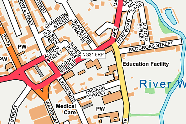
NG31 6RP is located in the Grantham St Wulfram's electoral ward, within the local authority district of South Kesteven and the English Parliamentary constituency of Grantham and Stamford. The Sub Integrated Care Board (ICB) Location is NHS Lincolnshire ICB - 71E and the police force is Lincolnshire. This postcode has been in use since January 1980.


GetTheData
Source: OS OpenMap – Local (Ordnance Survey)
Source: OS VectorMap District (Ordnance Survey)
Licence: Open Government Licence (requires attribution)
| Easting | 491431 |
| Northing | 336254 |
| Latitude | 52.915938 |
| Longitude | -0.641693 |
GetTheData
Source: Open Postcode Geo
Licence: Open Government Licence
| Country | England |
| Postcode District | NG31 |
| ➜ NG31 open data dashboard ➜ See where NG31 is on a map ➜ Where is Grantham? | |
GetTheData
Source: Land Registry Price Paid Data
Licence: Open Government Licence
Elevation or altitude of NG31 6RP as distance above sea level:
| Metres | Feet | |
|---|---|---|
| Elevation | 50m | 164ft |
Elevation is measured from the approximate centre of the postcode, to the nearest point on an OS contour line from OS Terrain 50, which has contour spacing of ten vertical metres.
➜ How high above sea level am I? Find the elevation of your current position using your device's GPS.
GetTheData
Source: Open Postcode Elevation
Licence: Open Government Licence
| Ward | Grantham St Wulfram's |
| Constituency | Grantham And Stamford |
GetTheData
Source: ONS Postcode Database
Licence: Open Government Licence
| June 2022 | Anti-social behaviour | On or near Church Street | 89m |
| June 2022 | Criminal damage and arson | On or near Church Street | 89m |
| June 2022 | Violence and sexual offences | On or near Prospect Place | 119m |
| ➜ Get more crime data in our Crime section | |||
GetTheData
Source: data.police.uk
Licence: Open Government Licence
| The King's School (Brook Street) | Grantham | 24m |
| The King's School (Brook Street) | Grantham | 45m |
| Slate Mill Place (Manthorpe Road) | Grantham | 174m |
| Premier Court (Broad Street) | Grantham | 193m |
| National Junior School (Castlegate) | Grantham | 208m |
| Grantham Station | 1.1km |
GetTheData
Source: NaPTAN
Licence: Open Government Licence
GetTheData
Source: ONS Postcode Database
Licence: Open Government Licence


➜ Get more ratings from the Food Standards Agency
GetTheData
Source: Food Standards Agency
Licence: FSA terms & conditions
| Last Collection | |||
|---|---|---|---|
| Location | Mon-Fri | Sat | Distance |
| Brook Street Post Office | 18:30 | 11:45 | 156m |
| High Street | 19:00 | 12:00 | 355m |
| Asda | 16:30 | 11:30 | 372m |
GetTheData
Source: Dracos
Licence: Creative Commons Attribution-ShareAlike
| Facility | Distance |
|---|---|
| The King's School Brook Street, Grantham Sports Hall | 0m |
| Clubfit 24 (Grantham) Watergate, Watergate, Grantham Health and Fitness Gym | 234m |
| Feelgood Fitness (Grantham) The George Shopping Centre, Grantham Health and Fitness Gym, Studio | 429m |
GetTheData
Source: Active Places
Licence: Open Government Licence
| School | Phase of Education | Distance |
|---|---|---|
| The King's School, Grantham Brook Street, Grantham, NG31 6RP | Secondary | 0m |
| St Wulfram's National Church of England Primary School Castlegate, Grantham, NG31 6SR | Primary | 174m |
| Wyndham Park Nursery School Hill Avenue, Grantham, NG31 9BB | Nursery | 445m |
GetTheData
Source: Edubase
Licence: Open Government Licence
The below table lists the International Territorial Level (ITL) codes (formerly Nomenclature of Territorial Units for Statistics (NUTS) codes) and Local Administrative Units (LAU) codes for NG31 6RP:
| ITL 1 Code | Name |
|---|---|
| TLF | East Midlands (England) |
| ITL 2 Code | Name |
| TLF3 | Lincolnshire |
| ITL 3 Code | Name |
| TLF30 | Lincolnshire CC |
| LAU 1 Code | Name |
| E07000141 | South Kesteven |
GetTheData
Source: ONS Postcode Directory
Licence: Open Government Licence
The below table lists the Census Output Area (OA), Lower Layer Super Output Area (LSOA), and Middle Layer Super Output Area (MSOA) for NG31 6RP:
| Code | Name | |
|---|---|---|
| OA | E00133868 | |
| LSOA | E01026353 | South Kesteven 003F |
| MSOA | E02005478 | South Kesteven 003 |
GetTheData
Source: ONS Postcode Directory
Licence: Open Government Licence
| NG31 8BQ | Albion Place | 75m |
| NG31 6RY | Brook Street | 77m |
| NG31 6RX | Brook Street | 90m |
| NG31 8BH | Albion Place | 97m |
| NG31 6SS | Castlegate | 98m |
| NG31 8BW | Gladstone Terrace | 102m |
| NG31 8BG | Albion Street | 107m |
| NG31 8DB | Prospect Place | 117m |
| NG31 6RR | Church Street | 122m |
| NG31 6RL | Swinegate | 143m |
GetTheData
Source: Open Postcode Geo; Land Registry Price Paid Data
Licence: Open Government Licence