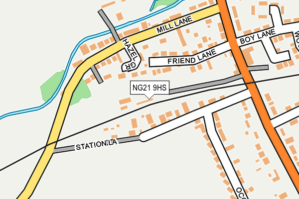
NG21 9HS is located in the Edwinstowe & Clipstone electoral ward, within the local authority district of Newark and Sherwood and the English Parliamentary constituency of Sherwood. The Sub Integrated Care Board (ICB) Location is NHS Nottingham and Nottinghamshire ICB - 52R and the police force is Nottinghamshire. This postcode has been in use since January 1980.


GetTheData
Source: OS OpenMap – Local (Ordnance Survey)
Source: OS VectorMap District (Ordnance Survey)
Licence: Open Government Licence (requires attribution)
| Easting | 462562 |
| Northing | 366196 |
| Latitude | 53.189184 |
| Longitude | -1.065149 |
GetTheData
Source: Open Postcode Geo
Licence: Open Government Licence
| Country | England |
| Postcode District | NG21 |
| ➜ NG21 open data dashboard ➜ See where NG21 is on a map ➜ Where is Edwinstowe? | |
GetTheData
Source: Land Registry Price Paid Data
Licence: Open Government Licence
Elevation or altitude of NG21 9HS as distance above sea level:
| Metres | Feet | |
|---|---|---|
| Elevation | 60m | 197ft |
Elevation is measured from the approximate centre of the postcode, to the nearest point on an OS contour line from OS Terrain 50, which has contour spacing of ten vertical metres.
➜ How high above sea level am I? Find the elevation of your current position using your device's GPS.
GetTheData
Source: Open Postcode Elevation
Licence: Open Government Licence
| Ward | Edwinstowe & Clipstone |
| Constituency | Sherwood |
GetTheData
Source: ONS Postcode Database
Licence: Open Government Licence
| January 2024 | Vehicle crime | On or near Third Avenue | 494m |
| October 2023 | Violence and sexual offences | On or near Third Avenue | 494m |
| August 2023 | Violence and sexual offences | On or near Third Avenue | 494m |
| ➜ Get more crime data in our Crime section | |||
GetTheData
Source: data.police.uk
Licence: Open Government Licence
| Station Lane (Rufford Road) | Lidgett | 195m |
| Station Lane (Rufford Road) | Lidgett | 207m |
| Henton Road (Rufford Road) | Lidgett | 373m |
| Henton Road (Rufford Road) | Lidgett | 373m |
| Abbey Road (Henton Road) | Lidgett | 378m |
GetTheData
Source: NaPTAN
Licence: Open Government Licence
GetTheData
Source: ONS Postcode Database
Licence: Open Government Licence


➜ Get more ratings from the Food Standards Agency
GetTheData
Source: Food Standards Agency
Licence: FSA terms & conditions
| Last Collection | |||
|---|---|---|---|
| Location | Mon-Fri | Sat | Distance |
| Mill Lane | 17:00 | 11:00 | 248m |
| Fourth Avenue | 17:00 | 11:00 | 437m |
| Edwinstowe Post Office | 16:30 | 11:00 | 608m |
GetTheData
Source: Dracos
Licence: Creative Commons Attribution-ShareAlike
| Facility | Distance |
|---|---|
| Sherwood Fields (Robin Hood Colts Fc) Sixth Avenue, Edwinstowe Grass Pitches | 658m |
| King Edwin Primary School Fourth Avenue, Edwinstowe, Mansfield Grass Pitches | 671m |
| Thoresby Sporting Trust Fourth Avenue, Edwinstowe Grass Pitches | 742m |
GetTheData
Source: Active Places
Licence: Open Government Licence
| School | Phase of Education | Distance |
|---|---|---|
| King Edwin Primary and Nursery School Fourth Avenue, Edwinstowe, King Edwin Primary School, Mansfield, NG21 9NS | Primary | 672m |
| St. Mary's Church of England Primary School, Edwinstowe Paddock Close, Mansfield, NG21 9LP | Primary | 998m |
| Maun Infant and Nursery School Walesby Lane, New Ollerton, Maun Infant & Nursery School, NEWARK, NG22 9RJ | Primary | 3.8km |
GetTheData
Source: Edubase
Licence: Open Government Licence
The below table lists the International Territorial Level (ITL) codes (formerly Nomenclature of Territorial Units for Statistics (NUTS) codes) and Local Administrative Units (LAU) codes for NG21 9HS:
| ITL 1 Code | Name |
|---|---|
| TLF | East Midlands (England) |
| ITL 2 Code | Name |
| TLF1 | Derbyshire and Nottinghamshire |
| ITL 3 Code | Name |
| TLF15 | North Nottinghamshire |
| LAU 1 Code | Name |
| E07000175 | Newark and Sherwood |
GetTheData
Source: ONS Postcode Directory
Licence: Open Government Licence
The below table lists the Census Output Area (OA), Lower Layer Super Output Area (LSOA), and Middle Layer Super Output Area (MSOA) for NG21 9HS:
| Code | Name | |
|---|---|---|
| OA | E00144312 | |
| LSOA | E01028321 | Newark and Sherwood 002C |
| MSOA | E02005894 | Newark and Sherwood 002 |
GetTheData
Source: ONS Postcode Directory
Licence: Open Government Licence
| NG21 9RS | Hazel Grove | 60m |
| NG21 9HR | Old Station Yard | 76m |
| NG21 9HT | Station Road | 78m |
| NG21 9QY | Mill Lane | 108m |
| NG21 9QZ | Friend Lane | 117m |
| NG21 9RF | Chapel Court | 168m |
| NG21 9RR | Sherwood Mews | 189m |
| NG21 9QX | High Street | 204m |
| NG21 9AR | Dukeries Crescent | 283m |
| NG21 9QU | High Street | 290m |
GetTheData
Source: Open Postcode Geo; Land Registry Price Paid Data
Licence: Open Government Licence