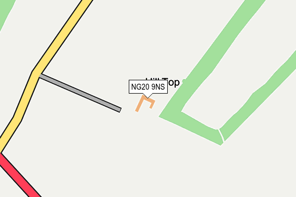
NG20 9NS is located in the Welbeck electoral ward, within the local authority district of Bassetlaw and the English Parliamentary constituency of Bassetlaw. The Sub Integrated Care Board (ICB) Location is NHS Nottingham and Nottinghamshire ICB - 02Q and the police force is Nottinghamshire. This postcode has been in use since January 1980.


GetTheData
Source: OS OpenMap – Local (Ordnance Survey)
Source: OS VectorMap District (Ordnance Survey)
Licence: Open Government Licence (requires attribution)
| Easting | 454329 |
| Northing | 372457 |
| Latitude | 53.246360 |
| Longitude | -1.187286 |
GetTheData
Source: Open Postcode Geo
Licence: Open Government Licence
| Country | England |
| Postcode District | NG20 |
| ➜ NG20 open data dashboard ➜ See where NG20 is on a map | |
GetTheData
Source: Land Registry Price Paid Data
Licence: Open Government Licence
Elevation or altitude of NG20 9NS as distance above sea level:
| Metres | Feet | |
|---|---|---|
| Elevation | 80m | 262ft |
Elevation is measured from the approximate centre of the postcode, to the nearest point on an OS contour line from OS Terrain 50, which has contour spacing of ten vertical metres.
➜ How high above sea level am I? Find the elevation of your current position using your device's GPS.
GetTheData
Source: Open Postcode Elevation
Licence: Open Government Licence
| Ward | Welbeck |
| Constituency | Bassetlaw |
GetTheData
Source: ONS Postcode Database
Licence: Open Government Licence
| Park Lane | Holbeck | 786m |
| Park Lane | Holbeck | 792m |
| Main Gates Lodge (Mansfield Road) | Holbeck | 1,138m |
| Main Gates Lodge (Mansfield Road) | Holbeck | 1,169m |
| Tile Kiln Wood (Mansfield Road) | Holbeck | 1,170m |
| Langwith - Whaley Thorns Station | 2.2km |
| Creswell (Derbys) Station | 2.8km |
| Whitwell (Derbys) Station | 3.8km |
GetTheData
Source: NaPTAN
Licence: Open Government Licence
| Percentage of properties with Next Generation Access | 100.0% |
| Percentage of properties with Superfast Broadband | 0.0% |
| Percentage of properties with Ultrafast Broadband | 0.0% |
| Percentage of properties with Full Fibre Broadband | 0.0% |
Superfast Broadband is between 30Mbps and 300Mbps
Ultrafast Broadband is > 300Mbps
| Percentage of properties unable to receive 2Mbps | 0.0% |
| Percentage of properties unable to receive 5Mbps | 100.0% |
| Percentage of properties unable to receive 10Mbps | 100.0% |
| Percentage of properties unable to receive 30Mbps | 100.0% |
GetTheData
Source: Ofcom
Licence: Ofcom Terms of Use (requires attribution)
GetTheData
Source: ONS Postcode Database
Licence: Open Government Licence


➜ Get more ratings from the Food Standards Agency
GetTheData
Source: Food Standards Agency
Licence: FSA terms & conditions
| Last Collection | |||
|---|---|---|---|
| Location | Mon-Fri | Sat | Distance |
| The Post Office | 16:00 | 11:00 | 898m |
| Hillside Cottage | 16:00 | 09:45 | 1,015m |
| The Woodlands | 16:30 | 10:00 | 1,618m |
GetTheData
Source: Dracos
Licence: Creative Commons Attribution-ShareAlike
| Facility | Distance |
|---|---|
| Welbeck Tennis Club Worksop Road, Holbeck Outdoor Tennis Courts | 1.3km |
| Langwith Recreation Ground Cockshut Lane, Langwith, Mansfield Grass Pitches | 1.5km |
| Whaley Thorns Cricket Ground Main Street, Whaley Thorns Grass Pitches | 2km |
GetTheData
Source: Active Places
Licence: Open Government Licence
| School | Phase of Education | Distance |
|---|---|---|
| Whaley Thorns Primary School Portland Road, Langwith, Mansfield, NG20 9HB | Primary | 1.7km |
| Cuckney CofE Primary School School Lane, Cuckney, Mansfield, NG20 9NB | Primary | 2.2km |
| Creswell Junior School Elmton Road, Creswell, Worksop, S80 4JD | Primary | 2.7km |
GetTheData
Source: Edubase
Licence: Open Government Licence
The below table lists the International Territorial Level (ITL) codes (formerly Nomenclature of Territorial Units for Statistics (NUTS) codes) and Local Administrative Units (LAU) codes for NG20 9NS:
| ITL 1 Code | Name |
|---|---|
| TLF | East Midlands (England) |
| ITL 2 Code | Name |
| TLF1 | Derbyshire and Nottinghamshire |
| ITL 3 Code | Name |
| TLF15 | North Nottinghamshire |
| LAU 1 Code | Name |
| E07000171 | Bassetlaw |
GetTheData
Source: ONS Postcode Directory
Licence: Open Government Licence
The below table lists the Census Output Area (OA), Lower Layer Super Output Area (LSOA), and Middle Layer Super Output Area (MSOA) for NG20 9NS:
| Code | Name | |
|---|---|---|
| OA | E00142877 | |
| LSOA | E01028041 | Bassetlaw 014B |
| MSOA | E02005848 | Bassetlaw 014 |
GetTheData
Source: ONS Postcode Directory
Licence: Open Government Licence
| NG20 9BZ | The Woodlands | 1579m |
| NG20 9BY | The Woodlands | 1602m |
| NG20 9BB | East View | 1630m |
| NG20 9JA | 1633m | |
| NG20 9DA | Moorfield Lane | 1639m |
| NG20 9HB | Portland Road | 1673m |
| NG20 9BX | The Woodlands | 1684m |
| NG20 9DB | Woodland View | 1705m |
| NG20 9BU | The Woodlands | 1747m |
| NG20 9BT | The Woodlands | 1762m |
GetTheData
Source: Open Postcode Geo; Land Registry Price Paid Data
Licence: Open Government Licence