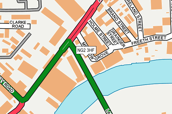
NG2 3HF is located in the Dales electoral ward, within the unitary authority of Nottingham and the English Parliamentary constituency of Nottingham East. The Sub Integrated Care Board (ICB) Location is NHS Nottingham and Nottinghamshire ICB - 52R and the police force is Nottinghamshire. This postcode has been in use since January 1980.


GetTheData
Source: OS OpenMap – Local (Ordnance Survey)
Source: OS VectorMap District (Ordnance Survey)
Licence: Open Government Licence (requires attribution)
| Easting | 458419 |
| Northing | 338848 |
| Latitude | 52.943870 |
| Longitude | -1.132096 |
GetTheData
Source: Open Postcode Geo
Licence: Open Government Licence
| Country | England |
| Postcode District | NG2 |
➜ See where NG2 is on a map ➜ Where is Nottingham? | |
GetTheData
Source: Land Registry Price Paid Data
Licence: Open Government Licence
Elevation or altitude of NG2 3HF as distance above sea level:
| Metres | Feet | |
|---|---|---|
| Elevation | 30m | 98ft |
Elevation is measured from the approximate centre of the postcode, to the nearest point on an OS contour line from OS Terrain 50, which has contour spacing of ten vertical metres.
➜ How high above sea level am I? Find the elevation of your current position using your device's GPS.
GetTheData
Source: Open Postcode Elevation
Licence: Open Government Licence
| Ward | Dales |
| Constituency | Nottingham East |
GetTheData
Source: ONS Postcode Database
Licence: Open Government Licence
| Poulton Drive (Daleside Road) | Meadow Lane Industrial Estate | 428m |
| Poulton Drive (Daleside Road) | Meadow Lane Industrial Estate | 462m |
| London Road Temporary (London Road) | Nottingham | 539m |
| Waterway Street (London Road) | Meadows | 548m |
| London Road Temporary (London Road) | Nottingham | 551m |
| Nottingham Station Tram Stop (N/A) | Nottingham | 970m |
| Queens Walk Tram Stop (Queens Walk) | Meadows | 1,236m |
| Lace Market Tram Stop (Fletcher Gate) | Nottingham | 1,362m |
| Meadows Embankment Tram Stop (Queens Walk) | Meadows | 1,545m |
| Old Market Square Tram Stop (South Parade) | Nottingham | 1,616m |
| Nottingham Station | 1km |
| Netherfield Station | 4km |
| Carlton Station | 4.3km |
GetTheData
Source: NaPTAN
Licence: Open Government Licence
GetTheData
Source: ONS Postcode Database
Licence: Open Government Licence


➜ Get more ratings from the Food Standards Agency
GetTheData
Source: Food Standards Agency
Licence: FSA terms & conditions
| Last Collection | |||
|---|---|---|---|
| Location | Mon-Fri | Sat | Distance |
| Cattle Market | 18:45 | 11:30 | 150m |
| Meadow Lane | 18:45 | 11:30 | 182m |
| Eugene Gardens | 18:30 | 12:30 | 578m |
GetTheData
Source: Dracos
Licence: Creative Commons Attribution-ShareAlike
| Risk of NG2 3HF flooding from rivers and sea | Low |
| ➜ NG2 3HF flood map | |
GetTheData
Source: Open Flood Risk by Postcode
Licence: Open Government Licence
The below table lists the International Territorial Level (ITL) codes (formerly Nomenclature of Territorial Units for Statistics (NUTS) codes) and Local Administrative Units (LAU) codes for NG2 3HF:
| ITL 1 Code | Name |
|---|---|
| TLF | East Midlands (England) |
| ITL 2 Code | Name |
| TLF1 | Derbyshire and Nottinghamshire |
| ITL 3 Code | Name |
| TLF14 | Nottingham |
| LAU 1 Code | Name |
| E06000018 | Nottingham |
GetTheData
Source: ONS Postcode Directory
Licence: Open Government Licence
The below table lists the Census Output Area (OA), Lower Layer Super Output Area (LSOA), and Middle Layer Super Output Area (MSOA) for NG2 3HF:
| Code | Name | |
|---|---|---|
| OA | E00173468 | |
| LSOA | E01013920 | Nottingham 029C |
| MSOA | E02002896 | Nottingham 029 |
GetTheData
Source: ONS Postcode Directory
Licence: Open Government Licence
| NG2 3GL | Meadow Lane | 177m |
| NG2 3JJ | Clarke Road | 208m |
| NG2 3GG | Daleside Road | 422m |
| NG2 3HR | Meadow Lane | 479m |
| NG2 3HZ | Meadow Close | 488m |
| NG2 4GR | Marham Close | 498m |
| NG2 5FU | Orston Road | 507m |
| NG2 4GP | Ardmore Close | 516m |
| NG2 5FT | Thoroton Road | 531m |
| NG2 5FR | Colwick Road | 551m |
GetTheData
Source: Open Postcode Geo; Land Registry Price Paid Data
Licence: Open Government Licence