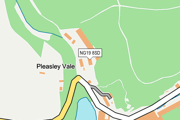
NG19 8SD is located in the Ault Hucknall electoral ward, within the local authority district of Bolsover and the English Parliamentary constituency of Bolsover. The Sub Integrated Care Board (ICB) Location is NHS Derby and Derbyshire ICB - 15M and the police force is Derbyshire. This postcode has been in use since January 1995.


GetTheData
Source: OS OpenMap – Local (Ordnance Survey)
Source: OS VectorMap District (Ordnance Survey)
Licence: Open Government Licence (requires attribution)
| Easting | 451555 |
| Northing | 365107 |
| Latitude | 53.180593 |
| Longitude | -1.230036 |
GetTheData
Source: Open Postcode Geo
Licence: Open Government Licence
| Country | England |
| Postcode District | NG19 |
| ➜ NG19 open data dashboard ➜ See where NG19 is on a map ➜ Where is Pleasley Vale? | |
GetTheData
Source: Land Registry Price Paid Data
Licence: Open Government Licence
Elevation or altitude of NG19 8SD as distance above sea level:
| Metres | Feet | |
|---|---|---|
| Elevation | 110m | 361ft |
Elevation is measured from the approximate centre of the postcode, to the nearest point on an OS contour line from OS Terrain 50, which has contour spacing of ten vertical metres.
➜ How high above sea level am I? Find the elevation of your current position using your device's GPS.
GetTheData
Source: Open Postcode Elevation
Licence: Open Government Licence
| Ward | Ault Hucknall |
| Constituency | Bolsover |
GetTheData
Source: ONS Postcode Database
Licence: Open Government Licence
| Mill No 1 (Pleasley Vale) | Pleasley | 207m |
| Mill No 1 (Pleasley Vale) | Pleasley | 241m |
| Mill No 3 (Pleasley Vale) | Pleasley | 499m |
| Mill No 3 (Pleasley Vale) | Pleasley | 511m |
| Archaeological Way (Common Lane) | Pleasley | 759m |
| Mansfield Woodhouse Station | 2.7km |
| Shirebrook Station | 3.2km |
| Mansfield Station | 4.8km |
GetTheData
Source: NaPTAN
Licence: Open Government Licence
GetTheData
Source: ONS Postcode Database
Licence: Open Government Licence


➜ Get more ratings from the Food Standards Agency
GetTheData
Source: Food Standards Agency
Licence: FSA terms & conditions
| Last Collection | |||
|---|---|---|---|
| Location | Mon-Fri | Sat | Distance |
| Pleasley Post Office | 16:45 | 11:00 | 1,314m |
| New Houghton Post Office | 16:45 | 10:45 | 1,600m |
| Stinting Lane | 16:00 | 11:00 | 1,946m |
GetTheData
Source: Dracos
Licence: Creative Commons Attribution-ShareAlike
| Facility | Distance |
|---|---|
| Landmark @ Pleasley Chesterfield Road North, Pleasley Sports Hall, Health and Fitness Gym | 1.3km |
| Worburn Lane (Closed) Woburn Lane, Pleasley, Mansfield Grass Pitches | 1.3km |
| Mansfield Town Fc (The Radford And Hymas Academy) Woburn Lane, Pleasley, Mansfield Grass Pitches, Artificial Grass Pitch | 1.3km |
GetTheData
Source: Active Places
Licence: Open Government Licence
| School | Phase of Education | Distance |
|---|---|---|
| Farmilo Primary School and Nursery Woburn Lane, Pleasley, Mansfield, NG19 7RT | Primary | 1.4km |
| Anthony Bek Community Primary School Rotherham Road, Pleasley, Mansfield, NG19 7PG | Primary | 1.6km |
| Model Village Primary School Central Drive, Shirebrook, Mansfield, NG20 8BQ | Primary | 2.2km |
GetTheData
Source: Edubase
Licence: Open Government Licence
The below table lists the International Territorial Level (ITL) codes (formerly Nomenclature of Territorial Units for Statistics (NUTS) codes) and Local Administrative Units (LAU) codes for NG19 8SD:
| ITL 1 Code | Name |
|---|---|
| TLF | East Midlands (England) |
| ITL 2 Code | Name |
| TLF1 | Derbyshire and Nottinghamshire |
| ITL 3 Code | Name |
| TLF12 | East Derbyshire |
| LAU 1 Code | Name |
| E07000033 | Bolsover |
GetTheData
Source: ONS Postcode Directory
Licence: Open Government Licence
The below table lists the Census Output Area (OA), Lower Layer Super Output Area (LSOA), and Middle Layer Super Output Area (MSOA) for NG19 8SD:
| Code | Name | |
|---|---|---|
| OA | E00098637 | |
| LSOA | E01019503 | Bolsover 007A |
| MSOA | E02004051 | Bolsover 007 |
GetTheData
Source: ONS Postcode Directory
Licence: Open Government Licence
| NG19 8RQ | Vale House Mews | 157m |
| NG19 8RL | Outgang Lane | 284m |
| NG19 8SE | 327m | |
| NG19 8RS | Bottom Row | 867m |
| NG19 8RN | Top Row | 983m |
| NG19 8RP | 1139m | |
| NG19 8RU | Wood Lane | 1258m |
| NG19 7SR | Chesterfield Road North | 1279m |
| NG19 7RT | Woburn Lane | 1292m |
| NG19 7SH | Meden Bank | 1294m |
GetTheData
Source: Open Postcode Geo; Land Registry Price Paid Data
Licence: Open Government Licence