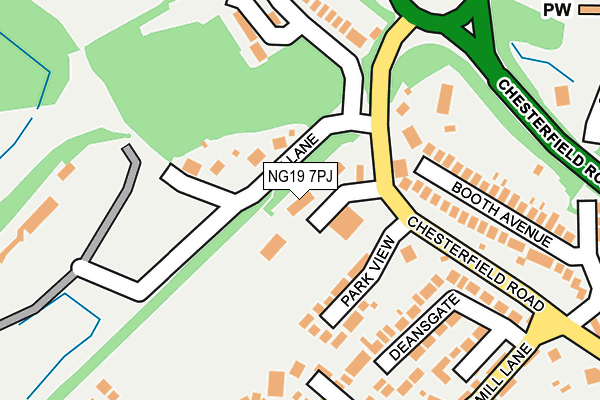
NG19 7PJ lies on Chesterfield Road in Pleasley, Mansfield. NG19 7PJ is located in the Ault Hucknall electoral ward, within the local authority district of Bolsover and the English Parliamentary constituency of Bolsover. The Sub Integrated Care Board (ICB) Location is NHS Derby and Derbyshire ICB - 15M and the police force is Derbyshire. This postcode has been in use since January 1980.


GetTheData
Source: OS OpenMap – Local (Ordnance Survey)
Source: OS VectorMap District (Ordnance Survey)
Licence: Open Government Licence (requires attribution)
| Easting | 450132 |
| Northing | 364382 |
| Latitude | 53.174194 |
| Longitude | -1.251442 |
GetTheData
Source: Open Postcode Geo
Licence: Open Government Licence
| Street | Chesterfield Road |
| Locality | Pleasley |
| Town/City | Mansfield |
| Country | England |
| Postcode District | NG19 |
| ➜ NG19 open data dashboard ➜ See where NG19 is on a map ➜ Where is Pleasley? | |
GetTheData
Source: Land Registry Price Paid Data
Licence: Open Government Licence
Elevation or altitude of NG19 7PJ as distance above sea level:
| Metres | Feet | |
|---|---|---|
| Elevation | 140m | 459ft |
Elevation is measured from the approximate centre of the postcode, to the nearest point on an OS contour line from OS Terrain 50, which has contour spacing of ten vertical metres.
➜ How high above sea level am I? Find the elevation of your current position using your device's GPS.
GetTheData
Source: Open Postcode Elevation
Licence: Open Government Licence
| Ward | Ault Hucknall |
| Constituency | Bolsover |
GetTheData
Source: ONS Postcode Database
Licence: Open Government Licence
| June 2022 | Violence and sexual offences | On or near Chesterfield Road | 94m |
| June 2022 | Violence and sexual offences | On or near Chesterfield Road | 94m |
| June 2022 | Violence and sexual offences | On or near Phoenix Rise | 299m |
| ➜ Get more crime data in our Crime section | |||
GetTheData
Source: data.police.uk
Licence: Open Government Licence
| Pit Lane (Chesterfield Road) | Pleasley | 85m |
| Pit Lane (Chesterfield Road) | Pleasley | 131m |
| Newboundmill Lane | Pleasley | 264m |
| Newboundmill Lane | Pleasley | 271m |
| Anthony Bek School (Chesterfield Road) | Pleasley | 287m |
| Mansfield Woodhouse Station | 3.5km |
| Shirebrook Station | 4.7km |
| Mansfield Station | 5km |
GetTheData
Source: NaPTAN
Licence: Open Government Licence
| Percentage of properties with Next Generation Access | 100.0% |
| Percentage of properties with Superfast Broadband | 100.0% |
| Percentage of properties with Ultrafast Broadband | 100.0% |
| Percentage of properties with Full Fibre Broadband | 100.0% |
Superfast Broadband is between 30Mbps and 300Mbps
Ultrafast Broadband is > 300Mbps
| Percentage of properties unable to receive 2Mbps | 0.0% |
| Percentage of properties unable to receive 5Mbps | 0.0% |
| Percentage of properties unable to receive 10Mbps | 0.0% |
| Percentage of properties unable to receive 30Mbps | 0.0% |
GetTheData
Source: Ofcom
Licence: Ofcom Terms of Use (requires attribution)
GetTheData
Source: ONS Postcode Database
Licence: Open Government Licence


➜ Get more ratings from the Food Standards Agency
GetTheData
Source: Food Standards Agency
Licence: FSA terms & conditions
| Last Collection | |||
|---|---|---|---|
| Location | Mon-Fri | Sat | Distance |
| Pleasley Post Office | 16:45 | 11:00 | 449m |
| New Houghton Post Office | 16:45 | 10:45 | 725m |
| Stoney Houghton | 16:30 | 10:00 | 2,116m |
GetTheData
Source: Dracos
Licence: Creative Commons Attribution-ShareAlike
| Facility | Distance |
|---|---|
| The Nags Head Chesterfield Road North, Pleasley, Mansfield Sports Hall | 342m |
| Landmark @ Pleasley Chesterfield Road North, Pleasley Sports Hall, Health and Fitness Gym | 687m |
| Rotherham Road Sports Ground Rotherham Road, New Houghton, Mansfield Grass Pitches | 904m |
GetTheData
Source: Active Places
Licence: Open Government Licence
| School | Phase of Education | Distance |
|---|---|---|
| Anthony Bek Community Primary School Rotherham Road, Pleasley, Mansfield, NG19 7PG | Primary | 409m |
| Farmilo Primary School and Nursery Woburn Lane, Pleasley, Mansfield, NG19 7RT | Primary | 1.3km |
| Crescent Primary School Booth Crescent, Mansfield, NG19 7LF | Primary | 2.3km |
GetTheData
Source: Edubase
Licence: Open Government Licence
The below table lists the International Territorial Level (ITL) codes (formerly Nomenclature of Territorial Units for Statistics (NUTS) codes) and Local Administrative Units (LAU) codes for NG19 7PJ:
| ITL 1 Code | Name |
|---|---|
| TLF | East Midlands (England) |
| ITL 2 Code | Name |
| TLF1 | Derbyshire and Nottinghamshire |
| ITL 3 Code | Name |
| TLF12 | East Derbyshire |
| LAU 1 Code | Name |
| E07000033 | Bolsover |
GetTheData
Source: ONS Postcode Directory
Licence: Open Government Licence
The below table lists the Census Output Area (OA), Lower Layer Super Output Area (LSOA), and Middle Layer Super Output Area (MSOA) for NG19 7PJ:
| Code | Name | |
|---|---|---|
| OA | E00098634 | |
| LSOA | E01019503 | Bolsover 007A |
| MSOA | E02004051 | Bolsover 007 |
GetTheData
Source: ONS Postcode Directory
Licence: Open Government Licence
| NG19 7PD | Chesterfield Road | 48m |
| NG19 7QE | Park View | 99m |
| NG19 7PH | Pit Lane | 115m |
| NG19 7PR | Leas Avenue | 171m |
| NG19 7PQ | Chesterfield Road | 180m |
| NG19 7PE | Chesterfield Road | 182m |
| NG19 7TE | Booth Avenue | 184m |
| NG19 7QW | Deansgate | 189m |
| NG19 7QP | Holbrook Close | 220m |
| NG19 7PP | Crookes Avenue | 227m |
GetTheData
Source: Open Postcode Geo; Land Registry Price Paid Data
Licence: Open Government Licence