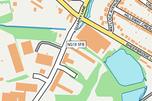
NG18 5FB lies on Hamilton Court in Mansfield. NG18 5FB is located in the Oakham electoral ward, within the local authority district of Mansfield and the English Parliamentary constituency of Mansfield. The Sub Integrated Care Board (ICB) Location is NHS Nottingham and Nottinghamshire ICB - 52R and the police force is Nottinghamshire. This postcode has been in use since December 2009.


GetTheData
Source: OS OpenMap – Local (Ordnance Survey)
Source: OS VectorMap District (Ordnance Survey)
Licence: Open Government Licence (requires attribution)
| Easting | 452978 |
| Northing | 359790 |
| Latitude | 53.132645 |
| Longitude | -1.209626 |
GetTheData
Source: Open Postcode Geo
Licence: Open Government Licence
| Street | Hamilton Court |
| Town/City | Mansfield |
| Country | England |
| Postcode District | NG18 |
| ➜ NG18 open data dashboard ➜ See where NG18 is on a map ➜ Where is Mansfield? | |
GetTheData
Source: Land Registry Price Paid Data
Licence: Open Government Licence
Elevation or altitude of NG18 5FB as distance above sea level:
| Metres | Feet | |
|---|---|---|
| Elevation | 120m | 394ft |
Elevation is measured from the approximate centre of the postcode, to the nearest point on an OS contour line from OS Terrain 50, which has contour spacing of ten vertical metres.
➜ How high above sea level am I? Find the elevation of your current position using your device's GPS.
GetTheData
Source: Open Postcode Elevation
Licence: Open Government Licence
| Ward | Oakham |
| Constituency | Mansfield |
GetTheData
Source: ONS Postcode Database
Licence: Open Government Licence
| June 2022 | Other theft | On or near Sheepbridge Lane | 178m |
| June 2022 | Violence and sexual offences | On or near Hillsway Crescent | 349m |
| June 2022 | Criminal damage and arson | On or near Hillsway Crescent | 349m |
| ➜ Get more crime data in our Crime section | |||
GetTheData
Source: data.police.uk
Licence: Open Government Licence
| Matlock Avenue (Sheepbridge Lane) | High Oakham | 229m |
| Matlock Avenue (Sheepbridge Lane) | High Oakham | 266m |
| High Oakham Hill (Garth Road) | High Oakham | 471m |
| High Oakham Hill (Garth Road) | High Oakham | 477m |
| Hillsway Crescent (Garth Road) | High Oakham | 562m |
| Mansfield Station | 1.3km |
| Sutton Parkway Station | 3.2km |
| Mansfield Woodhouse Station | 3.5km |
GetTheData
Source: NaPTAN
Licence: Open Government Licence
| Median download speed | 8.2Mbps |
| Average download speed | 12.6Mbps |
| Maximum download speed | 39.95Mbps |
| Median upload speed | 1.0Mbps |
| Average upload speed | 2.3Mbps |
| Maximum upload speed | 10.00Mbps |
GetTheData
Source: Ofcom
Licence: Ofcom Terms of Use (requires attribution)
GetTheData
Source: ONS Postcode Database
Licence: Open Government Licence


➜ Get more ratings from the Food Standards Agency
GetTheData
Source: Food Standards Agency
Licence: FSA terms & conditions
| Last Collection | |||
|---|---|---|---|
| Location | Mon-Fri | Sat | Distance |
| Sheepbridge Lane | 17:15 | 11:00 | 165m |
| Moor Lane | 17:30 | 11:00 | 832m |
| Sandhurst Avenue | 17:15 | 11:00 | 1,024m |
GetTheData
Source: Dracos
Licence: Creative Commons Attribution-ShareAlike
| Facility | Distance |
|---|---|
| Dw Fitness First (Mansfield) (Closed) Midland Way, Mansfield Health and Fitness Gym, Swimming Pool, Studio | 724m |
| Mansfield Town Fc (One Call Stadium) Quarry Lane, Mansfield Grass Pitches, Artificial Grass Pitch | 829m |
| Sutton Road Primary And Nursery School Moor Lane, Mansfield Grass Pitches | 837m |
GetTheData
Source: Active Places
Licence: Open Government Licence
| School | Phase of Education | Distance |
|---|---|---|
| Sutton Road Primary School Moor Lane, Mansfield, NG18 5SF | Primary | 809m |
| High Oakham Primary School Nottingham Road, Mansfield, NG18 4SH | Primary | 1km |
| APTCOO - A Place to Call Our Own Unit 15, Botany Commercial Park, Botany Avenue, Mansfield, NG18 5NF | Not applicable | 1.1km |
GetTheData
Source: Edubase
Licence: Open Government Licence
The below table lists the International Territorial Level (ITL) codes (formerly Nomenclature of Territorial Units for Statistics (NUTS) codes) and Local Administrative Units (LAU) codes for NG18 5FB:
| ITL 1 Code | Name |
|---|---|
| TLF | East Midlands (England) |
| ITL 2 Code | Name |
| TLF1 | Derbyshire and Nottinghamshire |
| ITL 3 Code | Name |
| TLF15 | North Nottinghamshire |
| LAU 1 Code | Name |
| E07000174 | Mansfield |
GetTheData
Source: ONS Postcode Directory
Licence: Open Government Licence
The below table lists the Census Output Area (OA), Lower Layer Super Output Area (LSOA), and Middle Layer Super Output Area (MSOA) for NG18 5FB:
| Code | Name | |
|---|---|---|
| OA | E00144038 | |
| LSOA | E01028270 | Mansfield 013F |
| MSOA | E02005892 | Mansfield 013 |
GetTheData
Source: ONS Postcode Directory
Licence: Open Government Licence
| NG18 5FA | Hamilton Place | 193m |
| NG18 5DT | Sheepbridge Lane | 274m |
| NG18 5DW | Matlock Avenue | 290m |
| NG18 5DS | Hillsway Crescent | 311m |
| NG18 5DR | Hillsway Crescent | 327m |
| NG18 5DP | Cromford Avenue | 340m |
| NG18 5BS | Bleak Hills Lane | 350m |
| NG18 5EE | Century Avenue | 405m |
| NG18 5DQ | Bradder Way | 453m |
| NG18 5AH | High Oakham Hill | 485m |
GetTheData
Source: Open Postcode Geo; Land Registry Price Paid Data
Licence: Open Government Licence