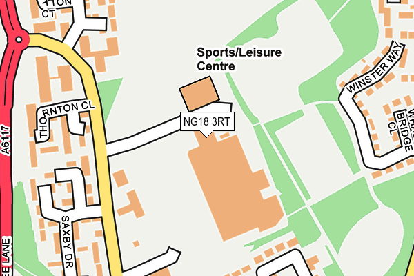
NG18 3RT lies on Jubilee Way South in Mansfield. NG18 3RT is located in the Oak Tree electoral ward, within the local authority district of Mansfield and the English Parliamentary constituency of Mansfield. The Sub Integrated Care Board (ICB) Location is NHS Nottingham and Nottinghamshire ICB - 52R and the police force is Nottinghamshire. This postcode has been in use since October 1985.


GetTheData
Source: OS OpenMap – Local (Ordnance Survey)
Source: OS VectorMap District (Ordnance Survey)
Licence: Open Government Licence (requires attribution)
| Easting | 456774 |
| Northing | 360095 |
| Latitude | 53.134997 |
| Longitude | -1.152842 |
GetTheData
Source: Open Postcode Geo
Licence: Open Government Licence
| Street | Jubilee Way South |
| Town/City | Mansfield |
| Country | England |
| Postcode District | NG18 |
| ➜ NG18 open data dashboard ➜ See where NG18 is on a map ➜ Where is Mansfield? | |
GetTheData
Source: Land Registry Price Paid Data
Licence: Open Government Licence
Elevation or altitude of NG18 3RT as distance above sea level:
| Metres | Feet | |
|---|---|---|
| Elevation | 130m | 427ft |
Elevation is measured from the approximate centre of the postcode, to the nearest point on an OS contour line from OS Terrain 50, which has contour spacing of ten vertical metres.
➜ How high above sea level am I? Find the elevation of your current position using your device's GPS.
GetTheData
Source: Open Postcode Elevation
Licence: Open Government Licence
| Ward | Oak Tree |
| Constituency | Mansfield |
GetTheData
Source: ONS Postcode Database
Licence: Open Government Licence
| December 2023 | Violence and sexual offences | On or near Morley Close | 402m |
| December 2023 | Public order | On or near Morley Close | 402m |
| December 2023 | Violence and sexual offences | On or near Morley Close | 402m |
| ➜ Jubilee Way South crime map and outcomes | |||
GetTheData
Source: data.police.uk
Licence: Open Government Licence
| Tesco (Jubilee Way South) | Oak Tree | 161m |
| Tesco (Jubilee Way South) | Oak Tree | 180m |
| Mappleton Drive (Jubilee Way South) | Oak Tree | 188m |
| Mappleton Drive (Jubilee South Way) | Oak Tree | 201m |
| Sawley Drive (Jubilee Way South) | Oak Tree | 264m |
| Mansfield Station | 3.2km |
| Mansfield Woodhouse Station | 4.6km |
GetTheData
Source: NaPTAN
Licence: Open Government Licence
GetTheData
Source: ONS Postcode Database
Licence: Open Government Licence

➜ Get more ratings from the Food Standards Agency
GetTheData
Source: Food Standards Agency
Licence: FSA terms & conditions
| Last Collection | |||
|---|---|---|---|
| Location | Mon-Fri | Sat | Distance |
| Ratcliffe Gate | 17:30 | 11:00 | 152m |
| Berry Hill Road | 17:00 | 11:00 | 281m |
| Bramble Lane | 17:00 | 11:00 | 387m |
GetTheData
Source: Dracos
Licence: Creative Commons Attribution-ShareAlike
| Facility | Distance |
|---|---|
| Oak Tree Leisure Centre Jubilee Way South, Mansfield Sports Hall, Health and Fitness Gym, Grass Pitches, Studio, Artificial Grass Pitch | 66m |
| Caddyshack Golf Centre (Closed) Jubilee Way North, Mansfield Golf | 553m |
| Bannatyne Health Club (Mansfield) Briar Lane, Mansfield Swimming Pool, Health and Fitness Gym, Studio | 867m |
GetTheData
Source: Active Places
Licence: Open Government Licence
| School | Phase of Education | Distance |
|---|---|---|
| St Patrick's Catholic Primary School, A Voluntary Academy Ling Forest Road, Mansfield, NG18 3NJ | Primary | 587m |
| Oak Tree Primary School Jubilee Way North, Mansfield, NG18 3PJ | Primary | 630m |
| Wynndale Primary School Wynndale Drive, Mansfield, NG18 3NY | Primary | 724m |
GetTheData
Source: Edubase
Licence: Open Government Licence
The below table lists the International Territorial Level (ITL) codes (formerly Nomenclature of Territorial Units for Statistics (NUTS) codes) and Local Administrative Units (LAU) codes for NG18 3RT:
| ITL 1 Code | Name |
|---|---|
| TLF | East Midlands (England) |
| ITL 2 Code | Name |
| TLF1 | Derbyshire and Nottinghamshire |
| ITL 3 Code | Name |
| TLF15 | North Nottinghamshire |
| LAU 1 Code | Name |
| E07000174 | Mansfield |
GetTheData
Source: ONS Postcode Directory
Licence: Open Government Licence
The below table lists the Census Output Area (OA), Lower Layer Super Output Area (LSOA), and Middle Layer Super Output Area (MSOA) for NG18 3RT:
| Code | Name | |
|---|---|---|
| OA | E00144008 | |
| LSOA | E01028263 | Mansfield 012D |
| MSOA | E02005891 | Mansfield 012 |
GetTheData
Source: ONS Postcode Directory
Licence: Open Government Licence
| NG18 3RR | Roston Close | 190m |
| NG18 3RY | Stanage Court | 209m |
| NG18 3RU | Saxby Drive | 245m |
| NG18 3SB | Thurley Walk | 248m |
| NG18 3SU | Winster Way | 264m |
| NG18 3RZ | Sudbury Court | 266m |
| NG18 3SQ | Shirland Drive | 290m |
| NG18 3RS | Pinxton Court | 292m |
| NG18 3FX | Grindleford Grange | 317m |
| NG18 3RG | Mackworth Court | 318m |
GetTheData
Source: Open Postcode Geo; Land Registry Price Paid Data
Licence: Open Government Licence