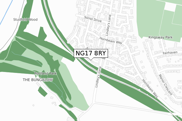
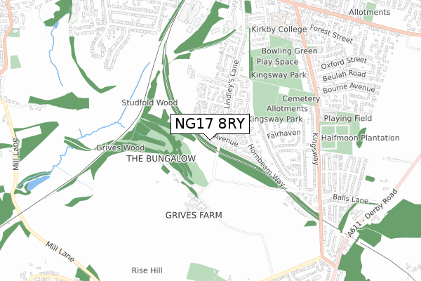
NG17 8RY lies on Wicket Close in Kirkby In Ashfield, Nottingham. NG17 8RY is located in the Kirkby Cross & Portland electoral ward, within the local authority district of Ashfield and the English Parliamentary constituency of Ashfield. The Sub Integrated Care Board (ICB) Location is NHS Nottingham and Nottinghamshire ICB - 52R and the police force is Nottinghamshire. This postcode has been in use since November 2007.


GetTheData
Source: OS Open Zoomstack (Ordnance Survey)
Licence: Open Government Licence (requires attribution)
Attribution: Contains OS data © Crown copyright and database right 2024
Source: Open Postcode Geo
Licence: Open Government Licence (requires attribution)
Attribution: Contains OS data © Crown copyright and database right 2024; Contains Royal Mail data © Royal Mail copyright and database right 2024; Source: Office for National Statistics licensed under the Open Government Licence v.3.0
| Easting | 450188 |
| Northing | 355188 |
| Latitude | 53.091551 |
| Longitude | -1.252040 |
GetTheData
Source: Open Postcode Geo
Licence: Open Government Licence
| Street | Wicket Close |
| Locality | Kirkby In Ashfield |
| Town/City | Nottingham |
| Country | England |
| Postcode District | NG17 |
| ➜ NG17 open data dashboard ➜ See where NG17 is on a map ➜ Where is Kirkby-in-Ashfield? | |
GetTheData
Source: Land Registry Price Paid Data
Licence: Open Government Licence
Elevation or altitude of NG17 8RY as distance above sea level:
| Metres | Feet | |
|---|---|---|
| Elevation | 150m | 492ft |
Elevation is measured from the approximate centre of the postcode, to the nearest point on an OS contour line from OS Terrain 50, which has contour spacing of ten vertical metres.
➜ How high above sea level am I? Find the elevation of your current position using your device's GPS.
GetTheData
Source: Open Postcode Elevation
Licence: Open Government Licence
| Ward | Kirkby Cross & Portland |
| Constituency | Ashfield |
GetTheData
Source: ONS Postcode Database
Licence: Open Government Licence
| June 2022 | Other theft | On or near Corncrake Mews | 104m |
| June 2022 | Vehicle crime | On or near Harebell Close | 111m |
| June 2022 | Anti-social behaviour | On or near Betony Grove | 221m |
| ➜ Wicket Close crime map and outcomes | |||
GetTheData
Source: data.police.uk
Licence: Open Government Licence
| Western Avenue (Kingsway) | Kirkby In Ashfield | 633m |
| Western Avenue (Kingsway) | Kirkby In Ashfield | 651m |
| Cemetery (Kingsway) | Kirkby In Ashfield | 658m |
| Cemetery (Kingsway) | Kirkby In Ashfield | 665m |
| Balls Lane (Kingsway) | Kirkby In Ashfield | 684m |
| Kirkby in Ashfield Station | 1km |
| Sutton Parkway Station | 2.5km |
| Newstead Station | 3.1km |
GetTheData
Source: NaPTAN
Licence: Open Government Licence
➜ Broadband speed and availability dashboard for NG17 8RY
| Percentage of properties with Next Generation Access | 100.0% |
| Percentage of properties with Superfast Broadband | 100.0% |
| Percentage of properties with Ultrafast Broadband | 0.0% |
| Percentage of properties with Full Fibre Broadband | 0.0% |
Superfast Broadband is between 30Mbps and 300Mbps
Ultrafast Broadband is > 300Mbps
| Median download speed | 53.1Mbps |
| Average download speed | 46.1Mbps |
| Maximum download speed | 75.99Mbps |
| Median upload speed | 10.0Mbps |
| Average upload speed | 11.7Mbps |
| Maximum upload speed | 20.00Mbps |
| Percentage of properties unable to receive 2Mbps | 0.0% |
| Percentage of properties unable to receive 5Mbps | 0.0% |
| Percentage of properties unable to receive 10Mbps | 0.0% |
| Percentage of properties unable to receive 30Mbps | 0.0% |
➜ Broadband speed and availability dashboard for NG17 8RY
GetTheData
Source: Ofcom
Licence: Ofcom Terms of Use (requires attribution)
Estimated total energy consumption in NG17 8RY by fuel type, 2015.
| Consumption (kWh) | 122,425 |
|---|---|
| Meter count | 12 |
| Mean (kWh/meter) | 10,202 |
| Median (kWh/meter) | 10,722 |
| Consumption (kWh) | 28,465 |
|---|---|
| Meter count | 12 |
| Mean (kWh/meter) | 2,372 |
| Median (kWh/meter) | 2,536 |
GetTheData
Source: Postcode level gas estimates: 2015 (experimental)
Source: Postcode level electricity estimates: 2015 (experimental)
Licence: Open Government Licence
GetTheData
Source: ONS Postcode Database
Licence: Open Government Licence


➜ Get more ratings from the Food Standards Agency
GetTheData
Source: Food Standards Agency
Licence: FSA terms & conditions
| Last Collection | |||
|---|---|---|---|
| Location | Mon-Fri | Sat | Distance |
| St Johns Avenue | 17:30 | 11:45 | 813m |
| Urban Road | 16:30 | 11:45 | 928m |
| Diamond Avenue | 18:30 | 11:45 | 969m |
GetTheData
Source: Dracos
Licence: Creative Commons Attribution-ShareAlike
| Facility | Distance |
|---|---|
| Kingsway Park Hodgkinson Road, Kirkby-in-ashfield, Nottingham Grass Pitches, Artificial Grass Pitch, Outdoor Tennis Courts | 586m |
| Kingsway Primary School Kingsway, Kirkby-in-ashfield, Nottingham Grass Pitches | 677m |
| Kirkby Portland Cricket Club Nuncargate Road, Kirkby In Ashfield Grass Pitches | 778m |
GetTheData
Source: Active Places
Licence: Open Government Licence
| School | Phase of Education | Distance |
|---|---|---|
| Kingsway Primary School Kingsway, Kirkby-in-Ashfield, Nottingham, NG17 7FH | Primary | 677m |
| Outwood Academy Kirkby Tennyson Street, Kirkby-in-Ashfield, Nottingham, NG17 7DH | Secondary | 820m |
| Pollyteach Limited First Floor Unit, Rear of 18-20 Diamond Avenue, Kirkby in Ashfield, NG17 7GR | Not applicable | 940m |
GetTheData
Source: Edubase
Licence: Open Government Licence
The below table lists the International Territorial Level (ITL) codes (formerly Nomenclature of Territorial Units for Statistics (NUTS) codes) and Local Administrative Units (LAU) codes for NG17 8RY:
| ITL 1 Code | Name |
|---|---|
| TLF | East Midlands (England) |
| ITL 2 Code | Name |
| TLF1 | Derbyshire and Nottinghamshire |
| ITL 3 Code | Name |
| TLF15 | North Nottinghamshire |
| LAU 1 Code | Name |
| E07000170 | Ashfield |
GetTheData
Source: ONS Postcode Directory
Licence: Open Government Licence
The below table lists the Census Output Area (OA), Lower Layer Super Output Area (LSOA), and Middle Layer Super Output Area (MSOA) for NG17 8RY:
| Code | Name | |
|---|---|---|
| OA | E00142389 | |
| LSOA | E01027948 | Ashfield 009B |
| MSOA | E02005827 | Ashfield 009 |
GetTheData
Source: ONS Postcode Directory
Licence: Open Government Licence
| NG17 8RG | Sylvan Avenue | 54m |
| NG17 8RR | Harebell Close | 81m |
| NG17 8RT | Keepers Avenue | 99m |
| NG17 8RP | Corncrake Mews | 114m |
| NG17 8RH | Robin Down Court | 134m |
| NG17 8RS | Boundary Close | 156m |
| NG17 8RJ | Linnet Close | 182m |
| NG17 8RL | Hornbeam Way | 207m |
| NG17 8RW | Sorrel Drive | 221m |
| NG17 8RN | Betony Grove | 221m |
GetTheData
Source: Open Postcode Geo; Land Registry Price Paid Data
Licence: Open Government Licence