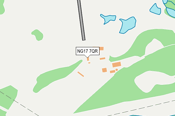
NG17 7QR is located in the Kingsway electoral ward, within the local authority district of Ashfield and the English Parliamentary constituency of Ashfield. The Sub Integrated Care Board (ICB) Location is NHS Nottingham and Nottinghamshire ICB - 52R and the police force is Nottinghamshire. This postcode has been in use since January 1980.


GetTheData
Source: OS OpenMap – Local (Ordnance Survey)
Source: OS VectorMap District (Ordnance Survey)
Licence: Open Government Licence (requires attribution)
| Easting | 452189 |
| Northing | 354432 |
| Latitude | 53.084583 |
| Longitude | -1.222283 |
GetTheData
Source: Open Postcode Geo
Licence: Open Government Licence
| Country | England |
| Postcode District | NG17 |
| ➜ NG17 open data dashboard ➜ See where NG17 is on a map | |
GetTheData
Source: Land Registry Price Paid Data
Licence: Open Government Licence
Elevation or altitude of NG17 7QR as distance above sea level:
| Metres | Feet | |
|---|---|---|
| Elevation | 130m | 427ft |
Elevation is measured from the approximate centre of the postcode, to the nearest point on an OS contour line from OS Terrain 50, which has contour spacing of ten vertical metres.
➜ How high above sea level am I? Find the elevation of your current position using your device's GPS.
GetTheData
Source: Open Postcode Elevation
Licence: Open Government Licence
| Ward | Kingsway |
| Constituency | Ashfield |
GetTheData
Source: ONS Postcode Database
Licence: Open Government Licence
| Moseley Road (Annesley Cutting) | Annesley Cutting | 1,237m |
| Moseley Road (Annesley Cutting) | Annesley Cutting | 1,259m |
| Mutton Hill Top (Derby Road) | Annesley | 1,285m |
| Mutton Hill Top (Derby Road) | Annesley | 1,287m |
| Blidworth Road | Kirkby In Ashfield | 1,313m |
| Newstead Station | 1.6km |
| Kirkby in Ashfield Station | 2.7km |
| Sutton Parkway Station | 3.6km |
GetTheData
Source: NaPTAN
Licence: Open Government Licence
GetTheData
Source: ONS Postcode Database
Licence: Open Government Licence


➜ Get more ratings from the Food Standards Agency
GetTheData
Source: Food Standards Agency
Licence: FSA terms & conditions
| Last Collection | |||
|---|---|---|---|
| Location | Mon-Fri | Sat | Distance |
| Derby Road | 16:45 | 11:30 | 1,473m |
| Abbey Road | 17:30 | 12:00 | 1,847m |
| St Johns Avenue | 17:30 | 11:45 | 1,879m |
GetTheData
Source: Dracos
Licence: Creative Commons Attribution-ShareAlike
| Facility | Distance |
|---|---|
| Notts Golf Club (Hollinwell) Derby Road, Kirkby-in-ashfield, Nottingham Golf | 37m |
| Newstead Recreation Ground Tilford Road, Newstead Village, Nottingham Grass Pitches | 1.5km |
| Annesley Welfare (Closed) Derby Road, Annesley, Nottingham Grass Pitches | 1.6km |
GetTheData
Source: Active Places
Licence: Open Government Licence
| School | Phase of Education | Distance |
|---|---|---|
| Annesley Primary and Nursery School Forest Road, Annesley Woodhouse, Kirkby-in-Ashfield, Nottingham, NG17 9BW | Primary | 1.6km |
| Kingsway Primary School Kingsway, Kirkby-in-Ashfield, Nottingham, NG17 7FH | Primary | 1.6km |
| Newstead Primary and Nursery School Hucknall Road, Newstead Village, Nottingham, NG15 0BB | Primary | 1.6km |
GetTheData
Source: Edubase
Licence: Open Government Licence
The below table lists the International Territorial Level (ITL) codes (formerly Nomenclature of Territorial Units for Statistics (NUTS) codes) and Local Administrative Units (LAU) codes for NG17 7QR:
| ITL 1 Code | Name |
|---|---|
| TLF | East Midlands (England) |
| ITL 2 Code | Name |
| TLF1 | Derbyshire and Nottinghamshire |
| ITL 3 Code | Name |
| TLF15 | North Nottinghamshire |
| LAU 1 Code | Name |
| E07000170 | Ashfield |
GetTheData
Source: ONS Postcode Directory
Licence: Open Government Licence
The below table lists the Census Output Area (OA), Lower Layer Super Output Area (LSOA), and Middle Layer Super Output Area (MSOA) for NG17 7QR:
| Code | Name | |
|---|---|---|
| OA | E00142398 | |
| LSOA | E01027950 | Ashfield 009C |
| MSOA | E02005827 | Ashfield 009 |
GetTheData
Source: ONS Postcode Directory
Licence: Open Government Licence
| NG17 7QQ | Derby Road | 777m |
| NG15 0AD | 831m | |
| NG15 0AF | Warren Avenue | 984m |
| NG15 0AB | Moseley Road | 1003m |
| NG15 0AE | Recreation Road | 1016m |
| NG15 0DW | Owston Road | 1100m |
| NG15 0EE | Annesley Cutting | 1102m |
| NG15 0DA | Dane Grove | 1122m |
| NG17 9AQ | Albert Close | 1135m |
| NG15 0AG | Byron Road | 1137m |
GetTheData
Source: Open Postcode Geo; Land Registry Price Paid Data
Licence: Open Government Licence