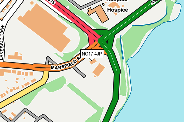
NG17 4JP is located in the Sutton Central & New Cross electoral ward, within the local authority district of Ashfield and the English Parliamentary constituency of Ashfield. The Sub Integrated Care Board (ICB) Location is NHS Nottingham and Nottinghamshire ICB - 52R and the police force is Nottinghamshire. This postcode has been in use since December 1996.


GetTheData
Source: OS OpenMap – Local (Ordnance Survey)
Source: OS VectorMap District (Ordnance Survey)
Licence: Open Government Licence (requires attribution)
| Easting | 451307 |
| Northing | 359625 |
| Latitude | 53.131344 |
| Longitude | -1.234623 |
GetTheData
Source: Open Postcode Geo
Licence: Open Government Licence
| Country | England |
| Postcode District | NG17 |
| ➜ NG17 open data dashboard ➜ See where NG17 is on a map ➜ Where is Sutton in Ashfield? | |
GetTheData
Source: Land Registry Price Paid Data
Licence: Open Government Licence
Elevation or altitude of NG17 4JP as distance above sea level:
| Metres | Feet | |
|---|---|---|
| Elevation | 140m | 459ft |
Elevation is measured from the approximate centre of the postcode, to the nearest point on an OS contour line from OS Terrain 50, which has contour spacing of ten vertical metres.
➜ How high above sea level am I? Find the elevation of your current position using your device's GPS.
GetTheData
Source: Open Postcode Elevation
Licence: Open Government Licence
| Ward | Sutton Central & New Cross |
| Constituency | Ashfield |
GetTheData
Source: ONS Postcode Database
Licence: Open Government Licence
| June 2022 | Other theft | On or near Sports/Recreation Area | 283m |
| June 2022 | Violence and sexual offences | On or near Sports/Recreation Area | 283m |
| June 2022 | Shoplifting | On or near Sports/Recreation Area | 283m |
| ➜ Get more crime data in our Crime section | |||
GetTheData
Source: data.police.uk
Licence: Open Government Licence
| Mansfield Road (Unwin Road) | Sutton Forest Side | 213m |
| Unwin Road (Mansfield Road) | Sutton Forest Side | 213m |
| Kings Mill Hospital (Mansfield Road) | Sutton In Ashfield | 242m |
| Kings Mill Hospital (A38) | Sutton In Ashfield | 244m |
| Mansfield Road (Unwin Road) | Sutton Forest Side | 252m |
| Sutton Parkway Station | 2.1km |
| Mansfield Station | 2.7km |
| Kirkby in Ashfield Station | 3.7km |
GetTheData
Source: NaPTAN
Licence: Open Government Licence
GetTheData
Source: ONS Postcode Database
Licence: Open Government Licence


➜ Get more ratings from the Food Standards Agency
GetTheData
Source: Food Standards Agency
Licence: FSA terms & conditions
| Last Collection | |||
|---|---|---|---|
| Location | Mon-Fri | Sat | Distance |
| Kings Mill Hospital | 17:00 | 11:00 | 418m |
| Forest Side Post Office | 17:00 | 11:00 | 702m |
| The Hillocks | 17:00 | 11:00 | 744m |
GetTheData
Source: Dracos
Licence: Creative Commons Attribution-ShareAlike
| Facility | Distance |
|---|---|
| Mansfield Athletic Fc (Lane End) Unwin Road, Sutton-in-ashfield Grass Pitches | 327m |
| Polly Bowls Sports Ground Unwin Road, Sutton-in-ashfield Grass Pitches | 510m |
| Dalestorth Primary And Nursery School Hill Crescent, Sutton-in-ashfield Grass Pitches | 890m |
GetTheData
Source: Active Places
Licence: Open Government Licence
| School | Phase of Education | Distance |
|---|---|---|
| Hillocks Primary Academy Unwin Road, Sutton-in-Ashfield, NG17 4ND | Primary | 685m |
| Dalestorth Primary and Nursery School Hill Crescent, Sutton-in-Ashfield, NG17 4JA | Primary | 890m |
| Forest Glade Primary School Mansfield Road, Sutton-in-Ashfield, NG17 4FL | Primary | 1.2km |
GetTheData
Source: Edubase
Licence: Open Government Licence
The below table lists the International Territorial Level (ITL) codes (formerly Nomenclature of Territorial Units for Statistics (NUTS) codes) and Local Administrative Units (LAU) codes for NG17 4JP:
| ITL 1 Code | Name |
|---|---|
| TLF | East Midlands (England) |
| ITL 2 Code | Name |
| TLF1 | Derbyshire and Nottinghamshire |
| ITL 3 Code | Name |
| TLF15 | North Nottinghamshire |
| LAU 1 Code | Name |
| E07000170 | Ashfield |
GetTheData
Source: ONS Postcode Directory
Licence: Open Government Licence
The below table lists the Census Output Area (OA), Lower Layer Super Output Area (LSOA), and Middle Layer Super Output Area (MSOA) for NG17 4JP:
| Code | Name | |
|---|---|---|
| OA | E00142542 | |
| LSOA | E01027977 | Ashfield 004C |
| MSOA | E02005822 | Ashfield 004 |
GetTheData
Source: ONS Postcode Directory
Licence: Open Government Licence
| NG17 4JQ | Blackmires Way | 368m |
| NG17 4HT | Unwin Road | 375m |
| NG17 4HU | Maundale Avenue | 378m |
| NG17 4NS | Harriers Grove | 416m |
| NG17 4HS | Mansfield Road | 419m |
| NG17 4JS | High Oakham Close | 447m |
| NG17 4HD | Ashcourt Gardens | 454m |
| NG17 4JN | Broadlands Close | 465m |
| NG17 4HX | Lawrence Crescent | 466m |
| NG17 4HQ | Mason Street | 511m |
GetTheData
Source: Open Postcode Geo; Land Registry Price Paid Data
Licence: Open Government Licence