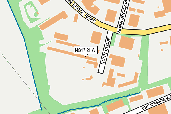
NG17 2HW lies on Nunn Close in Huthwaite, Sutton-in-ashfield. NG17 2HW is located in the Huthwaite & Brierley electoral ward, within the local authority district of Ashfield and the English Parliamentary constituency of Ashfield. The Sub Integrated Care Board (ICB) Location is NHS Nottingham and Nottinghamshire ICB - 52R and the police force is Nottinghamshire. This postcode has been in use since April 1985.


GetTheData
Source: OS OpenMap – Local (Ordnance Survey)
Source: OS VectorMap District (Ordnance Survey)
Licence: Open Government Licence (requires attribution)
| Easting | 446360 |
| Northing | 358394 |
| Latitude | 53.120732 |
| Longitude | -1.308732 |
GetTheData
Source: Open Postcode Geo
Licence: Open Government Licence
| Street | Nunn Close |
| Locality | Huthwaite |
| Town/City | Sutton-in-ashfield |
| Country | England |
| Postcode District | NG17 |
| ➜ NG17 open data dashboard ➜ See where NG17 is on a map ➜ Where is Huthwaite? | |
GetTheData
Source: Land Registry Price Paid Data
Licence: Open Government Licence
Elevation or altitude of NG17 2HW as distance above sea level:
| Metres | Feet | |
|---|---|---|
| Elevation | 130m | 427ft |
Elevation is measured from the approximate centre of the postcode, to the nearest point on an OS contour line from OS Terrain 50, which has contour spacing of ten vertical metres.
➜ How high above sea level am I? Find the elevation of your current position using your device's GPS.
GetTheData
Source: Open Postcode Elevation
Licence: Open Government Licence
| Ward | Huthwaite & Brierley |
| Constituency | Ashfield |
GetTheData
Source: ONS Postcode Database
Licence: Open Government Licence
MARTECH ENGINEERING, NUNN CLOSE, HUTHWAITE, SUTTON-IN-ASHFIELD, NG17 2HW 2005 21 FEB £340,000 |
GetTheData
Source: HM Land Registry Price Paid Data
Licence: Contains HM Land Registry data © Crown copyright and database right 2024. This data is licensed under the Open Government Licence v3.0.
| October 2023 | Violence and sexual offences | On or near Kedlestone Close | 395m |
| October 2023 | Violence and sexual offences | On or near Kedlestone Close | 395m |
| May 2023 | Violence and sexual offences | On or near Sudbury Drive | 482m |
| ➜ Nunn Close crime map and outcomes | |||
GetTheData
Source: data.police.uk
Licence: Open Government Licence
| Nunn Close (Nunn Brook Road) | Huthwaite | 91m |
| Nunn Close (Nunn Brook Road) | Huthwaite | 102m |
| Common Road (Nunn Brook Road) | Huthwaite | 417m |
| Common Road (Nunn Brook Road) | Huthwaite | 421m |
| Carnarvon Road (Common Road) | Huthwaite | 563m |
| Sutton Parkway Station | 4.3km |
| Kirkby in Ashfield Station | 4.4km |
| Alfreton Station | 4.7km |
GetTheData
Source: NaPTAN
Licence: Open Government Licence
Estimated total energy consumption in NG17 2HW by fuel type, 2015.
| Consumption (kWh) | 262,925 |
|---|---|
| Meter count | 19 |
| Mean (kWh/meter) | 13,838 |
| Median (kWh/meter) | 9 |
GetTheData
Source: Postcode level gas estimates: 2015 (experimental)
Source: Postcode level electricity estimates: 2015 (experimental)
Licence: Open Government Licence
GetTheData
Source: ONS Postcode Database
Licence: Open Government Licence


➜ Get more ratings from the Food Standards Agency
GetTheData
Source: Food Standards Agency
Licence: FSA terms & conditions
| Last Collection | |||
|---|---|---|---|
| Location | Mon-Fri | Sat | Distance |
| Springwell Street | 16:45 | 10:30 | 658m |
| Huthwaite Post Office | 18:00 | 11:00 | 987m |
| Berrister Lane | 17:00 | 09:00 | 1,229m |
GetTheData
Source: Dracos
Licence: Creative Commons Attribution-ShareAlike
| Facility | Distance |
|---|---|
| Huthwaite Leisure Centre (Closed) New Street, Huthwaite, Sutton-in-ashfield Sports Hall, Health and Fitness Gym | 1.2km |
| Brierly Forest Golf Club Main Street, Huthwaite, Sutton-in-ashfield Golf | 1.4km |
| Brierley Forest Park Skegby Road, Huthwaite, Sutton-in-ashfield Grass Pitches | 1.4km |
GetTheData
Source: Active Places
Licence: Open Government Licence
| School | Phase of Education | Distance |
|---|---|---|
| Huthwaite All Saints Church of England Infant and Nursery School Common Road, Huthwaite, NG17 2JR | Primary | 700m |
| Woodland View Primary School Barker Street, Huthwaite, Sutton-in-Ashfield, NG17 2LH | Primary | 1.4km |
| Mapplewells Primary and Nursery School Henning Lane, Sutton-in-Ashfield, NG17 1HU | Primary | 1.6km |
GetTheData
Source: Edubase
Licence: Open Government Licence
The below table lists the International Territorial Level (ITL) codes (formerly Nomenclature of Territorial Units for Statistics (NUTS) codes) and Local Administrative Units (LAU) codes for NG17 2HW:
| ITL 1 Code | Name |
|---|---|
| TLF | East Midlands (England) |
| ITL 2 Code | Name |
| TLF1 | Derbyshire and Nottinghamshire |
| ITL 3 Code | Name |
| TLF15 | North Nottinghamshire |
| LAU 1 Code | Name |
| E07000170 | Ashfield |
GetTheData
Source: ONS Postcode Directory
Licence: Open Government Licence
The below table lists the Census Output Area (OA), Lower Layer Super Output Area (LSOA), and Middle Layer Super Output Area (MSOA) for NG17 2HW:
| Code | Name | |
|---|---|---|
| OA | E00142607 | |
| LSOA | E01027990 | Ashfield 003D |
| MSOA | E02005821 | Ashfield 003 |
GetTheData
Source: ONS Postcode Directory
Licence: Open Government Licence
| NG17 2PD | Nunn Brook Rise | 206m |
| NG17 2HU | Nunn Brook Road | 320m |
| NG17 2SB | Sudbury Drive | 391m |
| NG17 2SE | Kedleston Close | 414m |
| NG17 2JQ | Carnarvon Road | 439m |
| NG17 2SF | Calke Avenue | 442m |
| NG17 2RU | Rose Cottage Drive | 477m |
| NG17 2SD | Stainsby Grove | 505m |
| NG17 2JL | Common Road | 513m |
| NG17 2RW | Yew Tree Drive | 524m |
GetTheData
Source: Open Postcode Geo; Land Registry Price Paid Data
Licence: Open Government Licence