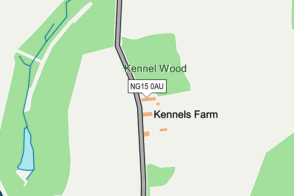
NG15 0AU is located in the Annesley & Kirkby Woodhouse electoral ward, within the local authority district of Ashfield and the English Parliamentary constituency of Ashfield. The Sub Integrated Care Board (ICB) Location is NHS Nottingham and Nottinghamshire ICB - 52R and the police force is Nottinghamshire. This postcode has been in use since January 1980.


GetTheData
Source: OS OpenMap – Local (Ordnance Survey)
Source: OS VectorMap District (Ordnance Survey)
Licence: Open Government Licence (requires attribution)
| Easting | 450088 |
| Northing | 351241 |
| Latitude | 53.056102 |
| Longitude | -1.254144 |
GetTheData
Source: Open Postcode Geo
Licence: Open Government Licence
| Country | England |
| Postcode District | NG15 |
➜ See where NG15 is on a map | |
GetTheData
Source: Land Registry Price Paid Data
Licence: Open Government Licence
Elevation or altitude of NG15 0AU as distance above sea level:
| Metres | Feet | |
|---|---|---|
| Elevation | 150m | 492ft |
Elevation is measured from the approximate centre of the postcode, to the nearest point on an OS contour line from OS Terrain 50, which has contour spacing of ten vertical metres.
➜ How high above sea level am I? Find the elevation of your current position using your device's GPS.
GetTheData
Source: Open Postcode Elevation
Licence: Open Government Licence
| Ward | Annesley & Kirkby Woodhouse |
| Constituency | Ashfield |
GetTheData
Source: ONS Postcode Database
Licence: Open Government Licence
| Layby (Mansfield Road) | Sherwood Business Park | 1,086m |
| Layby (Mansfield Road) | Sherwood Business Park | 1,167m |
| Willow Drive | Sherwood Business Park | 1,471m |
| Willow Drive | Sherwood Business Park | 1,477m |
| Newstead Station | 2.7km |
| Hucknall Station | 4.4km |
| Kirkby in Ashfield Station | 4.9km |
GetTheData
Source: NaPTAN
Licence: Open Government Licence
| Percentage of properties with Next Generation Access | 100.0% |
| Percentage of properties with Superfast Broadband | 0.0% |
| Percentage of properties with Ultrafast Broadband | 0.0% |
| Percentage of properties with Full Fibre Broadband | 0.0% |
Superfast Broadband is between 30Mbps and 300Mbps
Ultrafast Broadband is > 300Mbps
| Percentage of properties unable to receive 2Mbps | 0.0% |
| Percentage of properties unable to receive 5Mbps | 0.0% |
| Percentage of properties unable to receive 10Mbps | 0.0% |
| Percentage of properties unable to receive 30Mbps | 100.0% |
GetTheData
Source: Ofcom
Licence: Ofcom Terms of Use (requires attribution)
GetTheData
Source: ONS Postcode Database
Licence: Open Government Licence


➜ Get more ratings from the Food Standards Agency
GetTheData
Source: Food Standards Agency
Licence: FSA terms & conditions
| Last Collection | |||
|---|---|---|---|
| Location | Mon-Fri | Sat | Distance |
| Middlebrook Road | 16:30 | 10:30 | 2,630m |
| Derby Road | 16:45 | 11:30 | 2,693m |
| Wighay Road | 17:00 | 12:00 | 2,800m |
GetTheData
Source: Dracos
Licence: Creative Commons Attribution-ShareAlike
The below table lists the International Territorial Level (ITL) codes (formerly Nomenclature of Territorial Units for Statistics (NUTS) codes) and Local Administrative Units (LAU) codes for NG15 0AU:
| ITL 1 Code | Name |
|---|---|
| TLF | East Midlands (England) |
| ITL 2 Code | Name |
| TLF1 | Derbyshire and Nottinghamshire |
| ITL 3 Code | Name |
| TLF15 | North Nottinghamshire |
| LAU 1 Code | Name |
| E07000170 | Ashfield |
GetTheData
Source: ONS Postcode Directory
Licence: Open Government Licence
The below table lists the Census Output Area (OA), Lower Layer Super Output Area (LSOA), and Middle Layer Super Output Area (MSOA) for NG15 0AU:
| Code | Name | |
|---|---|---|
| OA | E00142650 | |
| LSOA | E01027995 | Ashfield 010A |
| MSOA | E02005828 | Ashfield 010 |
GetTheData
Source: ONS Postcode Directory
Licence: Open Government Licence
| NG15 0AS | Mansfield Road | 943m |
| NG15 0HT | Lake View Drive | 1606m |
| NG15 0DS | Osier Drive | 1646m |
| NG15 0DP | Willow Drive | 1657m |
| NG15 0DR | Little Oak Drive | 1985m |
| NG17 9LA | Salmon Lane | 2072m |
| NG15 0BD | Hucknall Road | 2095m |
| NG15 6QP | Whyburn Lane | 2203m |
| NG16 5FH | Mansfield Road | 2228m |
| NG15 0BE | Musters Road | 2233m |
GetTheData
Source: Open Postcode Geo; Land Registry Price Paid Data
Licence: Open Government Licence