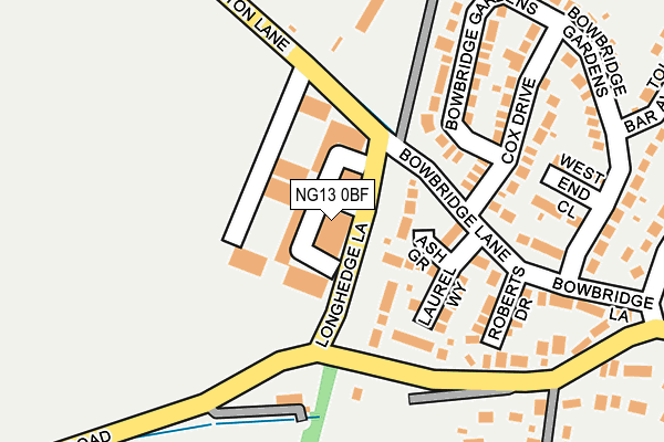
NG13 0BF is located in the Bottesford electoral ward, within the local authority district of Melton and the English Parliamentary constituency of Rutland and Melton. The Sub Integrated Care Board (ICB) Location is NHS Leicester, Leicestershire and Rutland ICB - 03W and the police force is Leicestershire. This postcode has been in use since December 2001.


GetTheData
Source: OS OpenMap – Local (Ordnance Survey)
Source: OS VectorMap District (Ordnance Survey)
Licence: Open Government Licence (requires attribution)
| Easting | 479804 |
| Northing | 339083 |
| Latitude | 52.943234 |
| Longitude | -0.813866 |
GetTheData
Source: Open Postcode Geo
Licence: Open Government Licence
| Country | England |
| Postcode District | NG13 |
➜ See where NG13 is on a map ➜ Where is Bottesford? | |
GetTheData
Source: Land Registry Price Paid Data
Licence: Open Government Licence
Elevation or altitude of NG13 0BF as distance above sea level:
| Metres | Feet | |
|---|---|---|
| Elevation | 30m | 98ft |
Elevation is measured from the approximate centre of the postcode, to the nearest point on an OS contour line from OS Terrain 50, which has contour spacing of ten vertical metres.
➜ How high above sea level am I? Find the elevation of your current position using your device's GPS.
GetTheData
Source: Open Postcode Elevation
Licence: Open Government Licence
| Ward | Bottesford |
| Constituency | Rutland And Melton |
GetTheData
Source: ONS Postcode Database
Licence: Open Government Licence
| Pinfold Lane (High Street) | Bottesford | 353m |
| Pinfold Lane (High Street) | Bottesford | 383m |
| School Buses Only (Barkestone Lane) | Bottesford | 617m |
| Queen Street (High Street) | Bottesford | 652m |
| Queen Street (High Street) | Bottesford | 677m |
| Bottesford Station | 1.3km |
| Elton & Orston Station | 3km |
GetTheData
Source: NaPTAN
Licence: Open Government Licence
GetTheData
Source: ONS Postcode Database
Licence: Open Government Licence


➜ Get more ratings from the Food Standards Agency
GetTheData
Source: Food Standards Agency
Licence: FSA terms & conditions
| Last Collection | |||
|---|---|---|---|
| Location | Mon-Fri | Sat | Distance |
| Elton | 16:45 | 09:45 | 3,056m |
| Orston | 16:00 | 09:00 | 3,278m |
| Sutton Cum Granby | 16:30 | 09:30 | 4,203m |
GetTheData
Source: Dracos
Licence: Creative Commons Attribution-ShareAlike
| Risk of NG13 0BF flooding from rivers and sea | Low |
| ➜ NG13 0BF flood map | |
GetTheData
Source: Open Flood Risk by Postcode
Licence: Open Government Licence
The below table lists the International Territorial Level (ITL) codes (formerly Nomenclature of Territorial Units for Statistics (NUTS) codes) and Local Administrative Units (LAU) codes for NG13 0BF:
| ITL 1 Code | Name |
|---|---|
| TLF | East Midlands (England) |
| ITL 2 Code | Name |
| TLF2 | Leicestershire, Rutland and Northamptonshire |
| ITL 3 Code | Name |
| TLF22 | Leicestershire CC and Rutland |
| LAU 1 Code | Name |
| E07000133 | Melton |
GetTheData
Source: ONS Postcode Directory
Licence: Open Government Licence
The below table lists the Census Output Area (OA), Lower Layer Super Output Area (LSOA), and Middle Layer Super Output Area (MSOA) for NG13 0BF:
| Code | Name | |
|---|---|---|
| OA | E00131354 | |
| LSOA | E01025886 | Melton 001B |
| MSOA | E02005391 | Melton 001 |
GetTheData
Source: ONS Postcode Directory
Licence: Open Government Licence
| NG13 0FR | Ash Grove | 62m |
| NG13 0FP | Laurel Way | 105m |
| NG13 0FT | Roberts Drive | 164m |
| NG13 0DJ | Cox Drive | 181m |
| NG13 0AU | Orston Lane | 186m |
| NG13 0AQ | Bowbridge Lane | 200m |
| NG13 0AP | Nottingham Road | 221m |
| NG13 0BA | West End Close | 225m |
| NG13 0AZ | Bowbridge Gardens | 258m |
| NG13 0BB | Toll Bar Avenue | 319m |
GetTheData
Source: Open Postcode Geo; Land Registry Price Paid Data
Licence: Open Government Licence