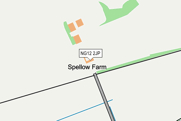
NG12 2JP is located in the Radcliffe on Trent electoral ward, within the local authority district of Rushcliffe and the English Parliamentary constituency of Rushcliffe. The Sub Integrated Care Board (ICB) Location is NHS Nottingham and Nottinghamshire ICB - 52R and the police force is Nottinghamshire. This postcode has been in use since January 1980.


GetTheData
Source: OS OpenMap – Local (Ordnance Survey)
Source: OS VectorMap District (Ordnance Survey)
Licence: Open Government Licence (requires attribution)
| Easting | 466451 |
| Northing | 339931 |
| Latitude | 52.952651 |
| Longitude | -1.012370 |
GetTheData
Source: Open Postcode Geo
Licence: Open Government Licence
| Country | England |
| Postcode District | NG12 |
| ➜ NG12 open data dashboard ➜ See where NG12 is on a map | |
GetTheData
Source: Land Registry Price Paid Data
Licence: Open Government Licence
Elevation or altitude of NG12 2JP as distance above sea level:
| Metres | Feet | |
|---|---|---|
| Elevation | 40m | 131ft |
Elevation is measured from the approximate centre of the postcode, to the nearest point on an OS contour line from OS Terrain 50, which has contour spacing of ten vertical metres.
➜ How high above sea level am I? Find the elevation of your current position using your device's GPS.
GetTheData
Source: Open Postcode Elevation
Licence: Open Government Licence
| Ward | Radcliffe On Trent |
| Constituency | Rushcliffe |
GetTheData
Source: ONS Postcode Database
Licence: Open Government Licence
| May 2021 | Public order | On or near Field View | 432m |
| ➜ Get more crime data in our Crime section | |||
GetTheData
Source: data.police.uk
Licence: Open Government Licence
| Grantham Road | Upper Saxondale | 320m |
| Grantham Road | Upper Saxondale | 328m |
| Grantham Road (Saxondale Drive) | Upper Saxondale | 385m |
| Northfield Avenue (Grantham Road) | Radcliffe Harlequin | 478m |
| Northfield Avenue (Grantham Road) | Radcliffe Harlequin | 511m |
| Radcliffe (Notts) Station | 1.7km |
| Burton Joyce Station | 3.9km |
| Bingham Station | 4.1km |
GetTheData
Source: NaPTAN
Licence: Open Government Licence
➜ Broadband speed and availability dashboard for NG12 2JP
| Percentage of properties with Next Generation Access | 100.0% |
| Percentage of properties with Superfast Broadband | 75.0% |
| Percentage of properties with Ultrafast Broadband | 0.0% |
| Percentage of properties with Full Fibre Broadband | 0.0% |
Superfast Broadband is between 30Mbps and 300Mbps
Ultrafast Broadband is > 300Mbps
| Median download speed | 18.0Mbps |
| Average download speed | 15.8Mbps |
| Maximum download speed | 32.11Mbps |
| Median upload speed | 2.0Mbps |
| Average upload speed | 4.1Mbps |
| Maximum upload speed | 8.55Mbps |
| Percentage of properties unable to receive 2Mbps | 0.0% |
| Percentage of properties unable to receive 5Mbps | 0.0% |
| Percentage of properties unable to receive 10Mbps | 0.0% |
| Percentage of properties unable to receive 30Mbps | 25.0% |
➜ Broadband speed and availability dashboard for NG12 2JP
GetTheData
Source: Ofcom
Licence: Ofcom Terms of Use (requires attribution)
GetTheData
Source: ONS Postcode Database
Licence: Open Government Licence


➜ Get more ratings from the Food Standards Agency
GetTheData
Source: Food Standards Agency
Licence: FSA terms & conditions
| Last Collection | |||
|---|---|---|---|
| Location | Mon-Fri | Sat | Distance |
| The Harlequin Post Office | 17:00 | 11:30 | 595m |
| Henson Lane | 17:00 | 11:30 | 938m |
| Saxondale Drive | 17:00 | 11:30 | 946m |
GetTheData
Source: Dracos
Licence: Creative Commons Attribution-ShareAlike
| Facility | Distance |
|---|---|
| Bingham Road Playing Fields Bingham Road, Radcliffe-on-trent, Nottingham Grass Pitches, Artificial Grass Pitch | 976m |
| Radcliffe-on-trent Golf Club Dewberry Lane, Radcliffe-on-trent, Nottingham Golf | 1.4km |
| South Nottinghamshire Academy Cropwell Road, Radcliffe-on-trent, Nottingham Sports Hall, Swimming Pool, Artificial Grass Pitch | 1.6km |
GetTheData
Source: Active Places
Licence: Open Government Licence
| School | Phase of Education | Distance |
|---|---|---|
| Radcliffe-on-Trent Infant and Nursery School Bingham Road, Radcliffe-on-Trent, Nottingham, NG12 2FU | Primary | 1.4km |
| South Nottinghamshire Academy Glebe Lane, Off Cropwell Road, Radcliffe on Trent, Nottingham, NG12 2FQ | Secondary | 1.6km |
| Radcliffe-on-Trent Junior School Cropwell Road, Radcliffe-on-Trent, Nottingham, NG12 2FS | Primary | 1.9km |
GetTheData
Source: Edubase
Licence: Open Government Licence
The below table lists the International Territorial Level (ITL) codes (formerly Nomenclature of Territorial Units for Statistics (NUTS) codes) and Local Administrative Units (LAU) codes for NG12 2JP:
| ITL 1 Code | Name |
|---|---|
| TLF | East Midlands (England) |
| ITL 2 Code | Name |
| TLF1 | Derbyshire and Nottinghamshire |
| ITL 3 Code | Name |
| TLF16 | South Nottinghamshire |
| LAU 1 Code | Name |
| E07000176 | Rushcliffe |
GetTheData
Source: ONS Postcode Directory
Licence: Open Government Licence
The below table lists the Census Output Area (OA), Lower Layer Super Output Area (LSOA), and Middle Layer Super Output Area (MSOA) for NG12 2JP:
| Code | Name | |
|---|---|---|
| OA | E00144789 | |
| LSOA | E01028415 | Rushcliffe 003F |
| MSOA | E02005908 | Rushcliffe 003 |
GetTheData
Source: ONS Postcode Directory
Licence: Open Government Licence
| NG12 2HY | Grantham Road | 459m |
| NG12 2PT | Grantham Road | 480m |
| NG12 2JE | Morton Close | 494m |
| NG12 2HX | Northfield Avenue | 576m |
| NG12 2GF | Harlequin Mews | 600m |
| NG12 2HW | Morton Gardens | 600m |
| NG12 2PR | Dowson Close | 618m |
| NG12 2HT | Thomas Avenue | 645m |
| NG12 2HS | Grantham Road | 649m |
| NG12 2HR | South Avenue | 653m |
GetTheData
Source: Open Postcode Geo; Land Registry Price Paid Data
Licence: Open Government Licence