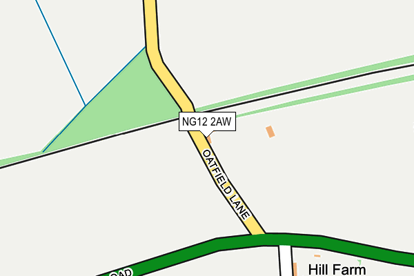
NG12 2AW is located in the Newton electoral ward, within the local authority district of Rushcliffe and the English Parliamentary constituency of Newark. The Sub Integrated Care Board (ICB) Location is NHS Nottingham and Nottinghamshire ICB - 52R and the police force is Nottinghamshire. This postcode has been in use since January 1993.


GetTheData
Source: OS OpenMap – Local (Ordnance Survey)
Source: OS VectorMap District (Ordnance Survey)
Licence: Open Government Licence (requires attribution)
| Easting | 467016 |
| Northing | 340010 |
| Latitude | 52.953311 |
| Longitude | -1.003942 |
GetTheData
Source: Open Postcode Geo
Licence: Open Government Licence
| Country | England |
| Postcode District | NG12 |
| ➜ NG12 open data dashboard ➜ See where NG12 is on a map | |
GetTheData
Source: Land Registry Price Paid Data
Licence: Open Government Licence
Elevation or altitude of NG12 2AW as distance above sea level:
| Metres | Feet | |
|---|---|---|
| Elevation | 50m | 164ft |
Elevation is measured from the approximate centre of the postcode, to the nearest point on an OS contour line from OS Terrain 50, which has contour spacing of ten vertical metres.
➜ How high above sea level am I? Find the elevation of your current position using your device's GPS.
GetTheData
Source: Open Postcode Elevation
Licence: Open Government Licence
| Ward | Newton |
| Constituency | Newark |
GetTheData
Source: ONS Postcode Database
Licence: Open Government Licence
| Henson Lane (Grantham Road) | Upper Saxondale | 206m |
| Henson Lane (Grantham Road) | Upper Saxondale | 255m |
| Grantham Road (Saxondale Drive) | Upper Saxondale | 536m |
| Grantham Road | Upper Saxondale | 602m |
| Turning Circle (Henson Close) | Upper Saxondale | 687m |
| Radcliffe (Notts) Station | 2.3km |
| Bingham Station | 3.5km |
| Burton Joyce Station | 4.2km |
GetTheData
Source: NaPTAN
Licence: Open Government Licence
GetTheData
Source: ONS Postcode Database
Licence: Open Government Licence


➜ Get more ratings from the Food Standards Agency
GetTheData
Source: Food Standards Agency
Licence: FSA terms & conditions
| Last Collection | |||
|---|---|---|---|
| Location | Mon-Fri | Sat | Distance |
| Henson Lane | 17:00 | 11:30 | 653m |
| Saxondale Drive | 17:00 | 11:30 | 838m |
| The Harlequin Post Office | 17:00 | 11:30 | 1,118m |
GetTheData
Source: Dracos
Licence: Creative Commons Attribution-ShareAlike
| Facility | Distance |
|---|---|
| Bingham Road Playing Fields Bingham Road, Radcliffe-on-trent, Nottingham Grass Pitches, Artificial Grass Pitch | 1.5km |
| Radcliffe-on-trent Golf Club Dewberry Lane, Radcliffe-on-trent, Nottingham Golf | 1.8km |
| South Nottinghamshire Academy Cropwell Road, Radcliffe-on-trent, Nottingham Sports Hall, Swimming Pool, Artificial Grass Pitch | 2.1km |
GetTheData
Source: Active Places
Licence: Open Government Licence
| School | Phase of Education | Distance |
|---|---|---|
| Radcliffe-on-Trent Infant and Nursery School Bingham Road, Radcliffe-on-Trent, Nottingham, NG12 2FU | Primary | 1.9km |
| South Nottinghamshire Academy Glebe Lane, Off Cropwell Road, Radcliffe on Trent, Nottingham, NG12 2FQ | Secondary | 2.2km |
| Radcliffe-on-Trent Junior School Cropwell Road, Radcliffe-on-Trent, Nottingham, NG12 2FS | Primary | 2.5km |
GetTheData
Source: Edubase
Licence: Open Government Licence
The below table lists the International Territorial Level (ITL) codes (formerly Nomenclature of Territorial Units for Statistics (NUTS) codes) and Local Administrative Units (LAU) codes for NG12 2AW:
| ITL 1 Code | Name |
|---|---|
| TLF | East Midlands (England) |
| ITL 2 Code | Name |
| TLF1 | Derbyshire and Nottinghamshire |
| ITL 3 Code | Name |
| TLF16 | South Nottinghamshire |
| LAU 1 Code | Name |
| E07000176 | Rushcliffe |
GetTheData
Source: ONS Postcode Directory
Licence: Open Government Licence
The below table lists the Census Output Area (OA), Lower Layer Super Output Area (LSOA), and Middle Layer Super Output Area (MSOA) for NG12 2AW:
| Code | Name | |
|---|---|---|
| OA | E00173577 | |
| LSOA | E01028360 | Rushcliffe 002D |
| MSOA | E02005907 | Rushcliffe 002 |
GetTheData
Source: ONS Postcode Directory
Licence: Open Government Licence
| NG12 2LL | Home Farm Lane | 583m |
| NG12 2JQ | Henson Close | 602m |
| NG12 2LQ | Carnaby Close | 627m |
| NG12 2JR | Henson Lane | 649m |
| NG12 2JL | Saxondale Drive | 652m |
| NG12 2PL | Pimlico Close | 722m |
| NG12 2NN | Grosvenor Close | 802m |
| NG12 2NE | Buckingham Drive | 867m |
| NG12 2NF | Covent Gardens | 867m |
| NG12 2NG | Bloomsbury Mews | 874m |
GetTheData
Source: Open Postcode Geo; Land Registry Price Paid Data
Licence: Open Government Licence