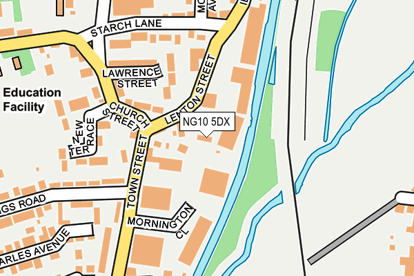
NG10 5DX is located in the Sandiacre electoral ward, within the local authority district of Erewash and the English Parliamentary constituency of Erewash. The Sub Integrated Care Board (ICB) Location is NHS Derby and Derbyshire ICB - 15M and the police force is Derbyshire. This postcode has been in use since January 1980.


GetTheData
Source: OS OpenMap – Local (Ordnance Survey)
Source: OS VectorMap District (Ordnance Survey)
Licence: Open Government Licence (requires attribution)
| Easting | 448092 |
| Northing | 336966 |
| Latitude | 52.927956 |
| Longitude | -1.286042 |
GetTheData
Source: Open Postcode Geo
Licence: Open Government Licence
| Country | England |
| Postcode District | NG10 |
| ➜ NG10 open data dashboard ➜ See where NG10 is on a map ➜ Where is Sandiacre? | |
GetTheData
Source: Land Registry Price Paid Data
Licence: Open Government Licence
Elevation or altitude of NG10 5DX as distance above sea level:
| Metres | Feet | |
|---|---|---|
| Elevation | 40m | 131ft |
Elevation is measured from the approximate centre of the postcode, to the nearest point on an OS contour line from OS Terrain 50, which has contour spacing of ten vertical metres.
➜ How high above sea level am I? Find the elevation of your current position using your device's GPS.
GetTheData
Source: Open Postcode Elevation
Licence: Open Government Licence
| Ward | Sandiacre |
| Constituency | Erewash |
GetTheData
Source: ONS Postcode Database
Licence: Open Government Licence
| September 2023 | Public order | On or near Church Street | 168m |
| September 2023 | Anti-social behaviour | On or near Church Street | 168m |
| September 2023 | Anti-social behaviour | On or near Church Street | 168m |
| ➜ Get more crime data in our Crime section | |||
GetTheData
Source: data.police.uk
Licence: Open Government Licence
| Kings Road (Town Street) | Sandiacre | 175m |
| The Blue Bell (Church Street) | Sandiacre | 186m |
| Town Street | Sandiacre | 429m |
| Beech Avenue South End (Beech Avenue) | Sandiacre | 433m |
| Vine Crescent (Spencer Avenue) | Sandiacre | 438m |
| Attenborough Station | 4.4km |
| Long Eaton Station | 4.8km |
GetTheData
Source: NaPTAN
Licence: Open Government Licence
GetTheData
Source: ONS Postcode Database
Licence: Open Government Licence


➜ Get more ratings from the Food Standards Agency
GetTheData
Source: Food Standards Agency
Licence: FSA terms & conditions
| Last Collection | |||
|---|---|---|---|
| Location | Mon-Fri | Sat | Distance |
| Church Street | 17:00 | 12:00 | 168m |
| Town Street | 17:00 | 12:00 | 216m |
| Park Street | 17:00 | 11:45 | 462m |
GetTheData
Source: Dracos
Licence: Creative Commons Attribution-ShareAlike
| Facility | Distance |
|---|---|
| St Giles Park Stanton Road, Sandiacre, Nottingham Grass Pitches | 322m |
| Cloudside Academy Stanton Road, Sandiacre, Nottingham Grass Pitches, Swimming Pool | 327m |
| Muscle Tone Gym Derby Road, Stapleford, Nottingham Health and Fitness Gym | 478m |
GetTheData
Source: Active Places
Licence: Open Government Licence
| School | Phase of Education | Distance |
|---|---|---|
| Cloudside Academy Stanton Road, Sandiacre, Nottingham, NG10 5DE | Primary | 327m |
| William Lilley Infant and Nursery School Halls Road, Stapleford, Nottingham, NG9 7FS | Primary | 605m |
| Ladycross Infant School Victoria Road, Sandiacre, Nottingham, NG10 5JD | Primary | 607m |
GetTheData
Source: Edubase
Licence: Open Government Licence
The below table lists the International Territorial Level (ITL) codes (formerly Nomenclature of Territorial Units for Statistics (NUTS) codes) and Local Administrative Units (LAU) codes for NG10 5DX:
| ITL 1 Code | Name |
|---|---|
| TLF | East Midlands (England) |
| ITL 2 Code | Name |
| TLF1 | Derbyshire and Nottinghamshire |
| ITL 3 Code | Name |
| TLF13 | South and West Derbyshire |
| LAU 1 Code | Name |
| E07000036 | Erewash |
GetTheData
Source: ONS Postcode Directory
Licence: Open Government Licence
The below table lists the Census Output Area (OA), Lower Layer Super Output Area (LSOA), and Middle Layer Super Output Area (MSOA) for NG10 5DX:
| Code | Name | |
|---|---|---|
| OA | E00099627 | |
| LSOA | E01019692 | Erewash 008C |
| MSOA | E02004085 | Erewash 008 |
GetTheData
Source: ONS Postcode Directory
Licence: Open Government Licence
| NG10 5DJ | Lenton Street | 42m |
| NG10 5DF | Church Street | 117m |
| NG10 5DS | Town Street | 118m |
| NG10 5DN | Town Street | 127m |
| NG10 5DH | Lawrence Street | 137m |
| NG10 5DY | Lawrence Street | 146m |
| NG10 5PU | New Terrace | 181m |
| NG10 5EB | Starch Lane | 182m |
| NG10 5PX | Taft Avenue | 185m |
| NG10 5ED | Moores Avenue | 219m |
GetTheData
Source: Open Postcode Geo; Land Registry Price Paid Data
Licence: Open Government Licence