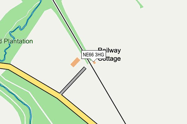
NE66 3HG is located in the Longhoughton electoral ward, within the unitary authority of Northumberland and the English Parliamentary constituency of Berwick-upon-Tweed. The Sub Integrated Care Board (ICB) Location is NHS North East and North Cumbria ICB - 00L and the police force is Northumbria. This postcode has been in use since January 1980.


GetTheData
Source: OS OpenMap – Local (Ordnance Survey)
Source: OS VectorMap District (Ordnance Survey)
Licence: Open Government Licence (requires attribution)
| Easting | 420715 |
| Northing | 624246 |
| Latitude | 55.511543 |
| Longitude | -1.673548 |
GetTheData
Source: Open Postcode Geo
Licence: Open Government Licence
| Country | England |
| Postcode District | NE66 |
| ➜ NE66 open data dashboard ➜ See where NE66 is on a map | |
GetTheData
Source: Land Registry Price Paid Data
Licence: Open Government Licence
Elevation or altitude of NE66 3HG as distance above sea level:
| Metres | Feet | |
|---|---|---|
| Elevation | 30m | 98ft |
Elevation is measured from the approximate centre of the postcode, to the nearest point on an OS contour line from OS Terrain 50, which has contour spacing of ten vertical metres.
➜ How high above sea level am I? Find the elevation of your current position using your device's GPS.
GetTheData
Source: Open Postcode Elevation
Licence: Open Government Licence
| Ward | Longhoughton |
| Constituency | Berwick-upon-tweed |
GetTheData
Source: ONS Postcode Database
Licence: Open Government Licence
| Phone Box (B6347) | Christon Bank | 1,318m |
| Phone Box (B6347) | Christon Bank | 1,328m |
| Burnhouses (Street) | Brunton | 1,388m |
| Burnhouses (Street) | Brunton | 1,412m |
| Chathill Station | 3.5km |
GetTheData
Source: NaPTAN
Licence: Open Government Licence
GetTheData
Source: ONS Postcode Database
Licence: Open Government Licence


➜ Get more ratings from the Food Standards Agency
GetTheData
Source: Food Standards Agency
Licence: FSA terms & conditions
| Last Collection | |||
|---|---|---|---|
| Location | Mon-Fri | Sat | Distance |
| Brunton House | 17:30 | 08:45 | 464m |
| Christon Bank | 16:00 | 10:30 | 1,301m |
| Newton Barns | 16:30 | 08:45 | 1,759m |
GetTheData
Source: Dracos
Licence: Creative Commons Attribution-ShareAlike
| Facility | Distance |
|---|---|
| Doxford Hall Hotel And Spa Doxford, Chathill Health and Fitness Gym, Swimming Pool | 2.1km |
| Creighton Memorial Hall W T Stead Road, Embleton, Alnwick Sports Hall | 3km |
| Embleton Playing Fields Embleton Main Street, Embleton Grass Pitches | 3.1km |
GetTheData
Source: Active Places
Licence: Open Government Licence
| School | Phase of Education | Distance |
|---|---|---|
| Embleton Vincent Edwards Church of England Primary School Embleton, Alnwick, NE66 3XR | Primary | 2.9km |
| Ellingham Church of England Aided Primary School Ellingham, Chathill, NE67 5ET | Primary | 3.3km |
GetTheData
Source: Edubase
Licence: Open Government Licence
The below table lists the International Territorial Level (ITL) codes (formerly Nomenclature of Territorial Units for Statistics (NUTS) codes) and Local Administrative Units (LAU) codes for NE66 3HG:
| ITL 1 Code | Name |
|---|---|
| TLC | North East (England) |
| ITL 2 Code | Name |
| TLC2 | Northumberland, and Tyne and Wear |
| ITL 3 Code | Name |
| TLC21 | Northumberland |
| LAU 1 Code | Name |
| E06000057 | Northumberland |
GetTheData
Source: ONS Postcode Directory
Licence: Open Government Licence
The below table lists the Census Output Area (OA), Lower Layer Super Output Area (LSOA), and Middle Layer Super Output Area (MSOA) for NE66 3HG:
| Code | Name | |
|---|---|---|
| OA | E00139235 | |
| LSOA | E01027366 | Northumberland 004C |
| MSOA | E02005702 | Northumberland 004 |
GetTheData
Source: ONS Postcode Directory
Licence: Open Government Licence
| NE66 3EX | Station Cottages | 1238m |
| NE66 3FB | Horsley Place | 1265m |
| NE66 3ES | 1288m | |
| NE67 5ED | 1354m | |
| NE66 3HP | Mount View | 1377m |
| NE66 3HR | The Sidings | 1411m |
| NE66 3EY | The Village | 1412m |
| NE66 3ET | Springfield View | 1483m |
| NE66 3HS | The Steadings | 1508m |
| NE66 3EU | 1516m |
GetTheData
Source: Open Postcode Geo; Land Registry Price Paid Data
Licence: Open Government Licence