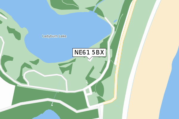
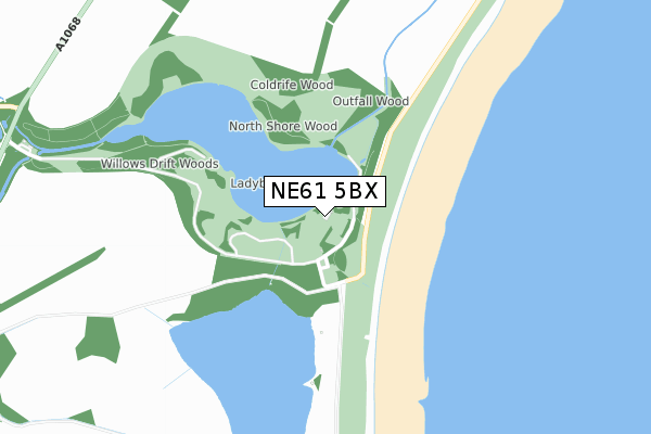
NE61 5BX is located in the Amble electoral ward, within the unitary authority of Northumberland and the English Parliamentary constituency of Berwick-upon-Tweed. The Sub Integrated Care Board (ICB) Location is NHS North East and North Cumbria ICB - 00L and the police force is Northumbria. This postcode has been in use since February 1990.


GetTheData
Source: OS Open Zoomstack (Ordnance Survey)
Licence: Open Government Licence (requires attribution)
Attribution: Contains OS data © Crown copyright and database right 2024
Source: Open Postcode Geo
Licence: Open Government Licence (requires attribution)
Attribution: Contains OS data © Crown copyright and database right 2024; Contains Royal Mail data © Royal Mail copyright and database right 2024; Source: Office for National Statistics licensed under the Open Government Licence v.3.0
| Easting | 427149 |
| Northing | 599850 |
| Latitude | 55.292024 |
| Longitude | -1.574035 |
GetTheData
Source: Open Postcode Geo
Licence: Open Government Licence
| Country | England |
| Postcode District | NE61 |
| ➜ NE61 open data dashboard ➜ See where NE61 is on a map | |
GetTheData
Source: Land Registry Price Paid Data
Licence: Open Government Licence
Elevation or altitude of NE61 5BX as distance above sea level:
| Metres | Feet | |
|---|---|---|
| Elevation | 10m | 33ft |
Elevation is measured from the approximate centre of the postcode, to the nearest point on an OS contour line from OS Terrain 50, which has contour spacing of ten vertical metres.
➜ How high above sea level am I? Find the elevation of your current position using your device's GPS.
GetTheData
Source: Open Postcode Elevation
Licence: Open Government Licence
| Ward | Amble |
| Constituency | Berwick-upon-tweed |
GetTheData
Source: ONS Postcode Database
Licence: Open Government Licence
| June 2023 | Anti-social behaviour | On or near Parking Area | 219m |
| June 2022 | Burglary | On or near Park/Open Space | 77m |
| May 2022 | Other theft | On or near Park/Open Space | 77m |
| ➜ Get more crime data in our Crime section | |||
GetTheData
Source: data.police.uk
Licence: Open Government Licence
| Acklington Station | 5.2km |
GetTheData
Source: NaPTAN
Licence: Open Government Licence
GetTheData
Source: ONS Postcode Database
Licence: Open Government Licence


➜ Get more ratings from the Food Standards Agency
GetTheData
Source: Food Standards Agency
Licence: FSA terms & conditions
| Last Collection | |||
|---|---|---|---|
| Location | Mon-Fri | Sat | Distance |
| Park View | 16:00 | 09:00 | 1,644m |
| Hadston Post Office | 16:00 | 10:15 | 1,917m |
| Red Row | 16:00 | 11:00 | 2,004m |
GetTheData
Source: Dracos
Licence: Creative Commons Attribution-ShareAlike
| Facility | Distance |
|---|---|
| Red Row Welfare Road From Junction Market Place To A1068, Red Row Grass Pitches | 1.8km |
| Red Row First School Red Row, Morpeth Grass Pitches | 1.9km |
| Druridge Bay Fitness Centre The Precinct, Hadston, Morpeth Health and Fitness Gym, Studio | 1.9km |
GetTheData
Source: Active Places
Licence: Open Government Licence
| School | Phase of Education | Distance |
|---|---|---|
| Red Row First School Red Row, Morpeth, NE61 5AS | Primary | 1.9km |
| Broomhill First School Station Road, North Broomhill, Morpeth, NE65 9UT | Primary | 3km |
| James Calvert Spence College Acklington Road, Amble, Morpeth, NE65 0NG | Secondary | 4.1km |
GetTheData
Source: Edubase
Licence: Open Government Licence
The below table lists the International Territorial Level (ITL) codes (formerly Nomenclature of Territorial Units for Statistics (NUTS) codes) and Local Administrative Units (LAU) codes for NE61 5BX:
| ITL 1 Code | Name |
|---|---|
| TLC | North East (England) |
| ITL 2 Code | Name |
| TLC2 | Northumberland, and Tyne and Wear |
| ITL 3 Code | Name |
| TLC21 | Northumberland |
| LAU 1 Code | Name |
| E06000057 | Northumberland |
GetTheData
Source: ONS Postcode Directory
Licence: Open Government Licence
The below table lists the Census Output Area (OA), Lower Layer Super Output Area (LSOA), and Middle Layer Super Output Area (MSOA) for NE61 5BX:
| Code | Name | |
|---|---|---|
| OA | E00139673 | |
| LSOA | E01027444 | Northumberland 008B |
| MSOA | E02005720 | Northumberland 008 |
GetTheData
Source: ONS Postcode Directory
Licence: Open Government Licence
| NE65 9RQ | Ladyburn Way | 1417m |
| NE65 9RJ | Ladyburn Way | 1441m |
| NE65 9RH | Beachcroft | 1461m |
| NE65 9AX | Chevington Green | 1510m |
| NE65 9TA | 1512m | |
| NE65 9RG | The Dunes | 1532m |
| NE65 9SN | Woodside Crescent | 1549m |
| NE65 9TJ | Hedgehope Crescent | 1562m |
| NE65 9SL | Woodside Crescent | 1563m |
| NE65 9SP | Cheviot Crescent | 1636m |
GetTheData
Source: Open Postcode Geo; Land Registry Price Paid Data
Licence: Open Government Licence