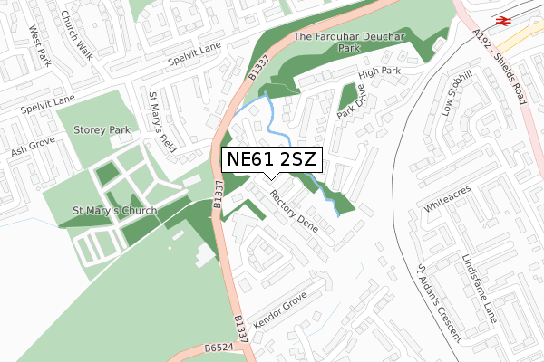
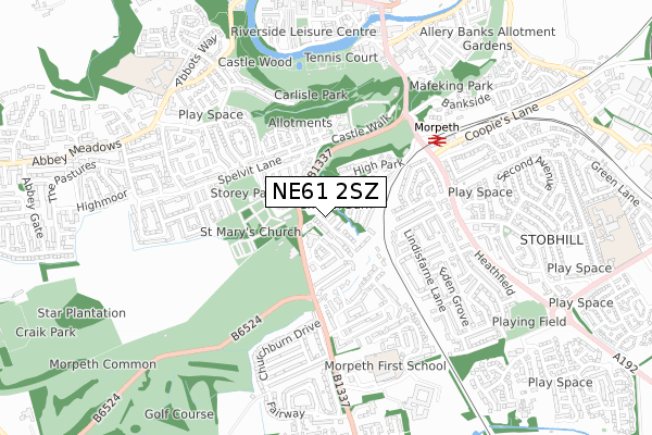
NE61 2SZ lies on Rectory Park in Morpeth. NE61 2SZ is located in the Morpeth Stobhill electoral ward, within the unitary authority of Northumberland and the English Parliamentary constituency of Wansbeck. The Sub Integrated Care Board (ICB) Location is NHS North East and North Cumbria ICB - 00L and the police force is Northumbria. This postcode has been in use since January 1980.


GetTheData
Source: OS Open Zoomstack (Ordnance Survey)
Licence: Open Government Licence (requires attribution)
Attribution: Contains OS data © Crown copyright and database right 2024
Source: Open Postcode Geo
Licence: Open Government Licence (requires attribution)
Attribution: Contains OS data © Crown copyright and database right 2024; Contains Royal Mail data © Royal Mail copyright and database right 2024; Source: Office for National Statistics licensed under the Open Government Licence v.3.0
| Easting | 419859 |
| Northing | 585088 |
| Latitude | 55.159723 |
| Longitude | -1.689860 |
GetTheData
Source: Open Postcode Geo
Licence: Open Government Licence
| Street | Rectory Park |
| Town/City | Morpeth |
| Country | England |
| Postcode District | NE61 |
| ➜ NE61 open data dashboard ➜ See where NE61 is on a map ➜ Where is Morpeth? | |
GetTheData
Source: Land Registry Price Paid Data
Licence: Open Government Licence
Elevation or altitude of NE61 2SZ as distance above sea level:
| Metres | Feet | |
|---|---|---|
| Elevation | 50m | 164ft |
Elevation is measured from the approximate centre of the postcode, to the nearest point on an OS contour line from OS Terrain 50, which has contour spacing of ten vertical metres.
➜ How high above sea level am I? Find the elevation of your current position using your device's GPS.
GetTheData
Source: Open Postcode Elevation
Licence: Open Government Licence
| Ward | Morpeth Stobhill |
| Constituency | Wansbeck |
GetTheData
Source: ONS Postcode Database
Licence: Open Government Licence
39, RECTORY PARK, DEUCHAR PARK, MORPETH, NE61 2SZ 2018 5 SEP £445,000 |
2015 7 AUG £250,000 |
2015 10 JUL £270,000 |
2014 20 JUN £280,000 |
4, RECTORY PARK, MORPETH, NE61 2SZ 2013 3 SEP £245,558 |
37, RECTORY PARK, MORPETH, NE61 2SZ 2012 10 AUG £230,000 |
5, RECTORY PARK, MORPETH, NE61 2SZ 2012 15 JUN £238,000 |
33, RECTORY PARK, MORPETH, NE61 2SZ 2011 15 JUL £230,000 |
20, RECTORY PARK, MORPETH, NE61 2SZ 2010 19 NOV £238,000 |
2010 13 SEP £285,000 |
GetTheData
Source: HM Land Registry Price Paid Data
Licence: Contains HM Land Registry data © Crown copyright and database right 2024. This data is licensed under the Open Government Licence v3.0.
| June 2022 | Bicycle theft | On or near Hillside | 111m |
| June 2022 | Anti-social behaviour | On or near Parking Area | 145m |
| June 2022 | Violence and sexual offences | On or near Kendor Grove | 239m |
| ➜ Rectory Park crime map and outcomes | |||
GetTheData
Source: data.police.uk
Licence: Open Government Licence
| Sun Inn (A197) | Morpeth | 165m |
| Morpeth Cottage Hospital (A197) | Loansdean | 178m |
| Sun Inn (A197) | Morpeth | 183m |
| The Kylins (A197) | Loansdean | 359m |
| Spelvit Lane | Kirkhill | 364m |
| Morpeth Station | 0.5km |
| Pegswood Station | 3.6km |
GetTheData
Source: NaPTAN
Licence: Open Government Licence
➜ Broadband speed and availability dashboard for NE61 2SZ
| Percentage of properties with Next Generation Access | 100.0% |
| Percentage of properties with Superfast Broadband | 100.0% |
| Percentage of properties with Ultrafast Broadband | 0.0% |
| Percentage of properties with Full Fibre Broadband | 0.0% |
Superfast Broadband is between 30Mbps and 300Mbps
Ultrafast Broadband is > 300Mbps
| Median download speed | 27.4Mbps |
| Average download speed | 26.6Mbps |
| Maximum download speed | 52.54Mbps |
| Median upload speed | 6.0Mbps |
| Average upload speed | 5.3Mbps |
| Maximum upload speed | 10.77Mbps |
| Percentage of properties unable to receive 2Mbps | 0.0% |
| Percentage of properties unable to receive 5Mbps | 0.0% |
| Percentage of properties unable to receive 10Mbps | 0.0% |
| Percentage of properties unable to receive 30Mbps | 0.0% |
➜ Broadband speed and availability dashboard for NE61 2SZ
GetTheData
Source: Ofcom
Licence: Ofcom Terms of Use (requires attribution)
Estimated total energy consumption in NE61 2SZ by fuel type, 2015.
| Consumption (kWh) | 686,785 |
|---|---|
| Meter count | 29 |
| Mean (kWh/meter) | 23,682 |
| Median (kWh/meter) | 22,999 |
| Consumption (kWh) | 129,747 |
|---|---|
| Meter count | 27 |
| Mean (kWh/meter) | 4,805 |
| Median (kWh/meter) | 4,089 |
GetTheData
Source: Postcode level gas estimates: 2015 (experimental)
Source: Postcode level electricity estimates: 2015 (experimental)
Licence: Open Government Licence
GetTheData
Source: ONS Postcode Database
Licence: Open Government Licence


➜ Get more ratings from the Food Standards Agency
GetTheData
Source: Food Standards Agency
Licence: FSA terms & conditions
| Last Collection | |||
|---|---|---|---|
| Location | Mon-Fri | Sat | Distance |
| Railway Station | 17:30 | 11:45 | 538m |
| Chantry Place | 17:30 | 12:00 | 834m |
| Chantry Place | 17:30 | 12:00 | 834m |
GetTheData
Source: Dracos
Licence: Creative Commons Attribution-ShareAlike
| Facility | Distance |
|---|---|
| Morpeth Golf Club Loansdean, Morpeth Golf | 199m |
| Storey Park St. Marys Field, Morpeth Grass Pitches | 330m |
| Carlisle Park Castle Square, Morpeth Outdoor Tennis Courts | 598m |
GetTheData
Source: Active Places
Licence: Open Government Licence
| School | Phase of Education | Distance |
|---|---|---|
| Morpeth First School Loansdean, Morpeth, NE61 2AP | Primary | 592m |
| Kyloe House Care of: Northumberland County Council, County Hall, Morpeth, NE61 2EF | Not applicable | 761m |
| Abbeyfields First School Abbot's Way, Morpeth, NE61 2LZ | Primary | 861m |
GetTheData
Source: Edubase
Licence: Open Government Licence
The below table lists the International Territorial Level (ITL) codes (formerly Nomenclature of Territorial Units for Statistics (NUTS) codes) and Local Administrative Units (LAU) codes for NE61 2SZ:
| ITL 1 Code | Name |
|---|---|
| TLC | North East (England) |
| ITL 2 Code | Name |
| TLC2 | Northumberland, and Tyne and Wear |
| ITL 3 Code | Name |
| TLC21 | Northumberland |
| LAU 1 Code | Name |
| E06000057 | Northumberland |
GetTheData
Source: ONS Postcode Directory
Licence: Open Government Licence
The below table lists the Census Output Area (OA), Lower Layer Super Output Area (LSOA), and Middle Layer Super Output Area (MSOA) for NE61 2SZ:
| Code | Name | |
|---|---|---|
| OA | E00139749 | |
| LSOA | E01027458 | Northumberland 018C |
| MSOA | E02005724 | Northumberland 018 |
GetTheData
Source: ONS Postcode Directory
Licence: Open Government Licence
| NE61 2SU | Hillside | 119m |
| NE61 2TD | Rectory Dene | 140m |
| NE61 2SY | Park Drive | 156m |
| NE61 2TA | High Park | 158m |
| NE61 2SX | Park Drive | 170m |
| NE61 2QF | St Marys Field | 184m |
| NE61 2QT | High Church | 188m |
| NE61 2QQ | St Marys Field | 220m |
| NE61 2QG | St Marys Field | 225m |
| NE61 2BU | Kendor Grove | 244m |
GetTheData
Source: Open Postcode Geo; Land Registry Price Paid Data
Licence: Open Government Licence