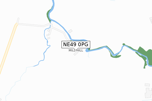
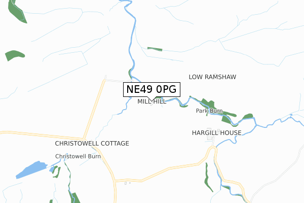
NE49 0PG is located in the Haltwhistle electoral ward, within the unitary authority of Northumberland and the English Parliamentary constituency of Hexham. The Sub Integrated Care Board (ICB) Location is NHS North East and North Cumbria ICB - 00L and the police force is Northumbria. This postcode has been in use since January 1980.


GetTheData
Source: OS Open Zoomstack (Ordnance Survey)
Licence: Open Government Licence (requires attribution)
Attribution: Contains OS data © Crown copyright and database right 2024
Source: Open Postcode Geo
Licence: Open Government Licence (requires attribution)
Attribution: Contains OS data © Crown copyright and database right 2024; Contains Royal Mail data © Royal Mail copyright and database right 2024; Source: Office for National Statistics licensed under the Open Government Licence v.3.0
| Easting | 370201 |
| Northing | 559808 |
| Latitude | 54.932053 |
| Longitude | -2.466571 |
GetTheData
Source: Open Postcode Geo
Licence: Open Government Licence
| Country | England |
| Postcode District | NE49 |
| ➜ NE49 open data dashboard ➜ See where NE49 is on a map | |
GetTheData
Source: Land Registry Price Paid Data
Licence: Open Government Licence
Elevation or altitude of NE49 0PG as distance above sea level:
| Metres | Feet | |
|---|---|---|
| Elevation | 220m | 722ft |
Elevation is measured from the approximate centre of the postcode, to the nearest point on an OS contour line from OS Terrain 50, which has contour spacing of ten vertical metres.
➜ How high above sea level am I? Find the elevation of your current position using your device's GPS.
GetTheData
Source: Open Postcode Elevation
Licence: Open Government Licence
| Ward | Haltwhistle |
| Constituency | Hexham |
GetTheData
Source: ONS Postcode Database
Licence: Open Government Licence
| Stonehouse Old Chapel (C326) | Coanwood | 1,322m |
| Stonehouse Old Chapel (C326) | Coanwood | 1,331m |
| Lanehead (C323) | Coanwood | 1,441m |
| Lanehead (C323) | Coanwood | 1,444m |
| Haltwhistle Station | 4km |
GetTheData
Source: NaPTAN
Licence: Open Government Licence
GetTheData
Source: ONS Postcode Database
Licence: Open Government Licence


➜ Get more ratings from the Food Standards Agency
GetTheData
Source: Food Standards Agency
Licence: FSA terms & conditions
| Last Collection | |||
|---|---|---|---|
| Location | Mon-Fri | Sat | Distance |
| Coanwood Post Office | 16:45 | 09:15 | 1,411m |
| Rowfoot | 16:45 | 09:00 | 1,934m |
| Herdley Bank | 16:45 | 09:15 | 2,203m |
GetTheData
Source: Dracos
Licence: Creative Commons Attribution-ShareAlike
| Facility | Distance |
|---|---|
| Haltwhistle Cricket Club Off A69, Haltwhistle Grass Pitches | 3.9km |
| Hadrian Works Haltwhistle Grass Pitches | 4km |
| Haltwhistle Swimming & Leisure Centre Woodhead Lane, Haltwhistle Sports Hall, Swimming Pool, Health and Fitness Gym, Squash Courts, Artificial Grass Pitch, Studio | 4.4km |
GetTheData
Source: Active Places
Licence: Open Government Licence
| School | Phase of Education | Distance |
|---|---|---|
| Haltwhistle Primary Academy Park Avenue, Haltwhistle, NE49 9BA | Primary | 4.4km |
GetTheData
Source: Edubase
Licence: Open Government Licence
The below table lists the International Territorial Level (ITL) codes (formerly Nomenclature of Territorial Units for Statistics (NUTS) codes) and Local Administrative Units (LAU) codes for NE49 0PG:
| ITL 1 Code | Name |
|---|---|
| TLC | North East (England) |
| ITL 2 Code | Name |
| TLC2 | Northumberland, and Tyne and Wear |
| ITL 3 Code | Name |
| TLC21 | Northumberland |
| LAU 1 Code | Name |
| E06000057 | Northumberland |
GetTheData
Source: ONS Postcode Directory
Licence: Open Government Licence
The below table lists the Census Output Area (OA), Lower Layer Super Output Area (LSOA), and Middle Layer Super Output Area (MSOA) for NE49 0PG:
| Code | Name | |
|---|---|---|
| OA | E00140024 | |
| LSOA | E01027512 | Northumberland 037E |
| MSOA | E02005728 | Northumberland 037 |
GetTheData
Source: ONS Postcode Directory
Licence: Open Government Licence
| NE49 0PE | 602m | |
| NE49 0QN | 1126m | |
| NE49 0QL | 1456m | |
| NE49 0NU | Lane Head | 1465m |
| NE49 0PA | 1575m | |
| NE49 0NX | 1701m | |
| NE49 0QW | 1783m | |
| NE49 0JE | 1945m | |
| NE49 0JF | 2094m | |
| NE49 0QU | High Ridley | 2277m |
GetTheData
Source: Open Postcode Geo; Land Registry Price Paid Data
Licence: Open Government Licence