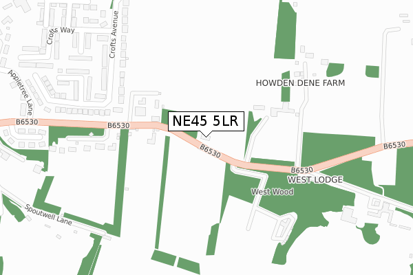
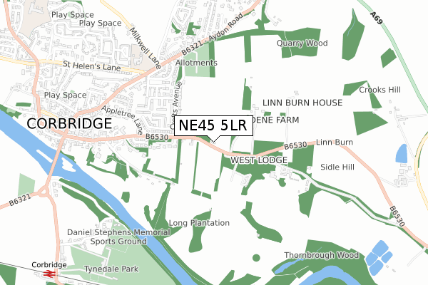
NE45 5LR lies on Eastfield Cottages in Corbridge. NE45 5LR is located in the Corbridge electoral ward, within the unitary authority of Northumberland and the English Parliamentary constituency of Hexham. The Sub Integrated Care Board (ICB) Location is NHS North East and North Cumbria ICB - 00L and the police force is Northumbria. This postcode has been in use since January 1980.


GetTheData
Source: OS Open Zoomstack (Ordnance Survey)
Licence: Open Government Licence (requires attribution)
Attribution: Contains OS data © Crown copyright and database right 2024
Source: Open Postcode Geo
Licence: Open Government Licence (requires attribution)
Attribution: Contains OS data © Crown copyright and database right 2024; Contains Royal Mail data © Royal Mail copyright and database right 2024; Source: Office for National Statistics licensed under the Open Government Licence v.3.0
| Easting | 399823 |
| Northing | 564287 |
| Latitude | 54.973198 |
| Longitude | -2.004297 |
GetTheData
Source: Open Postcode Geo
Licence: Open Government Licence
| Street | Eastfield Cottages |
| Town/City | Corbridge |
| Country | England |
| Postcode District | NE45 |
| ➜ NE45 open data dashboard ➜ See where NE45 is on a map | |
GetTheData
Source: Land Registry Price Paid Data
Licence: Open Government Licence
Elevation or altitude of NE45 5LR as distance above sea level:
| Metres | Feet | |
|---|---|---|
| Elevation | 60m | 197ft |
Elevation is measured from the approximate centre of the postcode, to the nearest point on an OS contour line from OS Terrain 50, which has contour spacing of ten vertical metres.
➜ How high above sea level am I? Find the elevation of your current position using your device's GPS.
GetTheData
Source: Open Postcode Elevation
Licence: Open Government Licence
| Ward | Corbridge |
| Constituency | Hexham |
GetTheData
Source: ONS Postcode Database
Licence: Open Government Licence
| June 2022 | Violence and sexual offences | On or near Crofts Close | 383m |
| June 2022 | Violence and sexual offences | On or near Crofts Close | 383m |
| June 2022 | Violence and sexual offences | On or near Crofts Close | 383m |
| ➜ Get more crime data in our Crime section | |||
GetTheData
Source: data.police.uk
Licence: Open Government Licence
| The Crofts (Newcastle Road) | Corbridge | 202m |
| Howden Dene (B6530) | Corbridge | 243m |
| Howden Dene (B6530) | Corbridge | 250m |
| The Crofts (Newcastle Road) | Corbridge | 251m |
| St Helen's Lane | Corbridge | 703m |
| Corbridge Station | 1.2km |
| Riding Mill Station | 3.4km |
GetTheData
Source: NaPTAN
Licence: Open Government Licence
| Percentage of properties with Next Generation Access | 100.0% |
| Percentage of properties with Superfast Broadband | 100.0% |
| Percentage of properties with Ultrafast Broadband | 0.0% |
| Percentage of properties with Full Fibre Broadband | 0.0% |
Superfast Broadband is between 30Mbps and 300Mbps
Ultrafast Broadband is > 300Mbps
| Percentage of properties unable to receive 2Mbps | 0.0% |
| Percentage of properties unable to receive 5Mbps | 0.0% |
| Percentage of properties unable to receive 10Mbps | 0.0% |
| Percentage of properties unable to receive 30Mbps | 0.0% |
GetTheData
Source: Ofcom
Licence: Ofcom Terms of Use (requires attribution)
GetTheData
Source: ONS Postcode Database
Licence: Open Government Licence


➜ Get more ratings from the Food Standards Agency
GetTheData
Source: Food Standards Agency
Licence: FSA terms & conditions
| Last Collection | |||
|---|---|---|---|
| Location | Mon-Fri | Sat | Distance |
| Woodside Avenue | 16:45 | 09:15 | 606m |
| Main Street | 16:00 | 09:00 | 613m |
| Aydon Road | 16:45 | 09:15 | 649m |
GetTheData
Source: Dracos
Licence: Creative Commons Attribution-ShareAlike
| Facility | Distance |
|---|---|
| Corbridge Church Of England Aided First School St. Helens Lane, Corbridge Grass Pitches | 659m |
| Corbridge Cricket Club Corbridge Grass Pitches | 739m |
| Tynedale Rugby Football Club Ltd The Stanners, Corbridge Health and Fitness Gym, Grass Pitches, Outdoor Tennis Courts | 906m |
GetTheData
Source: Active Places
Licence: Open Government Licence
| School | Phase of Education | Distance |
|---|---|---|
| Corbridge (VA) Church of England First School St Helen's Lane, Corbridge, NE45 5JQ | Primary | 664m |
| Corbridge Middle School Cow Lane, Corbridge, NE45 5HX | Middle deemed secondary | 1.4km |
| Cambian Dilston College Dilston Hall, Corbridge, NE45 5RJ | Not applicable | 2.6km |
GetTheData
Source: Edubase
Licence: Open Government Licence
The below table lists the International Territorial Level (ITL) codes (formerly Nomenclature of Territorial Units for Statistics (NUTS) codes) and Local Administrative Units (LAU) codes for NE45 5LR:
| ITL 1 Code | Name |
|---|---|
| TLC | North East (England) |
| ITL 2 Code | Name |
| TLC2 | Northumberland, and Tyne and Wear |
| ITL 3 Code | Name |
| TLC21 | Northumberland |
| LAU 1 Code | Name |
| E06000057 | Northumberland |
GetTheData
Source: ONS Postcode Directory
Licence: Open Government Licence
The below table lists the Census Output Area (OA), Lower Layer Super Output Area (LSOA), and Middle Layer Super Output Area (MSOA) for NE45 5LR:
| Code | Name | |
|---|---|---|
| OA | E00139865 | |
| LSOA | E01027481 | Northumberland 039A |
| MSOA | E02005732 | Northumberland 039 |
GetTheData
Source: ONS Postcode Directory
Licence: Open Government Licence
| NE45 5LP | Newcastle Road | 170m |
| NE45 5LS | Newcastle Road | 265m |
| NE45 5LN | Newcastle Road | 291m |
| NE45 5LY | Crofts Avenue | 305m |
| NE45 5NA | Carham Close | 344m |
| NE45 5LZ | Crofts Avenue | 379m |
| NE45 5ND | Crofts Close | 390m |
| NE45 5NB | Crofts Way | 430m |
| NE45 5LJ | Carrsfield | 445m |
| NE45 5ER | Aydon Court | 447m |
GetTheData
Source: Open Postcode Geo; Land Registry Price Paid Data
Licence: Open Government Licence