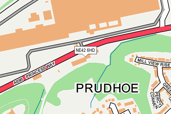
NE42 6HD is located in the Prudhoe North electoral ward, within the unitary authority of Northumberland and the English Parliamentary constituency of Hexham. The Sub Integrated Care Board (ICB) Location is NHS North East and North Cumbria ICB - 00L and the police force is Northumbria. This postcode has been in use since January 1980.


GetTheData
Source: OS OpenMap – Local (Ordnance Survey)
Source: OS VectorMap District (Ordnance Survey)
Licence: Open Government Licence (requires attribution)
| Easting | 409394 |
| Northing | 563575 |
| Latitude | 54.966721 |
| Longitude | -1.854815 |
GetTheData
Source: Open Postcode Geo
Licence: Open Government Licence
| Country | England |
| Postcode District | NE42 |
| ➜ NE42 open data dashboard ➜ See where NE42 is on a map ➜ Where is Prudhoe? | |
GetTheData
Source: Land Registry Price Paid Data
Licence: Open Government Licence
Elevation or altitude of NE42 6HD as distance above sea level:
| Metres | Feet | |
|---|---|---|
| Elevation | 20m | 66ft |
Elevation is measured from the approximate centre of the postcode, to the nearest point on an OS contour line from OS Terrain 50, which has contour spacing of ten vertical metres.
➜ How high above sea level am I? Find the elevation of your current position using your device's GPS.
GetTheData
Source: Open Postcode Elevation
Licence: Open Government Licence
| Ward | Prudhoe North |
| Constituency | Hexham |
GetTheData
Source: ONS Postcode Database
Licence: Open Government Licence
| June 2022 | Burglary | On or near Carnaby Close | 399m |
| May 2022 | Violence and sexual offences | On or near Carnaby Close | 399m |
| May 2022 | Violence and sexual offences | On or near Carnaby Close | 399m |
| ➜ Get more crime data in our Crime section | |||
GetTheData
Source: data.police.uk
Licence: Open Government Licence
| Western Avenue (Station Road) | Low Prudhoe | 378m |
| Prudhoe Castle (Station Road) | Low Prudhoe | 385m |
| Western Avenue (Station Road) | Low Prudhoe | 388m |
| Prudhoe Castle (Station Road) | Low Prudhoe | 399m |
| Princess Way | Low Prudhoe | 504m |
| Prudhoe Station | 0.7km |
| Wylam Station | 2.8km |
| Stocksfield Station | 4.5km |
GetTheData
Source: NaPTAN
Licence: Open Government Licence
GetTheData
Source: ONS Postcode Database
Licence: Open Government Licence


➜ Get more ratings from the Food Standards Agency
GetTheData
Source: Food Standards Agency
Licence: FSA terms & conditions
| Last Collection | |||
|---|---|---|---|
| Location | Mon-Fri | Sat | Distance |
| Appletree Drive | 17:45 | 11:30 | 279m |
| Castle Road | 17:00 | 11:30 | 569m |
| Prudhoe Post Office | 18:00 | 12:30 | 620m |
GetTheData
Source: Dracos
Licence: Creative Commons Attribution-ShareAlike
| Facility | Distance |
|---|---|
| Prudhoe West Academy West Road, Prudhoe Sports Hall | 771m |
| The Buzz Factory (Closed) Swalwell Close, Prudhoe Health and Fitness Gym, Studio | 790m |
| Adderlane Academy Broomhill Road, Prudhoe Grass Pitches | 891m |
GetTheData
Source: Active Places
Licence: Open Government Licence
| School | Phase of Education | Distance |
|---|---|---|
| Prudhoe West Academy West Road, Prudhoe, NE42 6HR | Primary | 753m |
| Adderlane Academy Broomhill Road, Adderlane Academy, Prudhoe, NE42 5HX | Primary | 890m |
| St Matthew's Catholic Primary School, Prudhoe Highfield Lane, Prudhoe, NE42 6EY | Primary | 910m |
GetTheData
Source: Edubase
Licence: Open Government Licence
The below table lists the International Territorial Level (ITL) codes (formerly Nomenclature of Territorial Units for Statistics (NUTS) codes) and Local Administrative Units (LAU) codes for NE42 6HD:
| ITL 1 Code | Name |
|---|---|
| TLC | North East (England) |
| ITL 2 Code | Name |
| TLC2 | Northumberland, and Tyne and Wear |
| ITL 3 Code | Name |
| TLC21 | Northumberland |
| LAU 1 Code | Name |
| E06000057 | Northumberland |
GetTheData
Source: ONS Postcode Directory
Licence: Open Government Licence
The below table lists the Census Output Area (OA), Lower Layer Super Output Area (LSOA), and Middle Layer Super Output Area (MSOA) for NE42 6HD:
| Code | Name | |
|---|---|---|
| OA | E00176359 | |
| LSOA | E01027497 | Northumberland 038A |
| MSOA | E02005731 | Northumberland 038 |
GetTheData
Source: ONS Postcode Directory
Licence: Open Government Licence
| NE42 5QL | Duckets Dean | 209m |
| NE42 5QF | Orchard Hill | 215m |
| NE42 5QG | Cockshott Dean | 220m |
| NE42 5QQ | Well Dean | 255m |
| NE42 5QE | The Haughs | 296m |
| NE42 5QH | The Ford | 298m |
| NE42 5QJ | Appletree Drive | 309m |
| NE42 5QX | Mill View Rise | 321m |
| NE42 5QN | The Waggonway | 322m |
| NE42 5QU | Percy Lonnen | 325m |
GetTheData
Source: Open Postcode Geo; Land Registry Price Paid Data
Licence: Open Government Licence