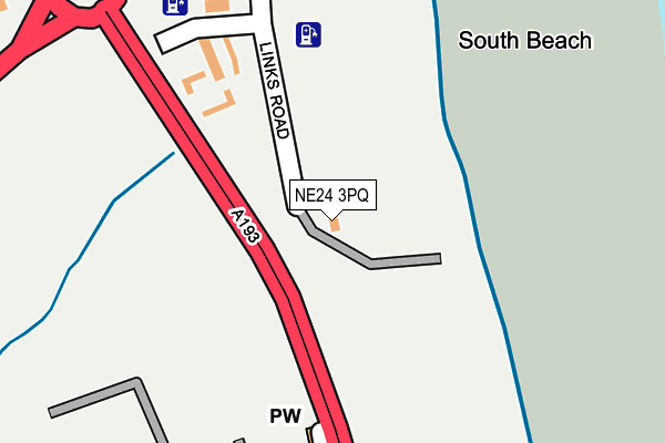
NE24 3PQ is located in the South Blyth electoral ward, within the unitary authority of Northumberland and the English Parliamentary constituency of Blyth Valley. The Sub Integrated Care Board (ICB) Location is NHS North East and North Cumbria ICB - 00L and the police force is Northumbria. This postcode has been in use since February 2014.


GetTheData
Source: OS OpenMap – Local (Ordnance Survey)
Source: OS VectorMap District (Ordnance Survey)
Licence: Open Government Licence (requires attribution)
| Easting | 432041 |
| Northing | 579325 |
| Latitude | 55.107303 |
| Longitude | -1.499322 |
GetTheData
Source: Open Postcode Geo
Licence: Open Government Licence
| Country | England |
| Postcode District | NE24 |
| ➜ NE24 open data dashboard ➜ See where NE24 is on a map ➜ Where is Blyth? | |
GetTheData
Source: Land Registry Price Paid Data
Licence: Open Government Licence
Elevation or altitude of NE24 3PQ as distance above sea level:
| Metres | Feet | |
|---|---|---|
| Elevation | 10m | 33ft |
Elevation is measured from the approximate centre of the postcode, to the nearest point on an OS contour line from OS Terrain 50, which has contour spacing of ten vertical metres.
➜ How high above sea level am I? Find the elevation of your current position using your device's GPS.
GetTheData
Source: Open Postcode Elevation
Licence: Open Government Licence
| Ward | South Blyth |
| Constituency | Blyth Valley |
GetTheData
Source: ONS Postcode Database
Licence: Open Government Licence
| June 2022 | Public order | On or near Oberon Way | 385m |
| June 2022 | Violence and sexual offences | On or near Oberon Way | 385m |
| June 2022 | Criminal damage and arson | On or near Oberon Way | 385m |
| ➜ Get more crime data in our Crime section | |||
GetTheData
Source: data.police.uk
Licence: Open Government Licence
| Cemetery (Links Road) | South Beach | 246m |
| Cemetery (Links Road) | South Beach | 251m |
| Links Road | South Beach | 348m |
| Links Road | South Beach | 431m |
| Caravan Park (Rotary Way) | South Beach | 498m |
GetTheData
Source: NaPTAN
Licence: Open Government Licence
GetTheData
Source: ONS Postcode Database
Licence: Open Government Licence


➜ Get more ratings from the Food Standards Agency
GetTheData
Source: Food Standards Agency
Licence: FSA terms & conditions
| Last Collection | |||
|---|---|---|---|
| Location | Mon-Fri | Sat | Distance |
| Fulmar Drive | 16:15 | 10:45 | 634m |
| Amersham Road | 17:30 | 10:45 | 995m |
| Gordon Road | 16:00 | 10:45 | 1,193m |
GetTheData
Source: Dracos
Licence: Creative Commons Attribution-ShareAlike
| Facility | Distance |
|---|---|
| Gloucester Lodge (Closed) Links Road, Blyth Grass Pitches | 559m |
| South Newsham Playing Fields Fulmar Drive, Blyth Grass Pitches | 814m |
| South Newsham Park (Blyth Town Fc) Sandringham Drive, Blyth Grass Pitches | 1.2km |
GetTheData
Source: Active Places
Licence: Open Government Licence
| School | Phase of Education | Distance |
|---|---|---|
| Croftway Academy William Street, Blyth, NE24 2HP | Primary | 1.8km |
| Bede Academy Sixth Avenue, Blyth, NE24 2SY | All-through | 1.8km |
| Newsham Primary School Warwick Street, Blyth, NE24 4NX | Primary | 2km |
GetTheData
Source: Edubase
Licence: Open Government Licence
The below table lists the International Territorial Level (ITL) codes (formerly Nomenclature of Territorial Units for Statistics (NUTS) codes) and Local Administrative Units (LAU) codes for NE24 3PQ:
| ITL 1 Code | Name |
|---|---|
| TLC | North East (England) |
| ITL 2 Code | Name |
| TLC2 | Northumberland, and Tyne and Wear |
| ITL 3 Code | Name |
| TLC21 | Northumberland |
| LAU 1 Code | Name |
| E06000057 | Northumberland |
GetTheData
Source: ONS Postcode Directory
Licence: Open Government Licence
The below table lists the Census Output Area (OA), Lower Layer Super Output Area (LSOA), and Middle Layer Super Output Area (MSOA) for NE24 3PQ:
| Code | Name | |
|---|---|---|
| OA | E00139653 | |
| LSOA | E01027440 | Northumberland 026D |
| MSOA | E02005713 | Northumberland 026 |
GetTheData
Source: ONS Postcode Directory
Licence: Open Government Licence
| NE24 3UE | 339m | |
| NE24 3UH | Taku Court | 368m |
| NE24 3RU | Oberon Way | 401m |
| NE24 3QE | Puffin Close | 404m |
| NE24 3UA | Dolphin Grove | 420m |
| NE24 3QA | Mallard Way | 442m |
| NE24 3RP | Talisman Way | 451m |
| NE24 3UG | Viking Court | 466m |
| NE24 3RY | Otus Grove | 477m |
| NE24 3PZ | Mallard Way | 491m |
GetTheData
Source: Open Postcode Geo; Land Registry Price Paid Data
Licence: Open Government Licence