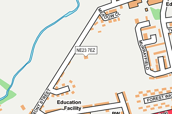
NE23 7EZ is located in the Seghill with Seaton Delaval electoral ward, within the unitary authority of Northumberland and the English Parliamentary constituency of Blyth Valley. The Sub Integrated Care Board (ICB) Location is NHS North East and North Cumbria ICB - 00L and the police force is Northumbria. This postcode has been in use since January 1980.


GetTheData
Source: OS OpenMap – Local (Ordnance Survey)
Source: OS VectorMap District (Ordnance Survey)
Licence: Open Government Licence (requires attribution)
| Easting | 428619 |
| Northing | 574614 |
| Latitude | 55.065180 |
| Longitude | -1.553429 |
GetTheData
Source: Open Postcode Geo
Licence: Open Government Licence
| Country | England |
| Postcode District | NE23 |
| ➜ NE23 open data dashboard ➜ See where NE23 is on a map ➜ Where is Seghill? | |
GetTheData
Source: Land Registry Price Paid Data
Licence: Open Government Licence
Elevation or altitude of NE23 7EZ as distance above sea level:
| Metres | Feet | |
|---|---|---|
| Elevation | 40m | 131ft |
Elevation is measured from the approximate centre of the postcode, to the nearest point on an OS contour line from OS Terrain 50, which has contour spacing of ten vertical metres.
➜ How high above sea level am I? Find the elevation of your current position using your device's GPS.
GetTheData
Source: Open Postcode Elevation
Licence: Open Government Licence
| Ward | Seghill With Seaton Delaval |
| Constituency | Blyth Valley |
GetTheData
Source: ONS Postcode Database
Licence: Open Government Licence
| January 2024 | Anti-social behaviour | On or near Fox Lea Walk | 471m |
| December 2023 | Violence and sexual offences | On or near Fox Lea Walk | 471m |
| December 2023 | Public order | On or near Fox Lea Walk | 471m |
| ➜ Get more crime data in our Crime section | |||
GetTheData
Source: data.police.uk
Licence: Open Government Licence
| Blake Arms (Station Road) | Blake Town | 334m |
| Blake Arms (Station Road) | Blake Town | 336m |
| Chester Grove (A190) | Seghill | 343m |
| Chester Grove (A190) | Seghill | 398m |
| Railway Crossing (Station Road) | Blake Town | 584m |
| Cramlington Station | 3.8km |
GetTheData
Source: NaPTAN
Licence: Open Government Licence
GetTheData
Source: ONS Postcode Database
Licence: Open Government Licence


➜ Get more ratings from the Food Standards Agency
GetTheData
Source: Food Standards Agency
Licence: FSA terms & conditions
| Last Collection | |||
|---|---|---|---|
| Location | Mon-Fri | Sat | Distance |
| Seghill Post Office | 17:30 | 12:15 | 255m |
| Burnside Close | 16:30 | 12:00 | 518m |
| Station Road | 16:45 | 12:15 | 612m |
GetTheData
Source: Dracos
Licence: Creative Commons Attribution-ShareAlike
| Facility | Distance |
|---|---|
| Seghill Welfare Park U9719 Front Street To Pitt Lane, Seghill Grass Pitches | 25m |
| Whytrig Community Middle School (Closed) Western Avenue, Seaton Delaval, Whitley Bay Sports Hall, Grass Pitches | 1.7km |
| Ann Welfare Playing Fields High Pit Road, Cramlington Grass Pitches | 1.7km |
GetTheData
Source: Active Places
Licence: Open Government Licence
| School | Phase of Education | Distance |
|---|---|---|
| Seghill First School Seghill, Cramlington, NE23 7SB | Primary | 203m |
| Seaton Delaval First School Western Avenue, Seaton Delaval, Whitley Bay, NE25 0EP | Primary | 1.4km |
| Astley Community High School Elsdon Avenue, Seaton Delaval, NE25 0BP | Secondary | 1.9km |
GetTheData
Source: Edubase
Licence: Open Government Licence
The below table lists the International Territorial Level (ITL) codes (formerly Nomenclature of Territorial Units for Statistics (NUTS) codes) and Local Administrative Units (LAU) codes for NE23 7EZ:
| ITL 1 Code | Name |
|---|---|
| TLC | North East (England) |
| ITL 2 Code | Name |
| TLC2 | Northumberland, and Tyne and Wear |
| ITL 3 Code | Name |
| TLC21 | Northumberland |
| LAU 1 Code | Name |
| E06000057 | Northumberland |
GetTheData
Source: ONS Postcode Directory
Licence: Open Government Licence
The below table lists the Census Output Area (OA), Lower Layer Super Output Area (LSOA), and Middle Layer Super Output Area (MSOA) for NE23 7EZ:
| Code | Name | |
|---|---|---|
| OA | E00139638 | |
| LSOA | E01027435 | Northumberland 032D |
| MSOA | E02005719 | Northumberland 032 |
GetTheData
Source: ONS Postcode Directory
Licence: Open Government Licence
| NE23 7FD | The Beehive | 121m |
| NE23 7TA | Carrington Close | 152m |
| NE23 7HJ | Meadow Close | 154m |
| NE23 7SS | Cheviot View | 175m |
| NE23 7SR | West View | 181m |
| NE23 7SP | East View | 217m |
| NE23 7TF | Murrayfield | 225m |
| NE23 7SB | Main Street North | 236m |
| NE23 7TE | Murrayfield | 249m |
| NE23 7ST | Barrass Avenue | 266m |
GetTheData
Source: Open Postcode Geo; Land Registry Price Paid Data
Licence: Open Government Licence