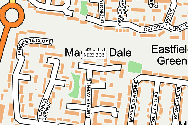
NE23 2DB lies on Tindale Avenue in Cramlington. NE23 2DB is located in the Cramlington East electoral ward, within the unitary authority of Northumberland and the English Parliamentary constituency of Blyth Valley. The Sub Integrated Care Board (ICB) Location is NHS North East and North Cumbria ICB - 00L and the police force is Northumbria. This postcode has been in use since June 1999.


GetTheData
Source: OS OpenMap – Local (Ordnance Survey)
Source: OS VectorMap District (Ordnance Survey)
Licence: Open Government Licence (requires attribution)
| Easting | 427311 |
| Northing | 576981 |
| Latitude | 55.086523 |
| Longitude | -1.573683 |
GetTheData
Source: Open Postcode Geo
Licence: Open Government Licence
| Street | Tindale Avenue |
| Town/City | Cramlington |
| Country | England |
| Postcode District | NE23 |
➜ See where NE23 is on a map ➜ Where is Cramlington? | |
GetTheData
Source: Land Registry Price Paid Data
Licence: Open Government Licence
Elevation or altitude of NE23 2DB as distance above sea level:
| Metres | Feet | |
|---|---|---|
| Elevation | 60m | 197ft |
Elevation is measured from the approximate centre of the postcode, to the nearest point on an OS contour line from OS Terrain 50, which has contour spacing of ten vertical metres.
➜ How high above sea level am I? Find the elevation of your current position using your device's GPS.
GetTheData
Source: Open Postcode Elevation
Licence: Open Government Licence
| Ward | Cramlington East |
| Constituency | Blyth Valley |
GetTheData
Source: ONS Postcode Database
Licence: Open Government Licence
| Telephone Exchange (Northumbrian Road) | Cramlington | 293m |
| Cornhill Road (B1326) | High Pit | 301m |
| Telephone Exchange (Northumbrian Road) | Cramlington | 305m |
| Mayfield Avenue (Village Road) | High Pit | 312m |
| Parkside Glade (Northumbrian Road) | Parkside | 326m |
| Cramlington Station | 1.6km |
GetTheData
Source: NaPTAN
Licence: Open Government Licence
| Percentage of properties with Next Generation Access | 100.0% |
| Percentage of properties with Superfast Broadband | 100.0% |
| Percentage of properties with Ultrafast Broadband | 0.0% |
| Percentage of properties with Full Fibre Broadband | 0.0% |
Superfast Broadband is between 30Mbps and 300Mbps
Ultrafast Broadband is > 300Mbps
| Median download speed | 47.5Mbps |
| Average download speed | 47.6Mbps |
| Maximum download speed | 78.12Mbps |
| Median upload speed | 8.6Mbps |
| Average upload speed | 8.6Mbps |
| Maximum upload speed | 19.53Mbps |
| Percentage of properties unable to receive 2Mbps | 0.0% |
| Percentage of properties unable to receive 5Mbps | 0.0% |
| Percentage of properties unable to receive 10Mbps | 0.0% |
| Percentage of properties unable to receive 30Mbps | 0.0% |
GetTheData
Source: Ofcom
Licence: Ofcom Terms of Use (requires attribution)
Estimated total energy consumption in NE23 2DB by fuel type, 2015.
| Consumption (kWh) | 94,352 |
|---|---|
| Meter count | 9 |
| Mean (kWh/meter) | 10,484 |
| Median (kWh/meter) | 11,732 |
| Consumption (kWh) | 30,281 |
|---|---|
| Meter count | 9 |
| Mean (kWh/meter) | 3,365 |
| Median (kWh/meter) | 3,141 |
GetTheData
Source: Postcode level gas estimates: 2015 (experimental)
Source: Postcode level electricity estimates: 2015 (experimental)
Licence: Open Government Licence
GetTheData
Source: ONS Postcode Database
Licence: Open Government Licence


➜ Get more ratings from the Food Standards Agency
GetTheData
Source: Food Standards Agency
Licence: FSA terms & conditions
| Last Collection | |||
|---|---|---|---|
| Location | Mon-Fri | Sat | Distance |
| Hawthorn Villas | 16:00 | 11:00 | 331m |
| Huntingdon Drive | 16:00 | 11:00 | 465m |
| Callaly Avenue | 16:00 | 12:00 | 473m |
GetTheData
Source: Dracos
Licence: Creative Commons Attribution-ShareAlike
The below table lists the International Territorial Level (ITL) codes (formerly Nomenclature of Territorial Units for Statistics (NUTS) codes) and Local Administrative Units (LAU) codes for NE23 2DB:
| ITL 1 Code | Name |
|---|---|
| TLC | North East (England) |
| ITL 2 Code | Name |
| TLC2 | Northumberland, and Tyne and Wear |
| ITL 3 Code | Name |
| TLC21 | Northumberland |
| LAU 1 Code | Name |
| E06000057 | Northumberland |
GetTheData
Source: ONS Postcode Directory
Licence: Open Government Licence
The below table lists the Census Output Area (OA), Lower Layer Super Output Area (LSOA), and Middle Layer Super Output Area (MSOA) for NE23 2DB:
| Code | Name | |
|---|---|---|
| OA | E00139414 | |
| LSOA | E01027396 | Northumberland 028B |
| MSOA | E02005716 | Northumberland 028 |
GetTheData
Source: ONS Postcode Directory
Licence: Open Government Licence
| NE23 2BZ | Torwood Court | 69m |
| NE23 2DA | Tindale Avenue | 92m |
| NE23 2YH | Oxford Avenue | 110m |
| NE23 2BS | Tindale Avenue | 133m |
| NE23 2BP | Tindale Avenue | 137m |
| NE23 2BT | Thornley Avenue | 146m |
| NE23 2BU | Thornley Avenue | 173m |
| NE23 2YL | Oxford Avenue | 174m |
| NE23 2AA | Mayfield Avenue | 186m |
| NE23 2DF | Thirston Drive | 188m |
GetTheData
Source: Open Postcode Geo; Land Registry Price Paid Data
Licence: Open Government Licence