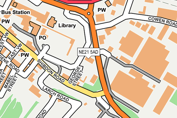
NE21 5AD is located in the Blaydon electoral ward, within the metropolitan district of Gateshead and the English Parliamentary constituency of Blaydon. The Sub Integrated Care Board (ICB) Location is NHS North East and North Cumbria ICB - 13T and the police force is Northumbria. This postcode has been in use since December 1996.


GetTheData
Source: OS OpenMap – Local (Ordnance Survey)
Source: OS VectorMap District (Ordnance Survey)
Licence: Open Government Licence (requires attribution)
| Easting | 418757 |
| Northing | 563233 |
| Latitude | 54.963378 |
| Longitude | -1.708584 |
GetTheData
Source: Open Postcode Geo
Licence: Open Government Licence
| Country | England |
| Postcode District | NE21 |
| ➜ NE21 open data dashboard ➜ See where NE21 is on a map ➜ Where is Blaydon? | |
GetTheData
Source: Land Registry Price Paid Data
Licence: Open Government Licence
Elevation or altitude of NE21 5AD as distance above sea level:
| Metres | Feet | |
|---|---|---|
| Elevation | 10m | 33ft |
Elevation is measured from the approximate centre of the postcode, to the nearest point on an OS contour line from OS Terrain 50, which has contour spacing of ten vertical metres.
➜ How high above sea level am I? Find the elevation of your current position using your device's GPS.
GetTheData
Source: Open Postcode Elevation
Licence: Open Government Licence
| Ward | Blaydon |
| Constituency | Blaydon |
GetTheData
Source: ONS Postcode Database
Licence: Open Government Licence
| January 2024 | Public order | On or near Larch Road | 159m |
| December 2023 | Criminal damage and arson | On or near Larch Road | 159m |
| December 2023 | Public order | On or near Larch Road | 159m |
| ➜ Get more crime data in our Crime section | |||
GetTheData
Source: data.police.uk
Licence: Open Government Licence
| Shibdon Road-larch Road (Shibdon Road) | Blaydon | 139m |
| Larch Road | Blaydon | 165m |
| Shibdon Road-east View (Shibdon Road) | Blaydon | 249m |
| Chainbridge Road-railway Crossing (Chainbridge Road) | Blaydon | 281m |
| Chainbridge Road-railway Crossing (Chainbridge Road) | Blaydon | 314m |
| Blaydon Station | 0.4km |
| Metrocentre Station | 2.8km |
| Dunston Station | 4.5km |
GetTheData
Source: NaPTAN
Licence: Open Government Licence
GetTheData
Source: ONS Postcode Database
Licence: Open Government Licence


➜ Get more ratings from the Food Standards Agency
GetTheData
Source: Food Standards Agency
Licence: FSA terms & conditions
| Last Collection | |||
|---|---|---|---|
| Location | Mon-Fri | Sat | Distance |
| Cowan Road | 18:30 | 135m | |
| Blaydon Delivery Office | 19:00 | 11:00 | 135m |
| Blaydon Post Office | 17:15 | 12:15 | 179m |
GetTheData
Source: Dracos
Licence: Creative Commons Attribution-ShareAlike
| Facility | Distance |
|---|---|
| Blaydon Youth Club (Closed) Shibdon Road, Blaydon-on-tyne Sports Hall | 112m |
| Shibdon Road Playings Fields Shibdon Road, Blaydon Grass Pitches | 557m |
| Greengates Park Masseys View, Blaydon-on-tyne Outdoor Tennis Courts | 612m |
GetTheData
Source: Active Places
Licence: Open Government Licence
| School | Phase of Education | Distance |
|---|---|---|
| Blaydon West Primary School Blaydon Bank, Blaydon-on-Tyne, NE21 4PY | Primary | 414m |
| St Joseph's Catholic Primary School, Blaydon Croftdale Road, Blaydon-on-Tyne, NE21 4BG | Primary | 747m |
| St Thomas More Catholic School, Blaydon Croftdale Road, Blaydon-on-Tyne, NE21 4BQ | Secondary | 906m |
GetTheData
Source: Edubase
Licence: Open Government Licence
The below table lists the International Territorial Level (ITL) codes (formerly Nomenclature of Territorial Units for Statistics (NUTS) codes) and Local Administrative Units (LAU) codes for NE21 5AD:
| ITL 1 Code | Name |
|---|---|
| TLC | North East (England) |
| ITL 2 Code | Name |
| TLC2 | Northumberland, and Tyne and Wear |
| ITL 3 Code | Name |
| TLC22 | Tyneside |
| LAU 1 Code | Name |
| E08000037 | Gateshead |
GetTheData
Source: ONS Postcode Directory
Licence: Open Government Licence
The below table lists the Census Output Area (OA), Lower Layer Super Output Area (LSOA), and Middle Layer Super Output Area (MSOA) for NE21 5AD:
| Code | Name | |
|---|---|---|
| OA | E00041469 | |
| LSOA | E01008177 | Gateshead 005A |
| MSOA | E02001686 | Gateshead 005 |
GetTheData
Source: ONS Postcode Directory
Licence: Open Government Licence
| NE21 5BT | The Precinct | 80m |
| NE21 5AL | Larch Road | 173m |
| NE21 5PU | Lucy Street | 187m |
| NE21 4QB | Dene Road | 254m |
| NE21 5AH | East View | 270m |
| NE21 5AF | Shibdon Road | 270m |
| NE21 5AE | Shibdon Road | 281m |
| NE21 5TW | Cowen Road | 289m |
| NE21 4QJ | Mabel Street | 290m |
| NE21 4QD | Theresa Street | 306m |
GetTheData
Source: Open Postcode Geo; Land Registry Price Paid Data
Licence: Open Government Licence