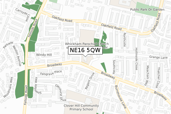
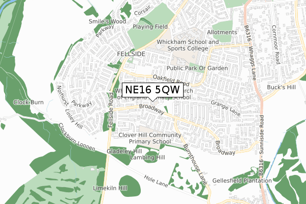
NE16 5QW is located in the Whickham South and Sunniside electoral ward, within the metropolitan district of Gateshead and the English Parliamentary constituency of Blaydon. The Sub Integrated Care Board (ICB) Location is NHS North East and North Cumbria ICB - 13T and the police force is Northumbria. This postcode has been in use since January 1980.


GetTheData
Source: OS Open Zoomstack (Ordnance Survey)
Licence: Open Government Licence (requires attribution)
Attribution: Contains OS data © Crown copyright and database right 2024
Source: Open Postcode Geo
Licence: Open Government Licence (requires attribution)
Attribution: Contains OS data © Crown copyright and database right 2024; Contains Royal Mail data © Royal Mail copyright and database right 2024; Source: Office for National Statistics licensed under the Open Government Licence v.3.0
| Easting | 419954 |
| Northing | 560141 |
| Latitude | 54.935547 |
| Longitude | -1.690103 |
GetTheData
Source: Open Postcode Geo
Licence: Open Government Licence
| Country | England |
| Postcode District | NE16 |
| ➜ NE16 open data dashboard ➜ See where NE16 is on a map ➜ Where is Whickham? | |
GetTheData
Source: Land Registry Price Paid Data
Licence: Open Government Licence
Elevation or altitude of NE16 5QW as distance above sea level:
| Metres | Feet | |
|---|---|---|
| Elevation | 140m | 459ft |
Elevation is measured from the approximate centre of the postcode, to the nearest point on an OS contour line from OS Terrain 50, which has contour spacing of ten vertical metres.
➜ How high above sea level am I? Find the elevation of your current position using your device's GPS.
GetTheData
Source: Open Postcode Elevation
Licence: Open Government Licence
| Ward | Whickham South And Sunniside |
| Constituency | Blaydon |
GetTheData
Source: ONS Postcode Database
Licence: Open Government Licence
| June 2022 | Violence and sexual offences | On or near Wyndley Close | 114m |
| June 2022 | Shoplifting | On or near Supermarket | 339m |
| June 2022 | Shoplifting | On or near Supermarket | 339m |
| ➜ Get more crime data in our Crime section | |||
GetTheData
Source: data.police.uk
Licence: Open Government Licence
| Broadway | Whickham | 135m |
| Broadway | Whickham | 141m |
| Broadway | Whickham | 158m |
| Oakfield Road-burnthouse Lane (Oakfield Road) | Whickham | 218m |
| Oakfield Road-marston Walk (Oakfield Road) | Whickham | 235m |
| Metrocentre Station | 3km |
| Dunston Station | 3.5km |
| Blaydon Station | 3.7km |
GetTheData
Source: NaPTAN
Licence: Open Government Licence
GetTheData
Source: ONS Postcode Database
Licence: Open Government Licence


➜ Get more ratings from the Food Standards Agency
GetTheData
Source: Food Standards Agency
Licence: FSA terms & conditions
| Last Collection | |||
|---|---|---|---|
| Location | Mon-Fri | Sat | Distance |
| The Broadway | 16:45 | 10:30 | 187m |
| Fellside Post Office | 17:00 | 11:45 | 345m |
| Fellside Post Office | 17:00 | 11:45 | 345m |
GetTheData
Source: Dracos
Licence: Creative Commons Attribution-ShareAlike
| Facility | Distance |
|---|---|
| Clover Hill Community Primary School Glenhurst Drive, Whickham, Newcastle Upon Tyne Grass Pitches | 261m |
| Fellside Community Primary School Fellside Road, Whickham, Newcastle Upon Tyne Grass Pitches | 465m |
| Whickham School & Sports College Burnt House Lane, Whickham, Newcastle Upon Tyne Sports Hall, Health and Fitness Gym, Artificial Grass Pitch, Grass Pitches, Studio, Outdoor Tennis Courts | 648m |
GetTheData
Source: Active Places
Licence: Open Government Licence
| School | Phase of Education | Distance |
|---|---|---|
| Whickham Parochial Church of England Primary School Broadway, Whickham, Newcastle-upon-Tyne, NE16 5QW | Primary | 4m |
| Clover Hill Community Primary School Glenhurst Drive, Whickham, Newcastle-upon-Tyne, NE16 5SJ | Primary | 261m |
| Fellside Community Primary School Fellside Road, Whickham, Fellside Community Primary School, Fellside Road, Newcastle-upon-Tyne, NE16 5AY | Primary | 456m |
GetTheData
Source: Edubase
Licence: Open Government Licence
The below table lists the International Territorial Level (ITL) codes (formerly Nomenclature of Territorial Units for Statistics (NUTS) codes) and Local Administrative Units (LAU) codes for NE16 5QW:
| ITL 1 Code | Name |
|---|---|
| TLC | North East (England) |
| ITL 2 Code | Name |
| TLC2 | Northumberland, and Tyne and Wear |
| ITL 3 Code | Name |
| TLC22 | Tyneside |
| LAU 1 Code | Name |
| E08000037 | Gateshead |
GetTheData
Source: ONS Postcode Directory
Licence: Open Government Licence
The below table lists the Census Output Area (OA), Lower Layer Super Output Area (LSOA), and Middle Layer Super Output Area (MSOA) for NE16 5QW:
| Code | Name | |
|---|---|---|
| OA | E00041954 | |
| LSOA | E01008271 | Gateshead 017D |
| MSOA | E02001698 | Gateshead 017 |
GetTheData
Source: ONS Postcode Directory
Licence: Open Government Licence
| NE16 5RF | Newmin Way | 80m |
| NE16 5SP | Wansford Way | 120m |
| NE16 5RP | Calow Way | 124m |
| NE16 5RW | Ancrum Way | 127m |
| NE16 5ST | Wyndley Close | 131m |
| NE16 5SU | Regent Drive | 151m |
| NE16 5RD | Broad Way | 166m |
| NE16 5SX | Windsor Close | 171m |
| NE16 5SW | Ennerdale Walk | 173m |
| NE16 5RN | Ancrum Way | 184m |
GetTheData
Source: Open Postcode Geo; Land Registry Price Paid Data
Licence: Open Government Licence