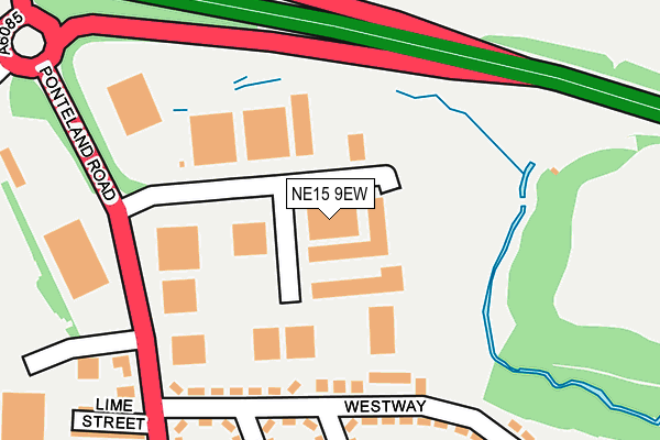
NE15 9EW is located in the Callerton & Throckley electoral ward, within the metropolitan district of Newcastle upon Tyne and the English Parliamentary constituency of Newcastle upon Tyne North. The Sub Integrated Care Board (ICB) Location is NHS North East and North Cumbria ICB - 13T and the police force is Northumbria. This postcode has been in use since January 1980.


GetTheData
Source: OS OpenMap – Local (Ordnance Survey)
Source: OS VectorMap District (Ordnance Survey)
Licence: Open Government Licence (requires attribution)
| Easting | 415950 |
| Northing | 567323 |
| Latitude | 55.000235 |
| Longitude | -1.752211 |
GetTheData
Source: Open Postcode Geo
Licence: Open Government Licence
| Country | England |
| Postcode District | NE15 |
| ➜ NE15 open data dashboard ➜ See where NE15 is on a map ➜ Where is Throckley? | |
GetTheData
Source: Land Registry Price Paid Data
Licence: Open Government Licence
Elevation or altitude of NE15 9EW as distance above sea level:
| Metres | Feet | |
|---|---|---|
| Elevation | 70m | 230ft |
Elevation is measured from the approximate centre of the postcode, to the nearest point on an OS contour line from OS Terrain 50, which has contour spacing of ten vertical metres.
➜ How high above sea level am I? Find the elevation of your current position using your device's GPS.
GetTheData
Source: Open Postcode Elevation
Licence: Open Government Licence
| Ward | Callerton & Throckley |
| Constituency | Newcastle Upon Tyne North |
GetTheData
Source: ONS Postcode Database
Licence: Open Government Licence
| June 2022 | Criminal damage and arson | On or near Westway | 176m |
| June 2022 | Vehicle crime | On or near A69 | 179m |
| June 2022 | Violence and sexual offences | On or near A69 | 179m |
| ➜ Get more crime data in our Crime section | |||
GetTheData
Source: data.police.uk
Licence: Open Government Licence
| Ponteland Road - Trading Estate (Ponteland Road) | Throckley | 184m |
| Ponteland Road - Alston Gardens (Ponteland Road) | Throckley | 365m |
| Ponteland Road-alston Gardens (Ponteland Road) | Throckley | 375m |
| Hexham Road-westway (Hexham Road) | Throckley | 485m |
| Hexham Road-hadrian Place (Hexham Road) | Throckley | 492m |
| Blaydon Station | 4.6km |
| Newcastle Airport Metro | 4.8km |
| Wylam Station | 4.9km |
GetTheData
Source: NaPTAN
Licence: Open Government Licence
GetTheData
Source: ONS Postcode Database
Licence: Open Government Licence


➜ Get more ratings from the Food Standards Agency
GetTheData
Source: Food Standards Agency
Licence: FSA terms & conditions
| Last Collection | |||
|---|---|---|---|
| Location | Mon-Fri | Sat | Distance |
| Kenton Grange | 17:30 | 12:00 | 1,379m |
| Alston Gardens | 17:30 | 11:00 | 1,786m |
| Marquis Avenue | 16:00 | 10:45 | 2,044m |
GetTheData
Source: Dracos
Licence: Creative Commons Attribution-ShareAlike
| Facility | Distance |
|---|---|
| Throckley Recreation Ground Poplar Street, Throckley, Newcastle Upon Tyne Grass Pitches, Outdoor Tennis Courts | 449m |
| Throckley Primary School Hexham Road, Newcastle Upon Tyne Grass Pitches | 620m |
| Walbottle Campus Hexham Road, Newcastle Upon Tyne Sports Hall, Artificial Grass Pitch, Grass Pitches, Studio, Outdoor Tennis Courts | 732m |
GetTheData
Source: Active Places
Licence: Open Government Licence
| School | Phase of Education | Distance |
|---|---|---|
| Throckley Primary School Hexham Road, Throckley, Newcastle-upon-Tyne, NE15 9DY | Primary | 639m |
| Walbottle Academy Hexham Road, Walbottle, Newcastle-upon-Tyne, NE15 9TP | Secondary | 798m |
| Talbot House Children's Charity Hexham Road, Walbottle, Newcastle upon Tyne, NE15 8HW | Not applicable | 1.1km |
GetTheData
Source: Edubase
Licence: Open Government Licence
The below table lists the International Territorial Level (ITL) codes (formerly Nomenclature of Territorial Units for Statistics (NUTS) codes) and Local Administrative Units (LAU) codes for NE15 9EW:
| ITL 1 Code | Name |
|---|---|
| TLC | North East (England) |
| ITL 2 Code | Name |
| TLC2 | Northumberland, and Tyne and Wear |
| ITL 3 Code | Name |
| TLC22 | Tyneside |
| LAU 1 Code | Name |
| E08000021 | Newcastle upon Tyne |
GetTheData
Source: ONS Postcode Directory
Licence: Open Government Licence
The below table lists the Census Output Area (OA), Lower Layer Super Output Area (LSOA), and Middle Layer Super Output Area (MSOA) for NE15 9EW:
| Code | Name | |
|---|---|---|
| OA | E00042617 | |
| LSOA | E01008405 | Newcastle upon Tyne 014F |
| MSOA | E02001721 | Newcastle upon Tyne 014 |
GetTheData
Source: ONS Postcode Directory
Licence: Open Government Licence
| NE15 9HG | High Dewley Burn | 156m |
| NE15 9HJ | Westway | 182m |
| NE15 9HL | Westway | 245m |
| NE15 9HS | Finchale Gardens | 249m |
| NE15 9HP | Northway | 253m |
| NE15 9ER | Lime Street | 281m |
| NE15 9HR | Alston Gardens | 282m |
| NE15 9EP | Ponteland Road | 285m |
| NE15 9EG | Laurel Street | 306m |
| NE15 9HQ | Alston Gardens | 318m |
GetTheData
Source: Open Postcode Geo; Land Registry Price Paid Data
Licence: Open Government Licence