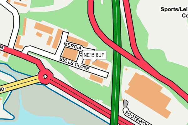
NE15 6UF is located in the Lemington electoral ward, within the metropolitan district of Newcastle upon Tyne and the English Parliamentary constituency of Newcastle upon Tyne North. The Sub Integrated Care Board (ICB) Location is NHS North East and North Cumbria ICB - 13T and the police force is Northumbria. This postcode has been in use since June 1981.


GetTheData
Source: OS OpenMap – Local (Ordnance Survey)
Source: OS VectorMap District (Ordnance Survey)
Licence: Open Government Licence (requires attribution)
| Easting | 419384 |
| Northing | 564292 |
| Latitude | 54.972878 |
| Longitude | -1.698734 |
GetTheData
Source: Open Postcode Geo
Licence: Open Government Licence
| Country | England |
| Postcode District | NE15 |
| ➜ NE15 open data dashboard ➜ See where NE15 is on a map ➜ Where is Newcastle upon Tyne? | |
GetTheData
Source: Land Registry Price Paid Data
Licence: Open Government Licence
Elevation or altitude of NE15 6UF as distance above sea level:
| Metres | Feet | |
|---|---|---|
| Elevation | 20m | 66ft |
Elevation is measured from the approximate centre of the postcode, to the nearest point on an OS contour line from OS Terrain 50, which has contour spacing of ten vertical metres.
➜ How high above sea level am I? Find the elevation of your current position using your device's GPS.
GetTheData
Source: Open Postcode Elevation
Licence: Open Government Licence
| Ward | Lemington |
| Constituency | Newcastle Upon Tyne North |
GetTheData
Source: ONS Postcode Database
Licence: Open Government Licence
| June 2022 | Anti-social behaviour | On or near Ordley Close | 331m |
| June 2022 | Violence and sexual offences | On or near St George'S Road | 384m |
| June 2022 | Public order | On or near Bankside Road | 474m |
| ➜ Get more crime data in our Crime section | |||
GetTheData
Source: data.police.uk
Licence: Open Government Licence
| Scotswood Road-bells Close (Scotswood Road) | Lemington | 103m |
| Scotswood Road-bells Close (Scotswood Road) | Lemington | 132m |
| Scotswood Road - Bells Close (Scotswood Road) | Lemington | 207m |
| Bells Close (Bell's Close) | Lemington | 274m |
| Scotswood Road-b&q (Scotswood Road) | Scotswood | 288m |
| Blaydon Station | 1.2km |
| Metrocentre Station | 2.6km |
| Dunston Station | 4.4km |
GetTheData
Source: NaPTAN
Licence: Open Government Licence
GetTheData
Source: ONS Postcode Database
Licence: Open Government Licence


➜ Get more ratings from the Food Standards Agency
GetTheData
Source: Food Standards Agency
Licence: FSA terms & conditions
| Last Collection | |||
|---|---|---|---|
| Location | Mon-Fri | Sat | Distance |
| Tundry Way | 16:00 | 11:00 | 746m |
| Factory Road | 16:15 | 11:00 | 805m |
| Whiteley Road | 18:45 | 805m | |
GetTheData
Source: Dracos
Licence: Creative Commons Attribution-ShareAlike
| Facility | Distance |
|---|---|
| Newcastle Blue Star Football Club Denton Road, Newcastle Upon Tyne Grass Pitches, Artificial Grass Pitch | 333m |
| Grainger Park Boxing Club Denton Road, Newcastle Upon Tyne Sports Hall, Health and Fitness Gym | 446m |
| Excelsior Academy Denton Road, Newcastle Upon Tyne Artificial Grass Pitch, Sports Hall, Studio, Health and Fitness Gym, Grass Pitches | 579m |
GetTheData
Source: Active Places
Licence: Open Government Licence
| School | Phase of Education | Distance |
|---|---|---|
| St George's Catholic Primary School, Bells Close Bell's Close, Newcastle-upon-Tyne, NE15 6XX | Primary | 466m |
| Excelsior Academy Denton Road, Newcastle-upon-Tyne, NE15 6AF | All-through | 579m |
| Waverley Primary School Maple Close, Lemington, Newcastle-upon-Tyne, NE15 7QZ | Primary | 634m |
GetTheData
Source: Edubase
Licence: Open Government Licence
The below table lists the International Territorial Level (ITL) codes (formerly Nomenclature of Territorial Units for Statistics (NUTS) codes) and Local Administrative Units (LAU) codes for NE15 6UF:
| ITL 1 Code | Name |
|---|---|
| TLC | North East (England) |
| ITL 2 Code | Name |
| TLC2 | Northumberland, and Tyne and Wear |
| ITL 3 Code | Name |
| TLC22 | Tyneside |
| LAU 1 Code | Name |
| E08000021 | Newcastle upon Tyne |
GetTheData
Source: ONS Postcode Directory
Licence: Open Government Licence
The below table lists the Census Output Area (OA), Lower Layer Super Output Area (LSOA), and Middle Layer Super Output Area (MSOA) for NE15 6UF:
| Code | Name | |
|---|---|---|
| OA | E00042538 | |
| LSOA | E01008387 | Newcastle upon Tyne 021G |
| MSOA | E02001728 | Newcastle upon Tyne 021 |
GetTheData
Source: ONS Postcode Directory
Licence: Open Government Licence
| NE15 7XT | Ordley Close | 337m |
| NE15 6YA | St Georges Terrace | 371m |
| NE15 6XY | Front Street | 375m |
| NE15 7XR | Ormiston | 424m |
| NE15 6XU | Bells Close | 435m |
| NE15 7XP | Ottershaw | 449m |
| NE15 7XQ | Neptune Road | 469m |
| NE15 7XS | Ottringham Close | 499m |
| NE15 6AR | Heighley Street | 526m |
| NE15 7XW | Ormiscraig | 531m |
GetTheData
Source: Open Postcode Geo; Land Registry Price Paid Data
Licence: Open Government Licence