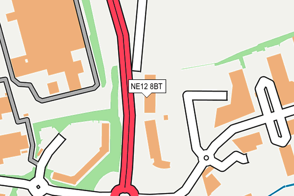
NE12 8BT is located in the Longbenton electoral ward, within the metropolitan district of North Tyneside and the English Parliamentary constituency of North Tyneside. The Sub Integrated Care Board (ICB) Location is NHS North East and North Cumbria ICB - 99C and the police force is Northumbria. This postcode has been in use since January 2008.


GetTheData
Source: OS OpenMap – Local (Ordnance Survey)
Source: OS VectorMap District (Ordnance Survey)
Licence: Open Government Licence (requires attribution)
| Easting | 426694 |
| Northing | 569767 |
| Latitude | 55.021732 |
| Longitude | -1.584020 |
GetTheData
Source: Open Postcode Geo
Licence: Open Government Licence
| Country | England |
| Postcode District | NE12 |
| ➜ NE12 open data dashboard ➜ See where NE12 is on a map ➜ Where is Longbenton? | |
GetTheData
Source: Land Registry Price Paid Data
Licence: Open Government Licence
Elevation or altitude of NE12 8BT as distance above sea level:
| Metres | Feet | |
|---|---|---|
| Elevation | 50m | 164ft |
Elevation is measured from the approximate centre of the postcode, to the nearest point on an OS contour line from OS Terrain 50, which has contour spacing of ten vertical metres.
➜ How high above sea level am I? Find the elevation of your current position using your device's GPS.
GetTheData
Source: Open Postcode Elevation
Licence: Open Government Licence
| Ward | Longbenton |
| Constituency | North Tyneside |
GetTheData
Source: ONS Postcode Database
Licence: Open Government Licence
| June 2022 | Vehicle crime | On or near Balliol Business Park East | 218m |
| April 2022 | Anti-social behaviour | On or near Balliol Business Park East | 218m |
| April 2022 | Drugs | On or near Balliol Business Park East | 218m |
| ➜ Get more crime data in our Crime section | |||
GetTheData
Source: data.police.uk
Licence: Open Government Licence
| Quorum Business Park Entrance (Benton Lane) | Benton | 76m |
| Quorum Business Park Entrance (Benton Lane) | Benton | 122m |
| Quorum Business Park (Quorum Business Park Internal Road) | Benton | 171m |
| Quorum Business Park (Quorum Business Park Internal Roads) | Benton | 202m |
| Balliol Business Park West Entrance (Business Park Internal Roads) | Benton | 252m |
| Four Lane Ends (Tyne And Wear Metro Station) (A188 Benton Road) | Four Lane Ends | 1,338m |
| Benton (Tyne And Wear Metro Station) (Station Approach) | Benton | 1,370m |
| Longbenton (Tyne And Wear Metro Station) (Leaholm Road) | Longbenton | 1,518m |
GetTheData
Source: NaPTAN
Licence: Open Government Licence
GetTheData
Source: ONS Postcode Database
Licence: Open Government Licence


➜ Get more ratings from the Food Standards Agency
GetTheData
Source: Food Standards Agency
Licence: FSA terms & conditions
| Last Collection | |||
|---|---|---|---|
| Location | Mon-Fri | Sat | Distance |
| Westmoor Post Office | 17:30 | 12:15 | 795m |
| Great Lime Road | 17:30 | 12:15 | 811m |
| Ancaster Avenue | 17:30 | 12:45 | 837m |
GetTheData
Source: Dracos
Licence: Creative Commons Attribution-ShareAlike
| Facility | Distance |
|---|---|
| Puregym (Newcastle Longbenton) Benton Lane, Longbenton Health and Fitness Gym, Studio | 97m |
| Quorum Sports Club Quorum Business Park, Benton Lane, Newcastle Upon Tyne Artificial Grass Pitch | 237m |
| West Moor Community Centre Benton Lane, Newcastle Upon Tyne Sports Hall, Grass Pitches, Artificial Grass Pitch | 642m |
GetTheData
Source: Active Places
Licence: Open Government Licence
| School | Phase of Education | Distance |
|---|---|---|
| Benton Dene Primary School Hailsham Avenue, Longbenton, Newcastle-upon-Tyne, NE12 8FD | Primary | 723m |
| Longbenton High School Hailsham Avenue, Longbenton, Newcastle-upon-Tyne, NE12 8ER | Secondary | 723m |
| Benton Dene School Hailsham Avenue, Longbenton, Newcastle upon Tyne, NE12 8FD | Not applicable | 739m |
GetTheData
Source: Edubase
Licence: Open Government Licence
The below table lists the International Territorial Level (ITL) codes (formerly Nomenclature of Territorial Units for Statistics (NUTS) codes) and Local Administrative Units (LAU) codes for NE12 8BT:
| ITL 1 Code | Name |
|---|---|
| TLC | North East (England) |
| ITL 2 Code | Name |
| TLC2 | Northumberland, and Tyne and Wear |
| ITL 3 Code | Name |
| TLC22 | Tyneside |
| LAU 1 Code | Name |
| E08000022 | North Tyneside |
GetTheData
Source: ONS Postcode Directory
Licence: Open Government Licence
The below table lists the Census Output Area (OA), Lower Layer Super Output Area (LSOA), and Middle Layer Super Output Area (MSOA) for NE12 8BT:
| Code | Name | |
|---|---|---|
| OA | E00043226 | |
| LSOA | E01008514 | North Tyneside 019D |
| MSOA | E02001756 | North Tyneside 019 |
GetTheData
Source: ONS Postcode Directory
Licence: Open Government Licence
| NE12 8FB | Quorum Business Park | 286m |
| NE12 8BU | Benton Lane | 311m |
| NE12 8EZ | Quorum Business Park | 331m |
| NE12 8EW | Balliol Business Park | 364m |
| NE12 7WA | Greenhaugh | 494m |
| NE12 8EL | Altan Place | 554m |
| NE12 8ED | Ongar Way | 562m |
| NE12 7NT | Cotswold Avenue | 564m |
| NE12 7NX | Grampian Place | 577m |
| NE12 8EP | Edenbridge Crescent | 577m |
GetTheData
Source: Open Postcode Geo; Land Registry Price Paid Data
Licence: Open Government Licence