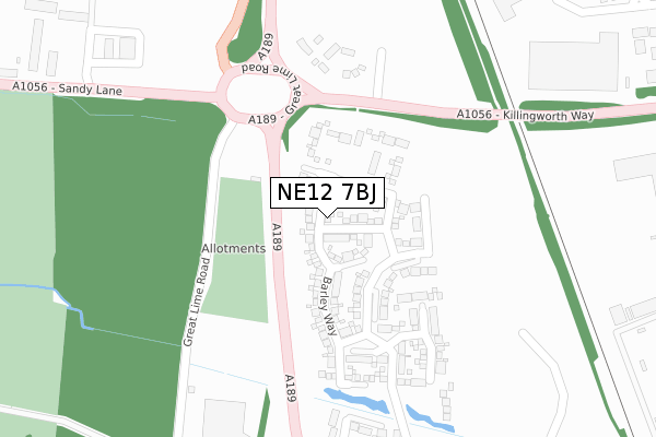
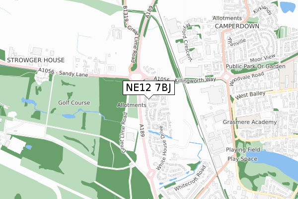
NE12 7BJ is located in the Longbenton electoral ward, within the metropolitan district of North Tyneside and the English Parliamentary constituency of North Tyneside. The Sub Integrated Care Board (ICB) Location is NHS North East and North Cumbria ICB - 99C and the police force is Northumbria. This postcode has been in use since July 2019.


GetTheData
Source: OS Open Zoomstack (Ordnance Survey)
Licence: Open Government Licence (requires attribution)
Attribution: Contains OS data © Crown copyright and database right 2024
Source: Open Postcode Geo
Licence: Open Government Licence (requires attribution)
Attribution: Contains OS data © Crown copyright and database right 2024; Contains Royal Mail data © Royal Mail copyright and database right 2024; Source: Office for National Statistics licensed under the Open Government Licence v.3.0
| Easting | 426278 |
| Northing | 571557 |
| Latitude | 55.037846 |
| Longitude | -1.590377 |
GetTheData
Source: Open Postcode Geo
Licence: Open Government Licence
| Country | England |
| Postcode District | NE12 |
| ➜ NE12 open data dashboard ➜ See where NE12 is on a map ➜ Where is Longbenton? | |
GetTheData
Source: Land Registry Price Paid Data
Licence: Open Government Licence
| Ward | Longbenton |
| Constituency | North Tyneside |
GetTheData
Source: ONS Postcode Database
Licence: Open Government Licence
2023 31 MAR £350,000 |
2022 27 OCT £460,000 |
2022 23 SEP £434,950 |
2021 20 AUG £253,000 |
28, STABLE CLOSE, KILLINGWORTH, NEWCASTLE UPON TYNE, NE12 7BJ 2020 23 NOV £328,495 |
32, STABLE CLOSE, KILLINGWORTH, NEWCASTLE UPON TYNE, NE12 7BJ 2020 20 NOV £337,495 |
38, STABLE CLOSE, KILLINGWORTH, NEWCASTLE UPON TYNE, NE12 7BJ 2020 25 SEP £299,495 |
37, STABLE CLOSE, KILLINGWORTH, NEWCASTLE UPON TYNE, NE12 7BJ 2020 24 SEP £297,495 |
2020 18 SEP £387,495 |
26, STABLE CLOSE, KILLINGWORTH, NEWCASTLE UPON TYNE, NE12 7BJ 2020 3 SEP £373,371 |
GetTheData
Source: HM Land Registry Price Paid Data
Licence: Contains HM Land Registry data © Crown copyright and database right 2024. This data is licensed under the Open Government Licence v3.0.
| June 2022 | Other theft | On or near Sandy Lane | 425m |
| June 2022 | Other theft | On or near Sandy Lane | 425m |
| June 2022 | Other theft | On or near Sandy Lane | 425m |
| ➜ Get more crime data in our Crime section | |||
GetTheData
Source: data.police.uk
Licence: Open Government Licence
| Sandy Lane-coal Depot (Sandy Lane) | Wideopen | 418m |
| Sandy Lane-coal Depot (Sandy Lane) | Wideopen | 515m |
| Station Road-council Offices (Station Rd) | Killingworth | 634m |
| West Bailey - Angus Close (West Bailey) | Killingworth | 663m |
| West Bailey - Angus Close (West Bailey) | Killingworth | 686m |
GetTheData
Source: NaPTAN
Licence: Open Government Licence
| Percentage of properties with Next Generation Access | 77.8% |
| Percentage of properties with Superfast Broadband | 77.8% |
| Percentage of properties with Ultrafast Broadband | 77.8% |
| Percentage of properties with Full Fibre Broadband | 77.8% |
Superfast Broadband is between 30Mbps and 300Mbps
Ultrafast Broadband is > 300Mbps
| Percentage of properties unable to receive 2Mbps | 0.0% |
| Percentage of properties unable to receive 5Mbps | 0.0% |
| Percentage of properties unable to receive 10Mbps | 0.0% |
| Percentage of properties unable to receive 30Mbps | 0.0% |
GetTheData
Source: Ofcom
Licence: Ofcom Terms of Use (requires attribution)
GetTheData
Source: ONS Postcode Database
Licence: Open Government Licence


➜ Get more ratings from the Food Standards Agency
GetTheData
Source: Food Standards Agency
Licence: FSA terms & conditions
| Last Collection | |||
|---|---|---|---|
| Location | Mon-Fri | Sat | Distance |
| Camperdown Industrial Estate | 601m | ||
| Killingworth Drive | 17:30 | 12:15 | 833m |
| Front Street | 18:30 | 12:00 | 916m |
GetTheData
Source: Dracos
Licence: Creative Commons Attribution-ShareAlike
| Facility | Distance |
|---|---|
| Newcastle Field Packaging (Closed) Station Road, Newcastle Upon Tyne Grass Pitches | 521m |
| Grasmere Academy Grasmere Court, Killingworth, Newcastle Upon Tyne Grass Pitches | 861m |
| Bailey Green Primary School West Bailey, Killingworth, Newcastle Upon Tyne Grass Pitches | 1.1km |
GetTheData
Source: Active Places
Licence: Open Government Licence
| School | Phase of Education | Distance |
|---|---|---|
| Grasmere Academy Grasmere Court, Killingworth, Newcastle-upon-Tyne, NE12 6TS | Primary | 964m |
| Bailey Green Primary School West Bailey, Killingworth, NE12 6QL | Primary | 1.1km |
| Burradon Community Primary School Burradon Road, Burradon, Cramlington, NE23 7NG | Primary | 1.1km |
GetTheData
Source: Edubase
Licence: Open Government Licence
The below table lists the International Territorial Level (ITL) codes (formerly Nomenclature of Territorial Units for Statistics (NUTS) codes) and Local Administrative Units (LAU) codes for NE12 7BJ:
| ITL 1 Code | Name |
|---|---|
| TLC | North East (England) |
| ITL 2 Code | Name |
| TLC2 | Northumberland, and Tyne and Wear |
| ITL 3 Code | Name |
| TLC22 | Tyneside |
| LAU 1 Code | Name |
| E08000022 | North Tyneside |
GetTheData
Source: ONS Postcode Directory
Licence: Open Government Licence
The below table lists the Census Output Area (OA), Lower Layer Super Output Area (LSOA), and Middle Layer Super Output Area (MSOA) for NE12 7BJ:
| Code | Name | |
|---|---|---|
| OA | E00043223 | |
| LSOA | E01008516 | North Tyneside 014D |
| MSOA | E02001751 | North Tyneside 014 |
GetTheData
Source: ONS Postcode Directory
Licence: Open Government Licence
| NE12 7HA | Whitehouse Farm | 513m |
| NE13 6PE | Sandy Lane | 588m |
| NE12 5US | Locomotion Way | 599m |
| NE12 5UJ | Mylord Crescent | 603m |
| NE12 6QQ | Harvey Combe | 683m |
| NE12 5UZ | Atkin Street | 688m |
| NE12 6GL | Chestnut Close | 702m |
| NE12 5XA | Station Road | 704m |
| NE12 6GT | Holly Close | 722m |
| NE12 5UX | Station Road | 727m |
GetTheData
Source: Open Postcode Geo; Land Registry Price Paid Data
Licence: Open Government Licence